Antalya City: Kaleiçi, Hadrian’s Gate and the Old Harbour
Antalya the city, not only the resort: Kaleiçi, the walled old town and harbour, what each age left there, the museum and the Turkish words.
Table of Contents
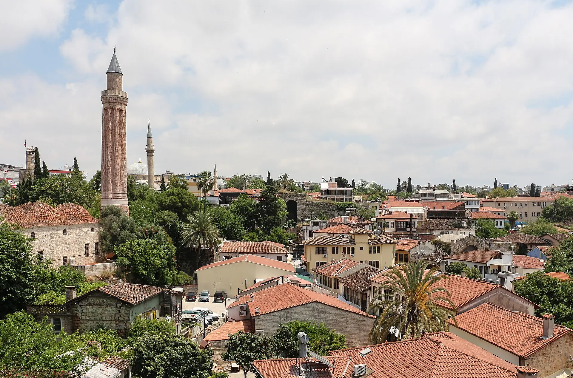
Antalya is the centre of Antalya province, at the north-west end of the Gulf of Antalya on Türkiye’s Mediterranean coast (TDV). Its old town, Kaleiçi («inside the fortress»), is a walled quarter round an old harbour, with a Roman gate, a Seljuk minaret and Ottoman houses. Walls built over more than 2,000 years ring it (Culture Portal).
In short · checked 30.10.2026
A port city with a walled old town, and the dated marks of each age that built there.
- Old town: Kaleiçi, inside walls built over more than 2,000 years, in the Muratpaşa district. You reach it on foot, by city bus from the east and west side of the city, or by car (Culture Portal).
- What each age left: a Roman gate of AD 130, a Seljuk minaret of 1220–1237, Ottoman mosques, baths, hans and mansions. Each date names its owner.
- Tram: the route map of Antalya Ulaşım joins its Üç Kapılar stop to a Kaleiçi marker. The Antray tram takes Antalyakart cards, contactless bank cards and others.
- Museum: muze.gov.tr lists the Antalya Museum as closed to visits (checked 30.10.2026).
- Pages differ: on the year Attaleia was founded, on the Yivli Minare, on Hadrian’s Gate and on the century of the Korkut Mosque. Each version is printed with its page.
Kaleiçi, age by age
Five ages in one walled town.
Press an age, then a mark on the drawing or in the list; Back and Next walk through every mark, and Play shows the ages one by one. Each mark has its Turkish name to copy, its dates with their pages, and a Turkish question to ask.
Hellenistic–Roman from the 2nd century BC
«Hellenistic» is the Greek-speaking world after Alexander the Great. The first wall, the harbour and the Roman street are the marks of this age.
Hadrian Kapısı Hadrian’s Gate; also Üç Kapılar, «three gates»
A marble gate with three arches, built for the Emperor Hadrian.
- AD 130 Culture Portalmunicipality
Hesapçı Sokak Hesapçı Street («sokak» is a street)
The main street of ancient Attaleia, called Platae, from Hadrian’s Gate to the Hıdırlık Tower. City offices and shops stood along it.
- Roman road remains came to light when a house beside it was pulled down municipality
Hıdırlık Kulesi Hıdırlık Tower («kule» is a tower)
Two storeys: a square base and a round drum on top, with a long corridor inside.
- A monumental tomb of the 1st or 2nd century AD, it is thought municipality
Yat Limanı the marina, the old harbour («liman» is a harbour)
A natural semicircular harbour. The mouth is 110 m wide.
- Built in the Hellenistic period municipality
Kent Surları the city walls («sur» is a city wall)
Walls ring the old town. They are known to have carried more than 60 towers.
- The walls’ history starts in the 2nd century BC; they were built over more than 2,000 years municipalityCulture Portal
Kesik Minare the Kesik Minare site, then the city’s agora (the market square)
In Hellenistic and Roman times the building stood on the city’s agora.
- Used as the city agora in Hellenistic and Roman times municipality
Byzantine after Rome
The walls are repaired against Arab raids and a screen wall with ditches goes up outside them. The gate is closed and the tomb joins the wall.
Perde sur screen wall («perde» is a curtain)
An outer wall with ditches, built outside the old wall after Arab raids.
- Byzantine period; walls strengthened from the 6th century municipality
- A second wall on the land side in the 10th century TDV
Hadrian Kapısı Hadrian’s Gate, walled in
The gate was walled in. The two pages give different reasons.
- Closed for defence in the Byzantine wars, with a wall built in front and behind municipality
- Walls closed its outer part over time, and it was uncovered in 1882 Culture Portal
Hıdırlık Kulesi Hıdırlık Tower, joined to the wall
In the Byzantine period the tomb was joined to the walls as a defence tower.
- Byzantine period municipality
Yat Limanı the harbour, a port
An active port in the Byzantine period. Arab raids began in the 7th century; in 860 a fleet commander of the caliph took the city, not for long.
- Byzantine period TDV
Panhagia Kilisesi Panhagia Church («kilise» is a church)
Built inside the old agora. The municipality glosses «Panhagia» as «holiest of the holy» and calls it the holiest place of Pamphylia from the Middle Byzantine period.
- Early Byzantine period municipality
Seljuk from 1207
The Seljuks, a Turkish dynasty, take the city on 5 March 1207. A series of inner walls goes up, and the minaret, the schools and the lodge belong to this age.
İç surlar inner walls
A series of inner walls added inside the old wall after 1207.
- 1207 municipalityTDV
Yivli Minare Fluted Minaret («yivli» is fluted, «minare» a minaret)
A brick minaret with eight flutes, the symbol of Antalya. It stands beside the Great Mosque.
- 1220–1237, under Alaaddin Keykubat I, named in the building inscription Culture PortalTDV
- The municipality attributes it to him on style municipality
Mevlevihane lodge of the Mevlevi order («hane» is a house)
A two-storey building with a domed hall and small rooms. The Mevlevi order follows Rumi.
- 1225 municipality
- Said to be Seljuk, repaired in the 16th century and made a mevlevihane in the 18th century by Tekeli Mehmed Paşa TDV
Atabey Armağan Medresesi Atabey Armağan Madrasa («medrese» is a school of Islamic learning)
Only the gate and bits of the side walls are left.
- 1239, built by Atabey Armağan municipalityTDV
Karatay Medresesi Karatay Madrasa
Built by Celaleddin Karatay. The monumental crown gate (taç kapı) is the part still standing; restored in 2006.
- 1250 municipalityTDV
Fetih Kitabesi Conquest Inscription («kitabe» is an inscription)
Arabic inscriptions in 42 pieces, 26 of them in place, set along the inner wall on Uzun Çarşı Sokak («çarşı» is a market).
- Written when the city was retaken on 22 January 1216 municipalityTDV
Yat Limanı the harbour, a naval base
After 1216 the harbour held a Seljuk shipyard and naval base.
- From 22 January 1216 TDV
Tophane Tophane, the inner fort («top» is a cannon)
The walled inner fort north of the harbour. A Seljuk palace quarter is presumed to have stood there.
- Presumed to be Seljuk municipality
Beylik–Ottoman from 1373
A «beylik» is a Turkish principality ruled by a bey. The Teke principality takes the city in 1373, Ottoman rule is firmly in place after January 1423, and the town spreads outside its walls in the 19th century.
Yivli Minare Camii Yivli Minare Mosque («cami» is a mosque), also Ulucami, the Great Mosque
A six-domed hall on twelve reused columns, beside the minaret.
- 1373, built by Mübarizüddin Mehmed Bey of the Hamidoğulları, architect Balaban et-Tavâşî TDVmunicipality
Bali Bey Camii Bali Bey Mosque
A mosque built by Bali Paşa; repaired in 1849–50.
- 1486–1494/95 municipality
Tekeli Mehmet Paşa Camii Tekeli Mehmet Paşa Mosque
A domed mosque of rubble and cut stone, repaired many times. The Culture Portal spells it Tekeli Mahmut Paşa Camii.
- 1606–1617 municipality
Kesik Minare Cut Minaret; the Korkut Mosque
The old church made a mosque in the time of Prince Korkut. A fire in 1895 gave it the name «cut minaret».
- Mosque from the time of Prince Korkut; fire of 1895 municipality
- Korkut Camii, 15th century; Prince Korkut was bey of Teke from 1502 to 1509 TDV
Pazar Hamamı Market Bath («hamam» is a bath)
A double bath, one for men and one for women.
- 16th century municipality
İki Kapılı Han Two-Gate Han («han» is an inn with a courtyard); the Tek Kapılı Han is next to it
Courtyard inns with a well and a fountain. Travellers once lodged in the upper rooms; today they hold a market.
- Late 18th or early 19th century municipality
Ömer Efendi Konağı Ömer Efendi Mansion («konak» is a mansion)
Counted by the municipality among Kaleiçi’s most splendid mansions, with a stone-paved hall on the ground floor.
- Late 19th century municipality
Kırk Merdivenler the Forty Steps
A stair from the city wall east of the marina down to the harbour. The stair was known in the Ottoman period.
- Supposed to have been built by the Venetians municipality
Yat Limanı the harbour in 1472
A crusader fleet breaks the harbour chain and burns the outer quarters, but cannot pass the walls.
- 1472 TDV
- The papal fleet put its arms on the breakwater towers and took the harbour chain to Rome municipality
Tophane Tophane, an ammunition store
Used as an ammunition store in the Ottoman period.
- Ottoman period municipality
20th century on from 1903
The Greek residents leave in 1922, the walls come down by the mid-1930s and the last residents move away from the 1950s. The wall ring is drawn dotted.
Surların yıkımı the pulling down of the walls
Much of the wall was down before the 1920s; the final demolition came in the mid-1930s. The reasons given then: the walls no longer served the city’s security and blocked the flow of air.
- Mid-1930s municipality
İskele Mescidi Pier Prayer Hall («mescit» is a small mosque)
A hexagonal hall of cut stone with a wooden minaret.
- 1903, built by the Teke governor Hüseyin Kenan Paşa municipality
Valilik Binası the Governor’s building
Built for labour battalions; a school until 2005.
- 1916 municipality
Saat Kulesi Clock Tower («saat» is a clock)
Built on the bastion of the Kale Kapısı, the main land gate. People who had come from İzmir after its occupation asked for it.
- 1921, built by the municipality; repaired in 1930 and 1967 municipality
Kaleiçi Müzesi Kaleiçi Museum
A museum building that shows scenes of 19th-century Ottoman life upstairs.
- Built 1993–1995 municipality
Attalos Heykeli Attalos Statue
A statue 2.60 m high, shaped on a torso and a head of Attalos in Berlin.
- 2004, made for the municipality; for the king who founded Attaleia in 158 BC municipality
Yat Limanı the marina
The ancient harbour is now a marina.
- Today Culture Portal
Tophane Tophane, a park
The area became a modern park.
- 1926 municipality
Kaleiçi the walled old town
Kaleiçi is the old city centre of Antalya, in the Muratpaşa district. The name means «inside the fortress»: kale is a fortress and iç the inside. Inner and outer walls ring it, built by the civilisations that lived here over more than 2,000 years, and some still stand. Narrow lanes run down to the harbour between traditional houses of two or three storeys, one front on the street and the others on the garden. The ancient harbour is now a marina, a harbour for yachts (yat limanı) (Culture Portal).
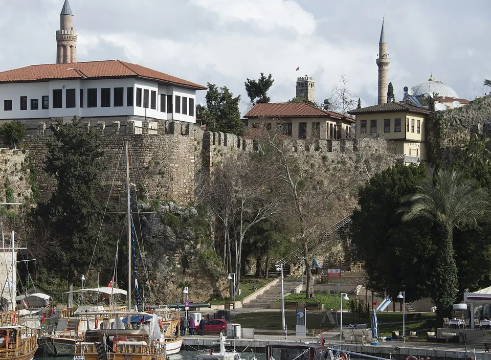
The walls
- 2nd century BC: the walls’ history starts here. They are known to have carried more than 60 towers at close intervals.
- Byzantine period: repaired after Arab raids, with a screen wall and ditches outside.
- From 1207: a series of inner walls added.
- Before the 1920s: a large part was already down. The final demolition came in the mid-1930s (municipality).
- Address
- Kaleiçi, Selçuk Uzun Çarşı Sokak, Muratpaşa / Antalya. Sokak is a street, çarşı a market and uzun long (Culture Portal).
- The harbour
- A natural semicircular harbour, built up in the Hellenistic period. The mouth is 110 m wide. A tower stood on each side of it, one possibly a lighthouse, with a chain between them (municipality).
- The people
- The Greek residents left Antalya in 1922. The last residents of Kaleiçi moved to the big cities from the 1950s (municipality).
The city in dated steps
Where the pages give different dates, both are printed, each with its page.
Greek and Roman
- 158 BC Attalos II of Pergamon founds Attaleia in 158 BC (municipality, entry on his statue); the municipality’s Kaleiçi history says «the 2nd century BC». TDV has him re-found the city on the site of an older one, with no year, and lists its names: Atalia and Adalia in antiquity, Satalia in medieval Western sources, Antâliyye and Adalya in Arab and Turkish sources (TDV).
- 79 BC The Roman consul P. Servilius clears the region of pirates, secures Roman rule in the city and has the walls strengthened (TDV).
- AD 130 Emperor Hadrian visits Attaleia and the gate is built in his honour (municipality, Culture Portal).
Byzantine and Seljuk
- From the 7th century Arab raids hit the Byzantine port. In 860 the fleet commander of Caliph al-Mutawakkil takes the city, but not for long (TDV).
- 1103–1148 The city is Seljuk until 1103, when the forces of the Byzantine emperor Alexios I Komnenos take it back. It changes hands several times. In 1120 John II Komnenos brings it under Byzantine rule again, and for a time it serves as a base for the Second Crusade, in 1148 (TDV).
- 5 March 1207 Sultan Gıyâseddin Keyhusrev I takes the city with the support of Greeks unhappy with the Latin administration, repairs the walls and has a masjid, a small mosque, built (TDV).
- 1212–1216 A revolt, backed by the king of Cyprus, puts the city in Cypriot hands in 1212. On 22 January 1216 İzzeddin Keykâvus takes it back; it becomes a Seljuk naval base with a shipyard (TDV).
Beylik (principality), Ottoman and after
- 1361–1373 King Pierre of Cyprus takes the city on 24 August 1361. Mehmed Bey, of the Teke principality, takes it back on 14 May 1373 (TDV). A beylik is a principality ruled by a bey.
- 1423 After January 1423, Ottoman rule is firmly in place in Antalya and in Teke-ili, the Teke region, of which it is the centre (TDV).
- 1472 A crusader fleet breaks the chain that guards the harbour and burns the outer quarters, but cannot pass the walls (TDV).
- 1502–1509 Prince Korkut, a son of Bayezid II, lives in Antalya as the bey of the Teke district (TDV).
- 16th–19th century In the 16th century the Mediterranean loses its old trade traffic and the city loses its medieval weight. It stays a small settlement centred on Kaleiçi until the early 19th century. Then migrants from Morea (the Peloponnese), Egypt and Crete arrive and the town spreads outside Kaleiçi (municipality).
The 20th century
- 29 April 1919 Italian forces occupy the city and its surroundings under the Armistice of Mudros. They begin to leave on 1 June 1921 (TDV).
- 1922 The Greek residents leave Antalya (municipality).
- 1927 The first census of the Republic counts 17,635 people in the city (TDV).
- Mid-1930s The walls round Kaleiçi are pulled down. The reasons put forward were that the walls fell short of the city’s security needs and blocked the air flow, which threatened public health. The last residents of Kaleiçi leave from the 1950s (municipality).
The tool above sorts the buildings by these ages. The chapters below take them in the same order.
The Roman line Hadrian’s Gate to the Hıdırlık Tower
Three marks of Roman Attaleia stand on one line: Hadrian’s Gate, the street called Hesapçı Sokak and the Hıdırlık Tower. The street ran from the gate to the tower. It was the city’s main street, called Platae, with buildings of the city’s administration and shops (municipality).
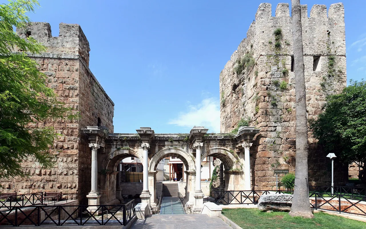
Hadrian Kapısı, «Hadrian’s Gate»
- Built
- AD 130, for Emperor Hadrian (Culture Portal). Also called Üç Kapılar, «three gates» (municipality).
- Shape
- Three arches, a Latin inscription, carved reliefs, white marble except the columns. Two storeys at first; the upper one is lost (Culture Portal).
- Towers
- Two, not built with the gate. South: the Julia Sancta Tower, from Hadrian’s time. North: a lower part from antiquity, an upper part from Seljuk times (Culture Portal).
- Use
- Not a defence. It opened onto the roads to Perge, Aspendos and Side (municipality).
Two accounts
How the gate was walled in
The Culture Portal: city walls closed its outer part over time, the gate went unused for years, and it came to light again in 1882 when wall remains were pulled down (Culture Portal).
The municipality: it was closed for defence in the Byzantine wars, with a wall built in front and behind (municipality).
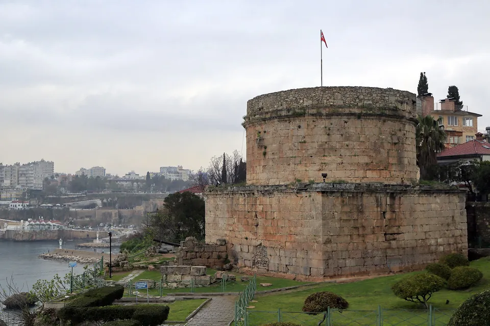
Hıdırlık Kulesi, «Hıdırlık Tower»
- Shape: two storeys, a square base and a round drum. A long corridor leads from the east door to a cross-shaped room with niches.
- Age: thought to be a monumental tomb of the 1st or 2nd century AD. Twelve fasces (bundles of rods with an axe) flank the door.
- For whom: accepted as built for Marcus Calpurnius Rufus, consul at Attaleia in the 1st century AD, and his family.
- Later: in the Byzantine period it was joined to the walls as a defence tower (municipality).
Seljuk Antalya the Yivli Minare and its neighbours
The Anatolian Seljuk sultans took Antalya in 1207. Their marks stand together around the Yivli Minare, a brick minaret with eight flutes: minare is a minaret and yivli means fluted. The Culture Portal calls it the symbol of Antalya.
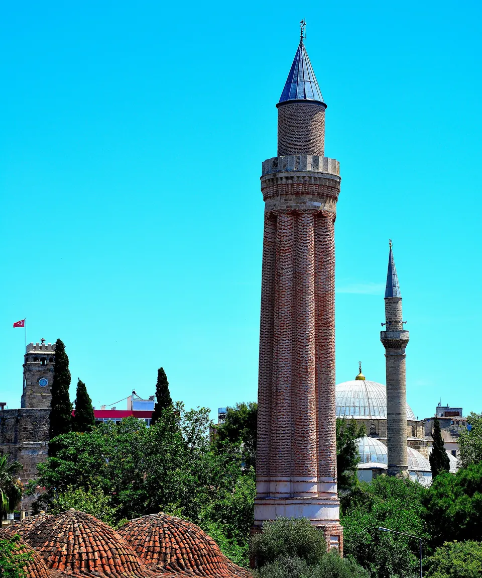
- külahThe cone at the top, the cap of the minaret.
- petekThe brick cylinder between the balcony and the cone.
- şerefeThe balcony. It is of stone; its upper part was renewed after the fire of 1954 (TDV).
- gövdeThe shaft, of polished red brick in eight flutes. Mosaic tiles once wrote «Allah» and «Muhammed» on it in Kufic script; almost all of that is lost (TDV).
Lower parts, hidden by trees in the picture
- kaide
- The base, a square block of cut stone (TDV).
- pabuç
- «Shoe»: the part just above the base in the Culture Portal’s list of the minaret’s parts (Culture Portal).
- tambur
- «Drum»: the octagonal drum above the square base, cut into niches. The building inscription is in the niches of its west face (TDV).
- Built
- 1220–1237, under the sultan Alaaddin Keykubat I (Culture Portal). TDV reads it from the building inscription on the west side (TDV); the municipality attributes the minaret to him on style (municipality).
- Height
- About 30 m (Culture Portal, TDV); 38 m (municipality).
- Steps
- Ninety, from a small door on the north side (Culture Portal).
- The complex
- A külliye is a complex of buildings round a mosque. Six more belong to it: the Atabey Armağan and Ulucami madrasas, the Mevlevihane, a bath and two tombs. It has been on Türkiye’s UNESCO World Heritage Tentative List since 2016 (Culture Portal).
Pages differ
The six-domed mosque beside the minaret
The Culture Portal dates only the minaret (1220–1237) and calls the mosque, with its six-domed prayer hall, the oldest surviving example in Anatolia of the many-domed mosque type.
TDV and the municipality date the hall that stands to 1373. The first mosque was built under Alaaddin Keykubat I, probably over earlier religious buildings; the surviving building was built for the emir Mübarizüddin Mehmed Bey by the architect Balaban et-Tavâşî. The municipality has the mosque destroyed under the Lusignans, the Cypriot rulers, before that rebuilding. TDV adds that the mosque served as a museum until 1972 (Culture Portal, TDV, municipality).
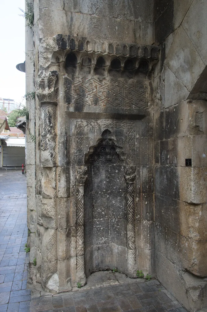
Beside the minaret
- Karatay Medresesi
- 1250, built by Celaleddin Karatay. A medrese is a school of Islamic learning. The crown gate is the part still standing; the madrasa was restored in 2006 (municipality).
- Atabey Armağan Medresesi
- 1239. Only the gate and parts of the side walls are left (municipality, TDV).
- Mevlevihane
- 1225 (municipality). TDV: said to be Seljuk, repaired in the 16th century and made a mevlevihane, a lodge of the Mevlevi order, in the 18th century by Tekeli Mehmed Paşa (TDV). The Mevlevis follow the teaching of Rumi.
- Ahi Yusuf Camii
- 1249–50, a mosque with a tomb joined to it by a wall (municipality).
- Fetih Kitabesi
- The Conquest Inscription: Arabic text in 42 pieces, 26 of them in place, on the inner walls along Uzun Çarşı Sokak. It was written when İzzeddin Keykâvus retook the city (municipality, TDV).
- İmaret Medresesi
- Also called the Ulucami Medresesi. Thought to be from the mid-13th century; its name and builder are not known. Its plan has a courtyard with four eyvans, vaulted halls open to the courtyard (municipality, TDV).
- Zincirkıran Mehmet Bey Türbesi
- A türbe is a tomb. Built in 1377 for Ali, a son of Mübarizüddin Mehmet Bey. The nickname «Zincirkıran» means «chain-breaker» (municipality, TDV).
- Nigâr Hatun Türbesi
- The tomb of Nigâr Hatun, wife of Bayezid II and mother of Prince Korkut (municipality). She died in March 1503 (TDV).
Ottoman Kaleiçi mosques, baths, hans and houses
Eight of the Ottoman buildings, with the municipality’s dates; the tool above lists more.
Bali Bey Camii
Built by Bali Paşa; repaired in 1849–50. Cami is a mosque.
Muratpaşa Camii
Built by Murad Paşa. The minaret was rebuilt in 1916.
Tekeli Mehmet Paşa Camii
A domed mosque, repaired many times. The Culture Portal spells it Tekeli Mahmut Paşa Camii.
Müsellim Camii
A plain outside; the inside is covered in tiles made in Kütahya.
Pazar Hamamı
A double bath, one for men and one for women. A hamam is a bath.
İki Kapılı Han
A courtyard inn with a well and a fountain; the Tek Kapılı Han is joined to it. A han is an inn. The upper rooms once lodged travellers and hold a market today.
Ömer Efendi Konağı
The municipality counts it among Kaleiçi’s most splendid mansions. A konak is a mansion.
Paşalar Konağı
A traditional house of two floors with a garden and a stone-paved hall.
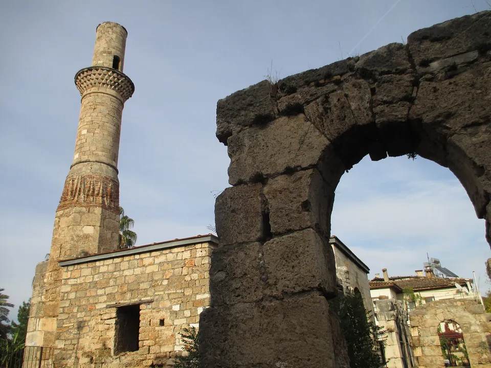
Kesik Minare, «Cut Minaret»
- Before: the city’s agora in Hellenistic and Roman times. In the early Byzantine period the Panhagia Church was built inside it, the holiest place of Pamphylia from the Middle Byzantine period.
- Mosque: the church became a mosque in the time of Prince Korkut. TDV’s list of the city’s mosques gives the Korkut Mosque as 15th century; Prince Korkut was bey of Teke here from 1502 to 1509 (TDV).
- The name: a fire in 1895 destroyed it and gave it the name (municipality, TDV).
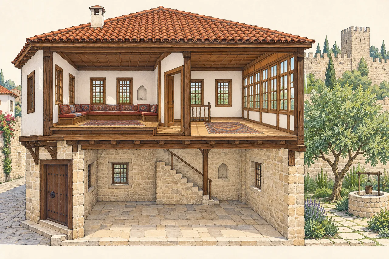
Inside a house of Kaleiçi
- Taşlık
- The stone-paved hall just inside the door.
- Hayat, sofa
- The open hall of the upper floor. Its whole front is windows onto the garden.
- Baş oda
- The main room, off the hall. Its door opens onto a part one step lower, the seki altı (municipality, on Paşalar Konağı).
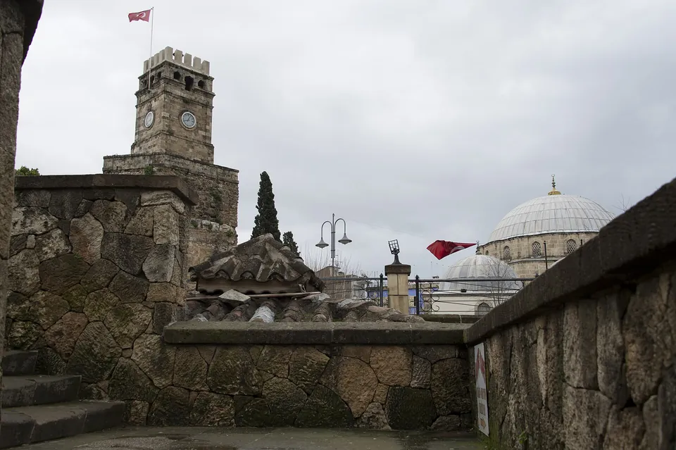
The 20th century in Kaleiçi
- 1903: the İskele Mescidi, a small hexagonal mosque with a wooden minaret (municipality).
- 1916: the Governor’s building, a school until 2005 (municipality).
- 1921: the Saat Kulesi, the Clock Tower, built by the municipality at the initiative of people from İzmir who had moved to Antalya. It stands on the bastion of the Kale Kapısı, the main gate of Kaleiçi on the land side, which was pulled down by the First World War years (municipality).
- 1993–1995: the Kaleiçi Müzesi, a museum of scenes of 19th-century Ottoman life (municipality).
- 2004: a statue of Attalos II, 2.60 m high (municipality).
The upper rooms of the İki Kapılı Han are a market today (municipality). For shops in the city see Shopping in Antalya.
The Antalya Museum and the hours the ministry lists
Status · checked 30.10.2026
Closed to visits
muze.gov.tr lists the Antalya Museum as closed to visits (checked 30.10.2026).
In the ministry’s hours list for Antalya it reads «KAPALI», closed, in both periods of the list below (antalya.ktb.gov.tr). Neither page states a reason or a reopening date.
The Antalya Museum (Antalya Müzesi; a müze is a museum) is the archaeology museum of the region. It was founded in 1922 by Süleyman Fikri Erten to keep works saved from looting by the occupation forces after the First World War (Culture Portal).
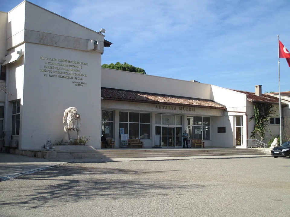
The museum in facts
- First homes
- The Alaaddin Mosque in Kaleiçi, then the Yivli Mosque (Culture Portal). The years in the Alaaddin Mosque: 1922–1934 (municipality).
- Since 1972
- In its present building, on 30,000 m² with 14 halls, open-air galleries and a garden (Culture Portal).
- Award
- Council of Europe Museum of the Year, 1988 (Culture Portal).
- Address
- Bahçelievler Mahallesi, Konyaaltı Caddesi No 88, Muratpaşa (muze.gov.tr).
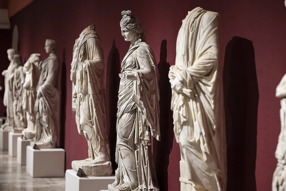
Halls of the museum
- Emperors’ Hall: statues from Perge, 2nd century AD, of emperors, empresses and political figures; the Dancer, black and white marble, is the museum’s emblem. Perge is an ancient site on the ministry’s hours list below (Culture Portal).
- Gods’ Hall: statues of the 2nd–3rd century AD from Perge.
- Mosaic Hall: the «Philosophers Mosaic» from the agora of Seleuceia.
- Perge Theatre Hall: 17 monumental statues, among them Alexander.
- Sarcophagi Hall: a lahit is a sarcophagus. The Heracles Sarcophagus came back from Geneva in September 2017 (Culture Portal).
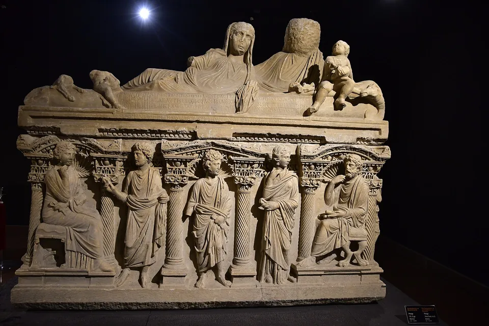
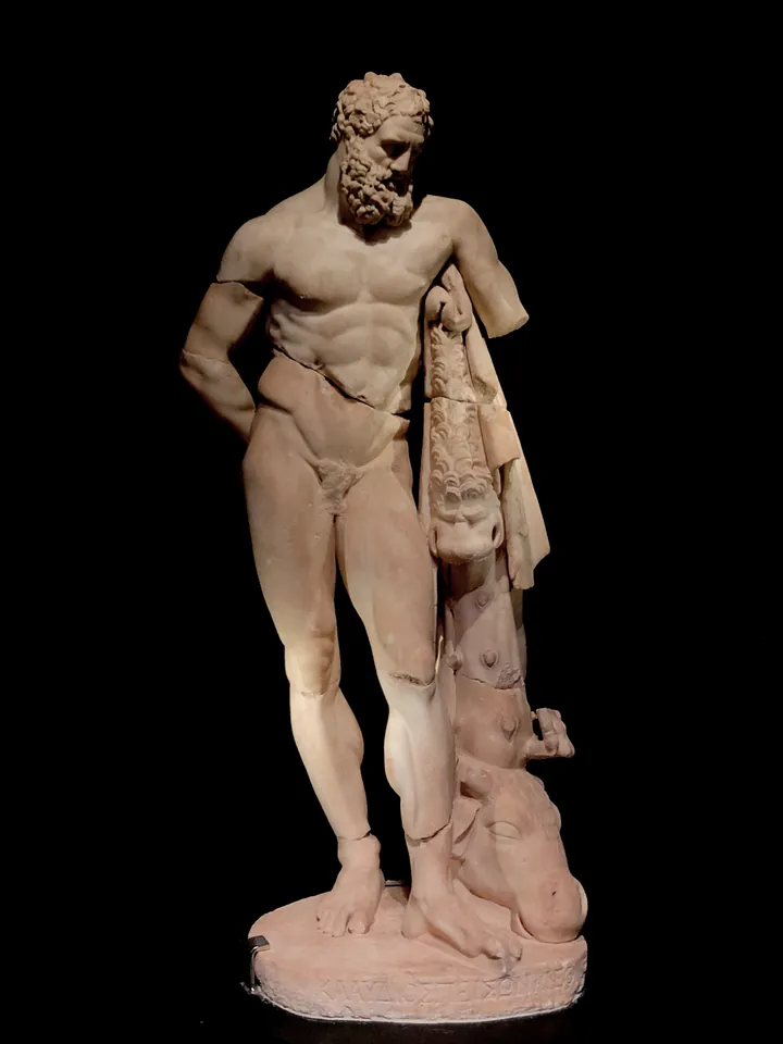
The MüzeKart is the ministry’s museum pass, valid for Turkish citizens (muze.gov.tr).
Visit hours, 02.10.2026 to 01.05.2027
- Antalya Müzesi: KAPALI, closed, in both periods.
- Antalya Etnografya Müzesi, Antalya Mevlevihane Müzesi: 08:30–19:00 from 02.10.2026 to 31.10.2026; 08:30–17:30 from 01.11.2026 to 01.05.2027.
- Perge Örenyeri, Phaselis Örenyeri, Olympos Örenyeri, Myra Örenyeri, Patara Örenyeri: 08:00–19:00 from 02.10.2026 to 31.10.2026; 08:00–17:00 from 01.11.2026 to 01.05.2027.
These are the hours of the transition period and the winter period in the hours list «Müze ve Örenyerleri» of the Antalya Provincial Directorate of Culture and Tourism, read 30.10.2026. Ören yeri is an ancient site; Etnografya is ethnography. The ticket office closes half an hour before the visit closes.
Getting to the old town
Kaleiçi can be reached on foot, by city bus from the east and west side of the city, or by car (Culture Portal). For a car see Car Rental in Turkey. The tram, tramvay, is a fourth way.
From the airport to Kaleiçi on the tram map
- Board Take the T1A line, Fatih–Havalimanı, at the airport. A durak is a stop. The airport has two stops on the map: Gelen Yolcu, arriving passengers, and Giden Yolcu, departing passengers (Antalya Ulaşım). Antalya Airport has been in service since 1960, with a domestic terminal, İç Hat Terminali, and an international one, Dış Hat Terminali (DHMİ).
- Ride Stay on the T1A line to the İsmetpaşa stop. The map shows 14 stops from the airport to İsmetpaşa, listed below.
- Change The map marks a transfer between İsmetpaşa on T1A and Kale Kapısı on T2, the line Zerdalilik–Müze.
- Get off One stop on, at Üç Kapılar. The map joins this stop with a dashed line to a «Kaleiçi» marker; Üç Kapılar is also the other name of Hadrian’s Gate (Antalya Ulaşım route map).
The 14 stops from the airport to İsmetpaşa
Havalimanı (Gelen Yolcu), Havalimanı (Giden Yolcu), Yonca Kavşak, Sinan, Yenigöl, Altınova, Cırnık, Demokrasi, Topçular, Kışla, Meydan, Burhanettin Onat, Doğu Garajı, İsmetpaşa. The map also marks the Otogar, the intercity bus station, on the T1A line, and a «Kart Merkezi», a card centre, near the Otogar and Doğu Garajı stops.
How the tram takes payment
- Cards: the turnstile reads an Antalyakart, the city’s transport card (Kişisel, Tam, Kullan At and NFC Mobil types), a bank or credit card with the contactless sign, or a contactless card issued by the Ministry of Family and Social Policy (Antray rules page).
- Children: children under seven ride free with a parent.
- Discounts: holders of discounted Antalyakart cards show their ID on request.
- Not printed: a fare. The rules page gives none.
The route map is the image on the Antray page, headed «Antray 1-2-3 Etap ve Nostalji Güzergah Haritası». The timetable page, Hareket Saatleri, covers the lines Fatih–Havalimanı–Aksu–Expo and Varsak–Müze, not T2, so no tram hours are printed here.
Around the old town cliffs, park and districts
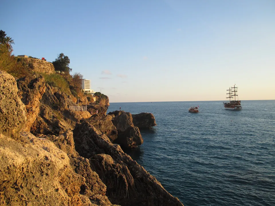
South of Kaleiçi the land ends in cliffs, with a park on them; Düden, the main waterfall off these cliffs, falls from them further along.
Falez and park
- Cliffs: falez means a high coast cut by waves. These are 40 m above the sea on average and run 20 km, from the Konyaaltı bypass to Lara Beach (municipality).
- Rock: the layer of travertine that forms them runs 30 km north to the Bey Mountains. Düden is the main waterfall that falls from them (municipality).
- Park: Karaalioğlu Parkı, built 1940–1945, first named İnönü Parkı: 140,000 m², three parallel avenues running down to the sea and ending in viewing terraces (municipality).
Waterfalls in Antalya
Düden, the main waterfall off the cliffs, and the province’s other falls.
Beaches in Antalya
Konyaaltı and Lara, the two ends of the cliffs, and the other beaches. Lara Beach has its own page.
Antalya Aquarium
The aquarium, on its own page.
Shopping in Antalya
Shops and markets of the city.
Climate, from MGM’s station table
- Period
- The figures are those of the Turkish State Meteorological Service, Meteoroloji Genel Müdürlüğü (MGM), for its Antalya station: measurement period 1930–2025 (MGM).
- Temperature
- The monthly mean runs from 10.1 °C in January to 28.6 °C in July. The highest recorded is 45.0 °C in July and the lowest −4.6 °C in February.
- Rain
- The monthly rainfall averages from 4.3 mm in August to 250.9 mm in December.
The Muratpaşa district holds Kaleiçi, Hadrian’s Gate, the Yivli Minare and the museum on the pages above. Konyaaltı and Lara, at the two ends of the cliffs, are the beach areas covered by Beaches in Antalya.
Turkish words and lines to copy
Nine short lines for the places on this page. Press Copy to put a line on the clipboard, then paste it into a message or show it. The words in them are explained where they first appear.
- Kaleiçi’ne nasıl gidilir?How do I get to Kaleiçi?
- Hadrian Kapısı nerede?Where is Hadrian’s Gate?
- Bu yapı ne zaman yapıldı?When was this building built?
- Yat limanı nerede?Where is the marina?
- Tramvay durağı nerede?Where is the tram stop?
- Antalyakart nereden alınır?Where do I get an Antalyakart?
- Temassız banka kartıyla ödeyebilir miyim?Can I pay with a contactless bank card?
- Yedi yaşından küçük çocuklar ücretsiz mi?Are children under seven free?
- Müze açık mı?Is the museum open?
- kale, iç
- fortress, inside
- sur, kapı, kule
- city wall, gate, tower
- cami, mescit, minare
- mosque, small mosque, minaret
- medrese, türbe, külliye
- school of Islamic learning, tomb, complex round a mosque
- han, konak, hamam
- inn with a courtyard, mansion, bath
- liman, yat limanı
- harbour, marina
- çarşı, sokak, cadde
- market, street, avenue
- falez
- a high coast cut by waves
- tramvay, durak, otogar
- tram, stop, intercity bus station
- müze, ören yeri, MüzeKart
- museum, ancient site, the ministry’s museum pass
- taşlık, hayat, baş oda
- stone-paved hall, open upper hall, main room
Sources and limits
Dates, hours and figures on this page are only what these pages print, read on 30.10.2026. The limits:
- Not printed: any fare for the tram, the tram timetable, the date of the route map, a ticket price for the museum, and a reason or date for its reopening. None of them is given here.
- The sketch: it is not a map and not to scale. No page gives coordinates, so only the places the pages state are drawn.
- Pictures: photographs from Wikimedia Commons with the credit in each caption. The house cut-away is an illustration, not a photograph.
- ANTALYA — TDV İslâm Ansiklopedisi, Feridun Emecen, print 1991, read 30.10.2026
- YİVLİ MİNARE KÜLLİYESİ — TDV İslâm Ansiklopedisi, Yavuz Tiryaki, print 2013, read 30.10.2026
- Kaleiçi – Antalya — Ministry of Culture and Tourism, Culture Portal, read 30.10.2026
- Hadrian Kapısı – Antalya — Ministry of Culture and Tourism, Culture Portal, read 30.10.2026
- Yivli Minare Camii – Antalya — Ministry of Culture and Tourism, Culture Portal, read 30.10.2026
- Antalya Müzesi – Antalya — Ministry of Culture and Tourism, Culture Portal, read 30.10.2026
- ANTALYA MUSEUM — Ministry of Culture and Tourism, muze.gov.tr, read 30.10.2026
- Antalya’daki Müze ve Ören Yerlerinde Ziyaret Saatleri Yeniden Düzenlendi — Antalya İl Kültür ve Turizm Müdürlüğü, with its hours list «Müze ve Örenyerleri», read 30.10.2026
- Kaleiçi — Antalya Büyükşehir Belediyesi, Kaleiçi Kültür ve Turizm Haritası, read 30.10.2026
- Antray Yolculuk Kuralları — Antalya Ulaşım Hizmetleri Petrol Sanayi ve Ticaret A.Ş., with its route map, read 30.10.2026
- ANTRAY | Hareket Saatleri — Antalya Ulaşım Hizmetleri Petrol Sanayi ve Ticaret A.Ş., read 30.10.2026
- Genel Bilgiler, Antalya Havalimanı — Devlet Hava Meydanları İşletmesi Genel Müdürlüğü, read 30.10.2026
- İl ve İlçeler İstatistik: Antalya — Meteoroloji Genel Müdürlüğü, read 30.10.2026