

Nevşehir and Cappadocia: Sights, Hours, Underground Cities
What Nevşehir and Cappadocia mean, how people carved homes, churches and underground cities into the rock, each site's hours, and how to get around.
Table of Contents
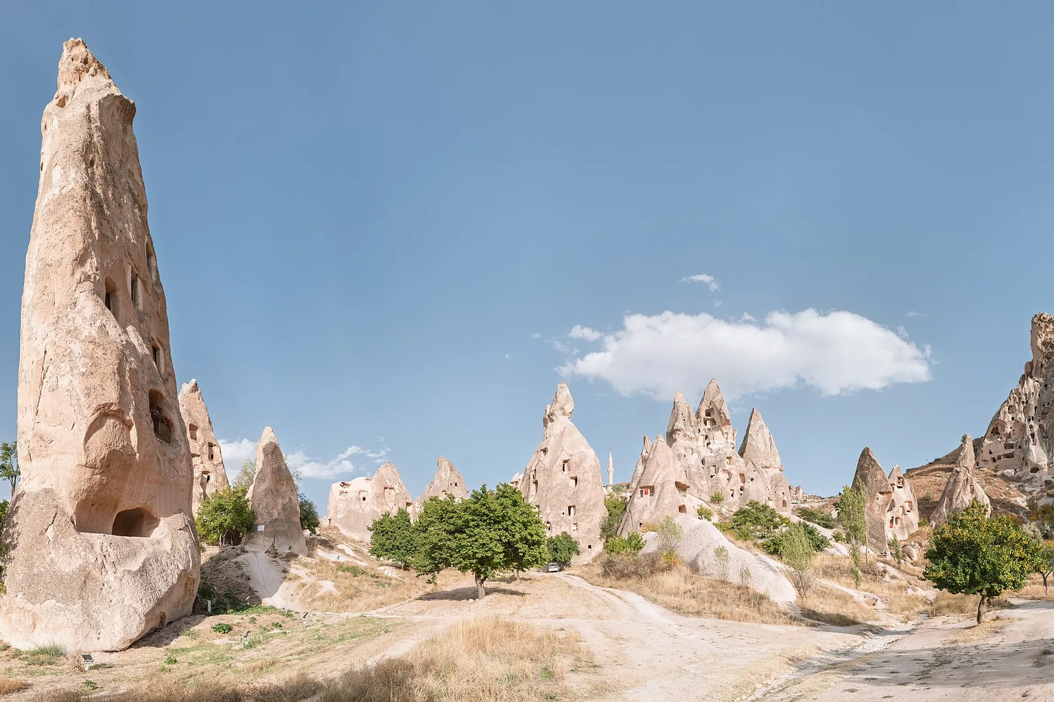
Nevşehir is a city and a province in central Türkiye. Its soft volcanic rock (tuff) was carved into homes, churches and whole underground cities. Göreme, Zelve, Derinkuyu and Kaymaklı all lie in the province and open every day from 08:00.
In short · checked 27.10.2026
Four sites open every day, and a city carved down into the rock.
- Göreme, Zelve–Paşabağlar, Derinkuyu and Kaymaklı are open every day, from 08:00; the last ticket is sold at 17:15.
- Derinkuyu is about 85 m deep, and about a tenth of it is open to visitors.
- Two airports serve the area: Kapadokya (NAV), in Nevşehir province, and Kayseri (ASR).
- Winters are cold and summers dry: the January mean is −0.1 °C and the July mean 21.4 °C (MGM, 1959–2025).
Tool · checked 27.10.2026
The carved city
Pick Derinkuyu or Kaymaklı and carry the lamp down with Step down. Tap a room to take the lamp there. Each stop is one part of the city as the Ministry of Culture and Tourism describes it.Both cities are drawn lit, and every stop is listed with its sentence.
Derinkuyu
Kaymaklı
The underground city Derinkuyu Yeraltı Şehri
Yeraltı şehri means underground city. Derinkuyu is carved down into soft volcanic rock (tuff). In Turkish derin is deep and kuyu is a well.
muze.gov.tr · checked 27.10.2026
Stables ahır
The first floors carved from the entrance are mostly stables. Animals could not be taken lower.
muze.gov.tr · checked 27.10.2026
Kitchens and a place for boiling molasses tandır · pekmez
The kitchens on the upper floors were used together. They had tandoor stoves (tandır), like those still used in Cappadocia’s towns and villages. One room was a place for boiling molasses (pekmez, a thick syrup boiled down from fruit).
muze.gov.tr · checked 27.10.2026
A missionary school
The school is on the second floor. The culture portal adds a place for confession and a baptismal pool, which it says Kaymaklı does not have.
muze.gov.tr · kulturportali.gov.tr · checked 27.10.2026
The narrow tunnel and its stone
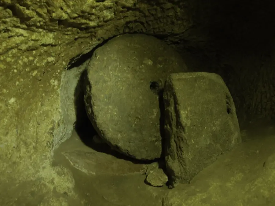
Some rooms are joined by tunnels only wide enough for one person. The culture portal says large stone cylinders at the tunnel entrances and exits were used to close the tunnel for security.
kulturportali.gov.tr · checked 27.10.2026
Cellars, dining halls, churches
Derinkuyu also has cellars, dining halls and churches.
muze.gov.tr · checked 27.10.2026
The ventilation shaft
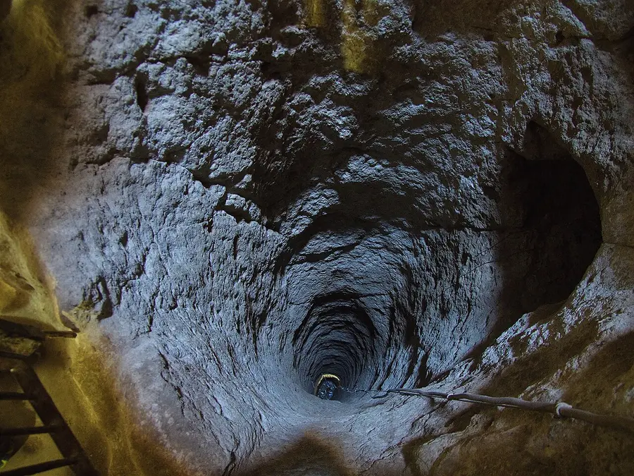
A ventilation shaft 55 m deep, also used as a water well.
muze.gov.tr · checked 27.10.2026
The deepest part
About 85 m deep. Derinkuyu opened to visitors in 1965, and about a tenth of it can be visited today. The culture portal describes it as eight floors.
muze.gov.tr · kulturportali.gov.tr · checked 27.10.2026
The underground city Kaymaklı Yeraltı Şehri
The village’s ancient name was Enegüp. Houses stand near 100 or more tunnels, and villagers still use parts of them as cellars, stores and stables.
muze.gov.tr · checked 27.10.2026
Stables ahır
The first floor holds stables.
muze.gov.tr · checked 27.10.2026
A church
On the second floor: a church with a single nave and two apses (the rounded recesses at its end), an altar and seating platforms.
muze.gov.tr · checked 27.10.2026
Stores, kitchens and a stone with 57 holes
The third floor has stores and kitchens, and a block of andesite (a volcanic rock) with 57 holes carved for crushing and grinding. The block is part of the rock, not brought in.
muze.gov.tr · checked 27.10.2026
Round the shafts
Four floors are dug out, with rooms gathered round the ventilation shafts. The passages are low, narrow and sloping. The Ministry calls Kaymaklı the widest underground city of those explored.
muze.gov.tr · checked 27.10.2026
Derinkuyu: about 85 m deep · a 55 m shaft that is also a well · about a tenth open · opened 1965 · eight floors, the culture portal says.
Kaymaklı: four floors dug out · low, narrow, sloping passages · the widest explored, the Ministry says · houses near 100 or more tunnels.
Derinkuyu · every day 08:00–18:00 · last ticket 17:15
Bayramlı Mah. Şemşili Yolu Sok. No:15, Derinkuyu.
Derinkuyu Yeraltı Şehri’ne gitmek istiyorum. Adres: Bayramlı Mah. Şemşili Yolu Sok. No:15, Derinkuyu.I want to go to the Derinkuyu Underground City. Address: Bayramlı Mah. Şemşili Yolu Sok. No:15, Derinkuyu.
muze.gov.tr · Derinkuyu · checked 27.10.2026. Hours change with the season; each site’s muze.gov.tr page shows the current ones.
Kaymaklı · every day 08:00–18:00 · last ticket 17:15
Camii Kebir Mah. Eşref Ayhan Cad. No:46, Kaymaklı.
Kaymaklı Yeraltı Şehri’ne gitmek istiyorum. Adres: Camii Kebir Mah. Eşref Ayhan Cad. No:46, Kaymaklı.I want to go to the Kaymaklı Underground City. Address: Camii Kebir Mah. Eşref Ayhan Cad. No:46, Kaymaklı.
muze.gov.tr · Kaymaklı · checked 27.10.2026. Hours change with the season; each site’s muze.gov.tr page shows the current ones.
Three names: Nevşehir, Kapadokya, Kapadokya Alanı
Signs, tickets and maps use three names for three different things: a city and province, a region, and an area with its own state body.
Nevşehir
Nevşehir means new city. Until 1725 the place was the village of Muşkara; it took its present name that year. It became a province on 20 July 1954. Besides the centre it has seven districts (ilçe): Acıgöl, Avanos, Derinkuyu, Gülşehir, Hacıbektaş, Kozaklı and Ürgüp. The city lies about 1,150 m above sea level.
Kapadokya (Cappadocia)
Kapadokya is a region, not a province. The Ministry’s culture portal bounds it by the Kızılırmak river in the north, Yeşilhisar in the east, the Hasan and Melendiz mountains in the south, Aksaray in the west and Kırşehir in the north-west. People have lived there since the Chalcolithic (Copper Age). UNESCO’s World Heritage site «Göreme National Park and the Rock Sites of Cappadocia» was inscribed in 1985.
Kapadokya Alanı
Kapadokya Alan Başkanlığı (the Cappadocia Area Authority) belongs to the Ministry of Culture and Tourism. Its stated mission is to protect and develop the area’s historical, cultural and natural value. Its office is at Fatih Sultan Mehmet Mah., Ali Dirikoç Bulvarı No:93, Nevşehir.
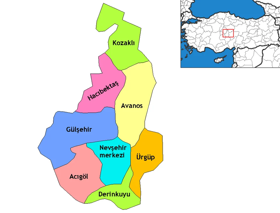
What UNESCO counts as the site
- The area between Nevşehir, Ürgüp and Avanos.
- Four more sites: Karain, Karlık, Yeşilöz and Soğanlı.
- Two underground cities: Kaymaklı and Derinkuyu.
- Two volcanoes bound it to the south and east: Erciyes Dağ, 3,916 m, and Hasan Dağ, 3,253 m. Dağ means mountain.
UNESCO World Heritage Centre · checked 27.10.2026 · source
How the rock formed: tuff and fairy chimneys
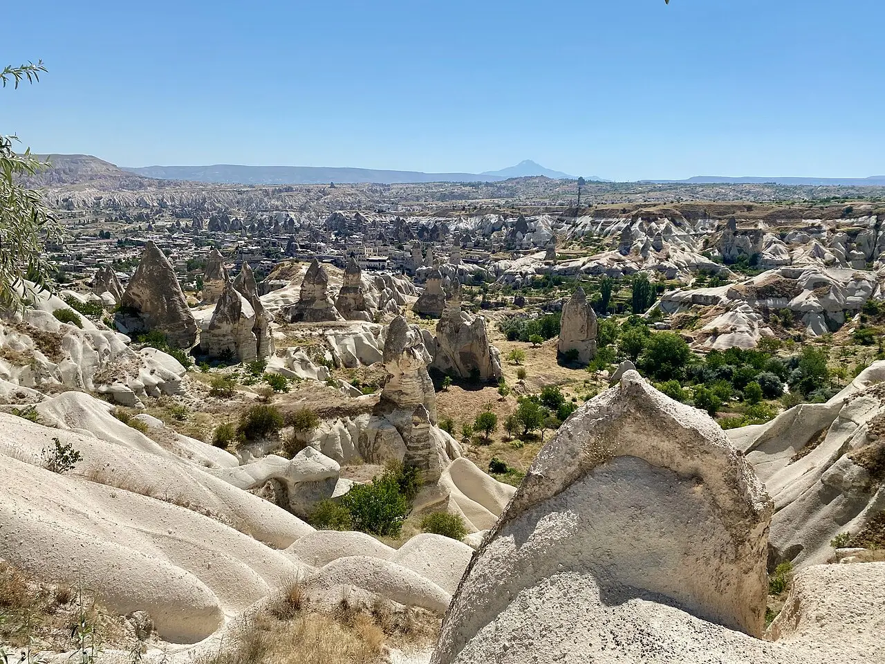
The soft rock is tuff (tüf): a light-coloured, porous rock made of volcanic ash, sand and lava particles. Wind and water wore the tuffs of the Erciyes and Hasan volcanoes into the valleys and rock shapes of Cappadocia.
How does a fairy chimney form?
Ash, sand and lava from volcanoes such as Erciyes and Hasan hardened into tuff.
TDK · kulturportali.gov.tr · checked 27.10.2026 · TDK · portal
Wind and water wear the soft rock away.
kulturportali.gov.tr · checked 27.10.2026 · source
Erosion cuts a volcanic landscape into ridges, valleys and pinnacles.
UNESCO · checked 27.10.2026 · source
Rock that stays comfortable
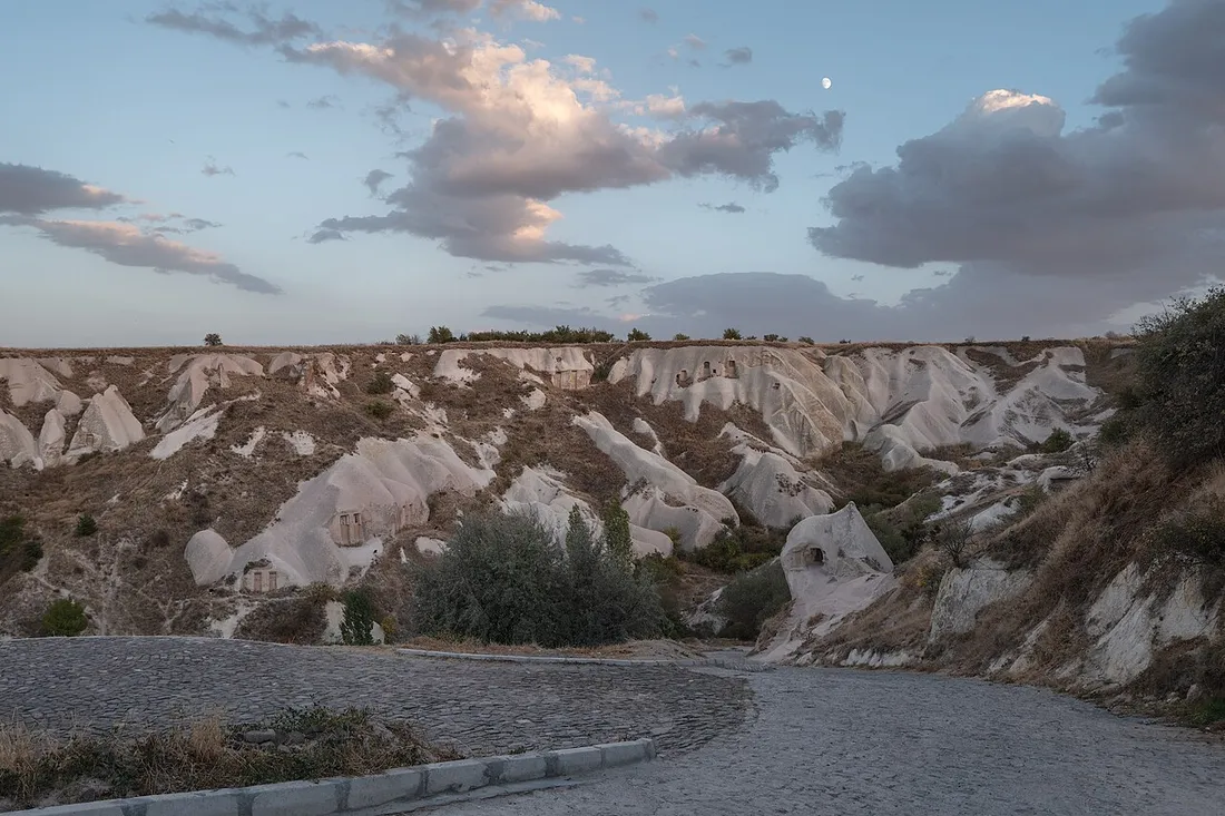
The rock-cut spaces stay warm in winter and cool in summer, so the Ministry’s culture portal calls their indoor climate suitable for every season.
kulturportali.gov.tr · checked 27.10.2026 · source
How people carved the rock: homes, churches and stores
People dug into the soft tuff for shelter, worship and storage; Göreme, Zelve and the underground cities show all three.
From the first cells to World Heritage
- 4th centuryUNESCO says monastic activity in Cappadocia is believed to have begun in this century, with small communities of hermits living in cells cut into the rock. In Göreme monastic life lasted from the 4th to the 13th century.
- 725–842The iconoclastic period, a time of dispute over holy images. UNESCO says many sanctuaries of these years kept a strict minimum of symbols, most often crosses.
- After 842Painted churches follow (UNESCO’s dates): Tokalı and El Nazar in the 10th century, St Barbara and Saklı in the 11th, Elmalı and Karanlık (the Dark Church) at the end of the 12th and the start of the 13th.
- 1071The Seljuk Turks arrive. UNESCO says the churches keep the image of a Byzantine province from the 4th century to this date.
- 1967Göreme opens to visitors.
- 1985UNESCO inscribes Göreme National Park and the Rock Sites of Cappadocia.
UNESCO · muze.gov.tr · checked 27.10.2026 · UNESCO · Göreme
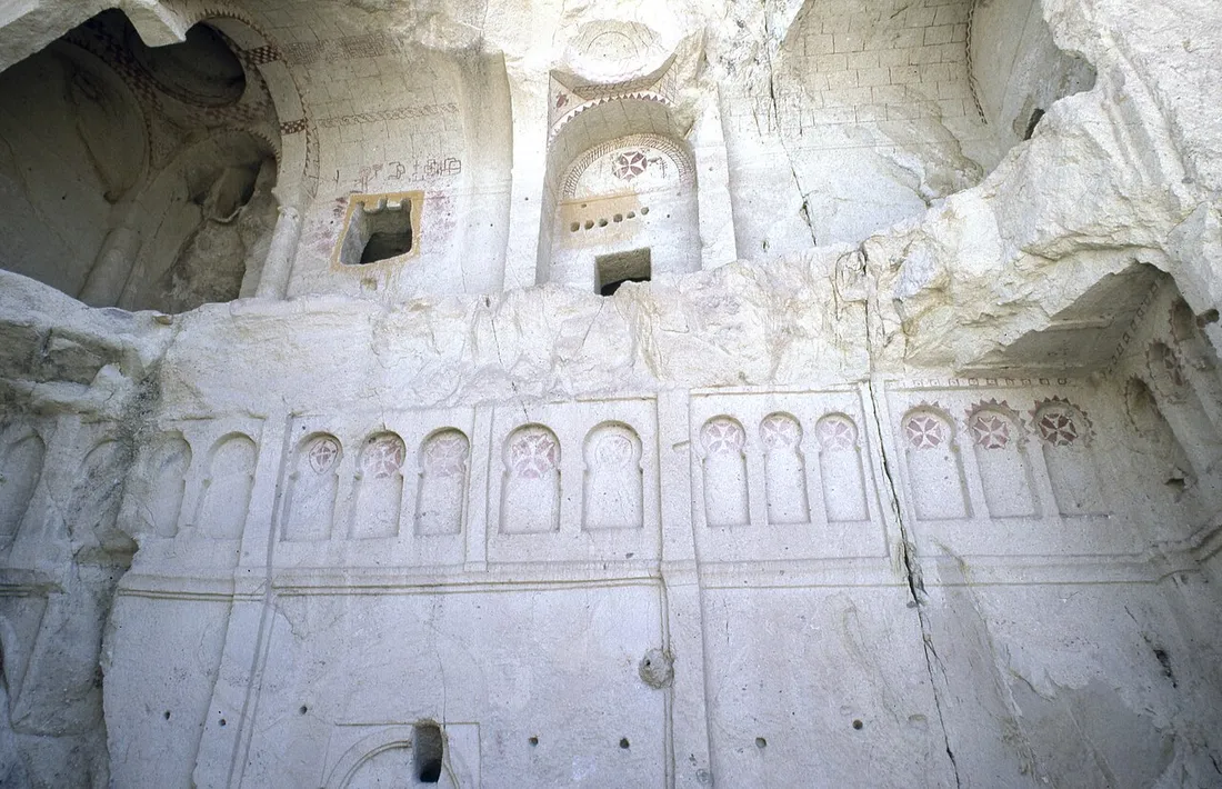
Göreme and the Dark Church
- Göreme
- Ten churches and monasteries are named in the open-air museum, among them St. Basil, Elmalı, Saint Barbara and Tokalı. They are painted two ways: on the bare rock, and in fresco-secco (paint on dry plaster).
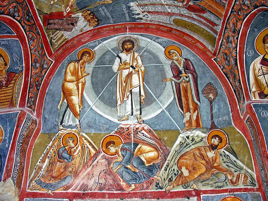
- The Dark Church
- Karanlık Kilise has its own ticket. It has a central dome, four columns and three apses (rounded recesses). Only a small window in the narthex (entrance porch) lets in light; the Ministry says this is why the colours of its frescoes stay vivid. The Ministry dates it to the late 11th and early 12th century; UNESCO to the end of the 12th and the start of the 13th.
muze.gov.tr · UNESCO · checked 27.10.2026 · Göreme · Dark Church · UNESCO
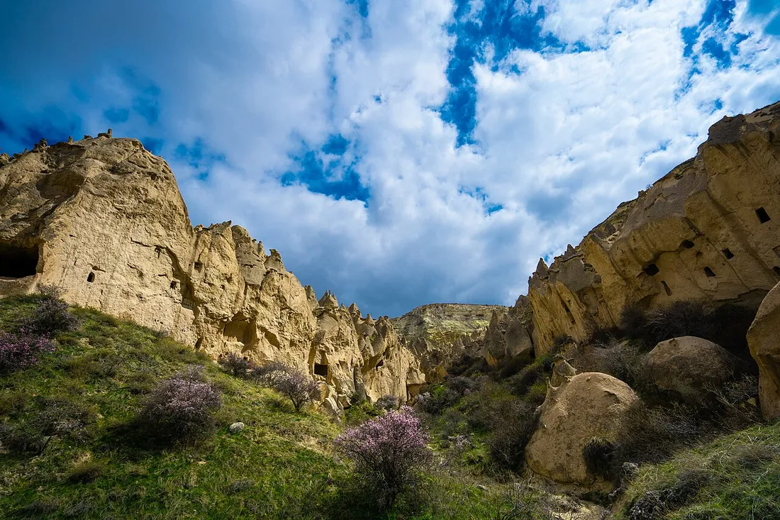
Zelve and Paşabağ
- Zelve lies on the steep northern slopes of Aktepe, in three valleys: a mill, churches, a monastery carved into a dome-shaped rock, a mosque, and pigeonhouses carved high up with decorated fronts.
- Paşabağ is the «Valley of the Priests»: multi-headed rock chimneys carved into chapels and living rooms, and the chapel of St Simeon with a cell.
- Çavuşin Church stands 2.5 km from Göreme on the Göreme–Avanos road, built into a massive rock on two floors and dated 964/965. It is closed for restoration (checked 27.10.2026).
muze.gov.tr · checked 27.10.2026 · Zelve–Paşabağlar · Çavuşin
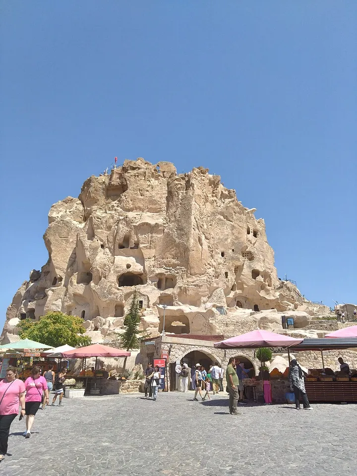
The sites and their hours: checked 27.10.2026
Göreme, Zelve–Paşabağlar, Derinkuyu and Kaymaklı are open every day. Hacıbektaş keeps its own schedule. An ören yeri is an archaeological site; gişe is the ticket window. Hours change with the season; each site’s muze.gov.tr page shows the current ones.
Which site?
- Open
- Every day 08:00–17:45. Last ticket 17:15.
- Where
- Gaferli Mah. Müze Cad., Göreme: Göreme Örenyeri, the open-air museum. The Dark Church has its own entrance and ticket, open every day 08:00–18:00, last ticket 17:45.
- Evenings
- In some seasons Göreme also opens in the evening; muze.gov.tr announces the dates.
- Cards
- MüzeKart (a state museum card) is valid for Turkish citizens. An audio guide is offered.
- Page
- muze.gov.tr · checked 27.10.2026 · Göreme · Dark Church
- Turkish line
Göreme Örenyeri’ne gitmek istiyorum. Adres: Gaferli Mah. Müze Cad., Göreme.I want to go to Göreme Örenyeri. Address: Gaferli Mah. Müze Cad., Göreme.
- Open
- Every day 08:00–18:00. Last ticket 17:15.
- Where
- Aktepe Köyü, Zelve Açıkhava Müzesi Küme Evleri No:1, Avanos. Köy is village; açıkhava müzesi is open-air museum.
- Cards
- MüzeKart is valid for Turkish citizens.
- Page
- muze.gov.tr · checked 27.10.2026 · Zelve–Paşabağlar
- Turkish line
Zelve–Paşabağlar Örenyeri’ne gitmek istiyorum. Adres: Aktepe Köyü, Zelve Açıkhava Müzesi Küme Evleri No:1, Avanos.I want to go to Zelve–Paşabağlar. Address: Aktepe Köyü, Zelve Açıkhava Müzesi Küme Evleri No:1, Avanos.
- Open
- Every day 08:00–18:00. Last ticket 17:15.
- Where
- Bayramlı Mah. Şemşili Yolu Sok. No:15, Derinkuyu.
- Page
- muze.gov.tr · checked 27.10.2026 · Derinkuyu
- Turkish line
- The tool above has it, with a Copy button.
- Open
- Every day 08:00–18:00. Last ticket 17:15.
- Where
- Camii Kebir Mah. Eşref Ayhan Cad. No:46, Kaymaklı.
- Page
- muze.gov.tr · checked 27.10.2026 · Kaymaklı
- Turkish line
- The tool above has it, with a Copy button.
- Open
- Summer (1 April–1 October) 08:00–19:00, winter (1 October–1 April) 08:00–17:00. The Ministry museum portal lists it as closed on Saturday and Sunday. The ticket window closes at the same hour as the site.
- Where
- Bala Mahallesi No:5, Hacıbektaş. The oldest section of the complex was built in the 13th century; the complex reached its present form in the 16th and was a lodge until 1925. It opened as a museum on 16 August 1964 and has three courtyards.
- Page
- Ministry museum portal · checked 27.10.2026 · Nevşehir Hacıbektaş Museum
- Turkish line
Hacıbektaş Müzesi’ne gitmek istiyorum. Adres: Bala Mahallesi No:5, Hacıbektaş.I want to go to the Hacıbektaş Museum. Address: Bala Mahallesi No:5, Hacıbektaş.
| Site | Days | Hours | Last ticket |
|---|---|---|---|
| Göreme | Every day | 08:00–17:45 | 17:15 |
| Dark Church (own ticket) | Every day | 08:00–18:00 | 17:45 |
| Zelve–Paşabağlar | Every day | 08:00–18:00 | 17:15 |
| Derinkuyu | Every day | 08:00–18:00 | 17:15 |
| Kaymaklı | Every day | 08:00–18:00 | 17:15 |
| Hacıbektaş | Saturday and Sunday closed | Summer 08:00–19:00, winter 08:00–17:00 | At closing |
| Çavuşin Church | Closed for restoration | – | – |
MüzeKart and Museum Pass
MüzeKart is the card Turkish citizens use at most ministry museums. Museum Pass Cappadocia covers more than 10 ministry museums and sites in Nevşehir and Aksaray provinces for 3 days; it is not valid for Night Museum visits. What each costs is in Turkey museum ticket prices. Public holidays: Turkey public holidays.
muze.gov.tr · Ministry museum portal · checked 27.10.2026 · MuseumPass · portal
Valleys on the area’s list
- Aşk Vadisi, Love Valley (aşk is love).
- Güvercinlik Vadisi, Pigeon Valley.
- Kızılçukur Vadisi, Red Valley.
- Paşabağlar Vadisi, also called Rahipler Vadisi, the Valley of the Priests.
kapadokyaalan.ktb.gov.tr · checked 27.10.2026 · Ziyaret Noktaları Balloon flights over the valleys: Cappadocia Hot Air Balloon Prices.
The underground cities: who dug them, and why
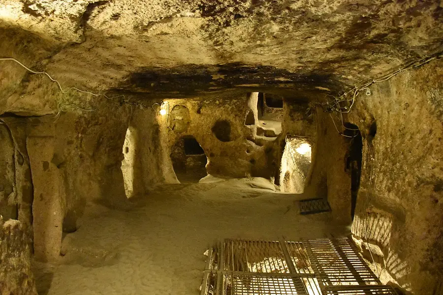
An underground city (yeraltı şehri) is a set of rooms joined by galleries and tunnels, carved down into soft tuff. The tool above walks through two of them.
What are they?
The Ministry estimates 150–200 underground settlements in Cappadocia, mostly carved down into soft tuff. Hundreds of rooms are joined by galleries and tunnels.
Who dug them, and why?
The Ministry says they were built as a secure refuge in the event of threat or attack, and they are cool in summer and warm in winter. Sources differ on the people and the century. The culture portal says the first Christians to settle at Derinkuyu came from the Roman Empire in the 2nd century and hid in cities whose entrances were hard to notice. TDV says Christians carved underground cities as refuges in the Byzantine period, especially the 6th to 9th centuries. UNESCO says rock-cell monks later banded together into underground towns as a refuge against Arab invasions.
How were they defended?
The Ministry says Kaymaklı’s galleries are low, narrow and long to restrict the enemy’s movement. The culture portal says some tunnels are only wide enough for one person, and that large stone cylinders at their entrances and exits were used to close them for security.
How deep is Derinkuyu?
About 85 m. A ventilation shaft 55 m deep was also used as a water well. It opened to visitors in 1965 and about a tenth can be visited today.
What is different at Kaymaklı?
Its passages are low, narrow and sloping, and four floors are dug out, with rooms round the ventilation shafts. The Ministry calls it the widest underground city of those explored. The culture portal says Derinkuyu, unlike Kaymaklı, has a missionary school, a place for confession and a baptismal pool.
What did people keep there?
Stables on the first floors, kitchens used together with tandoor stoves, a place for boiling molasses, stores, and at Kaymaklı a church with two apses and a stone block with 57 holes for crushing and grinding.
Nevşehir city: a new town for a grand vizier
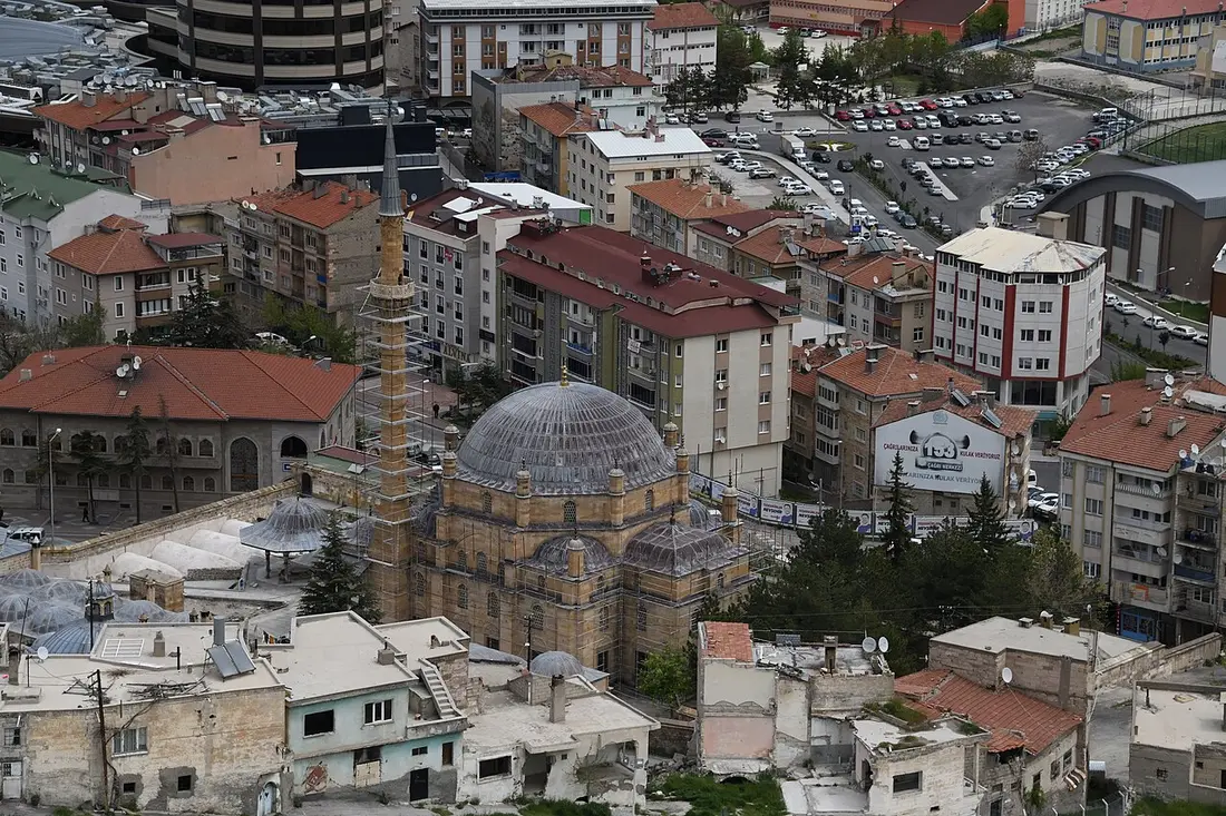
Until 1725 the city was a village called Muşkara. A grand vizier, the sultan’s chief minister, built a mosque complex there and gave it its name.
From Muşkara to Nevşehir
- Before 1725Muşkara, a village with a castle from the Seljuk period (a medieval Turkish dynasty).
- 1718–1730Damat İbrahim Paşa is grand vizier under Sultan Ahmed III. He was born in Muşkara, and the sultan gave him the village. Damat means son-in-law.
- 1725The village takes the name Nevşehir, «new city», with tax relief to draw settlers.
- 1726–27His külliye is complete: a mosque with a medrese (a school of Islamic learning), a primary school, an imaret (a public kitchen), a han (an inn), a hamam (a bath) and two fountains.
- 20 July 1954Nevşehir becomes a province.
TDV İslâm Ansiklopedisi · checked 27.10.2026 · Nevşehir · the külliye · külliye: the whole of a mosque and the buildings built round it (TDK).
Prayer times for the city: Turkey prayer times. For a hamam: A day at a Turkish hammam.
Getting there and around: airports, buses and minibuses
Two airports serve the area: Kapadokya in Nevşehir province and Kayseri.
How do you want to travel?
- Kapadokya (NAV)
- A civil airport in Nevşehir province, in service since 1998, with domestic and international flights. The first phase of a new terminal building opened on 16.02.2026. It lies 30 km from the city centre; a city shuttle, taxis, rental cars and private cars serve it.
- Kayseri (ASR)
- A civil and military airport in the city of Kayseri, in service since 1998, with domestic and international flights.
- Otogar
- An otogar is the intercity bus station: the place where intercity vehicles pick up and set down passengers.
- Turkish line
Otogara gitmek istiyorum.I want to go to the bus station.
- Source
- TDK · checked 27.10.2026 · sozluk.gov.tr
- Dolmuş
- A dolmuş is a small shared passenger vehicle, a minibus. Göreme lies 10 km from Nevşehir and public transport serves it.
- Taxis
- Ranks, apps and what to expect: Taxis in Turkey.
- Turkish line
Göreme’ye gitmek istiyorum.I want to go to Göreme.
- Rental cars
- Companies, papers and rules: Car rental in Turkey.
- Nearest sites
- Göreme, Zelve, Derinkuyu and Kaymaklı have their own addresses in the site picker above and in the tool.
The weather: MGM figures for 1959–2025
MGM, the state weather service (Meteoroloji Genel Müdürlüğü), measured Nevşehir from 1959 to 2025. January is the coldest month, July the hottest and May the wettest.
MGM · measurement period 1959–2025 · checked 27.10.2026
−0.1 °C in January, 21.4 °C in July.
The mean daily lowest and highest: −3.6 °C and 4.0 °C in January, 13.7 °C and 28.5 °C in July.
The record low is −23.6 °C (February) and the record high 39.5 °C (July). The deepest snow was 64 cm (02.02.1992). Rain averages 8.4 mm in August and 57.9 mm in May.
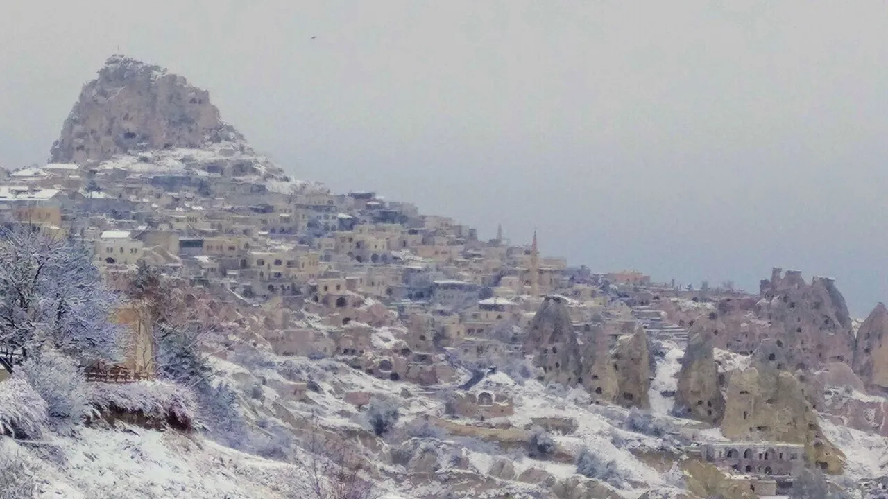
All twelve months
| Month | Mean °C | Lowest, mean °C | Highest, mean °C | Rain, mm | Rainy days | Sunshine, hours a day |
|---|---|---|---|---|---|---|
| Jan | −0.1 | −3.6 | 4.0 | 45.4 | 12.31 | 3.1 |
| Feb | 0.9 | −2.6 | 5.5 | 41.1 | 12.10 | 4.2 |
| Mar | 5.0 | 0.7 | 10.3 | 48.1 | 13.09 | 5.3 |
| Apr | 10.2 | 5.1 | 16.0 | 50.2 | 12.49 | 6.6 |
| May | 14.5 | 8.9 | 20.6 | 57.9 | 12.93 | 8.4 |
| Jun | 18.3 | 11.7 | 24.9 | 37.5 | 8.10 | 10.6 |
| Jul | 21.4 | 13.7 | 28.5 | 9.4 | 2.30 | 11.9 |
| Aug | 21.3 | 13.6 | 28.7 | 8.4 | 1.72 | 11.3 |
| Sep | 17.3 | 10.5 | 24.5 | 14.3 | 3.42 | 9.4 |
| Oct | 12.1 | 6.8 | 18.3 | 28.0 | 6.99 | 6.5 |
| Nov | 6.7 | 2.5 | 11.8 | 34.3 | 8.54 | 4.6 |
| Dec | 2.1 | −1.3 | 6.2 | 48.4 | 12.27 | 3.1 |
Two food words on a menu: testi kebabı and pekmez
Two words you may meet in Nevşehir are testi kebabı, a kebab cooked in a clay pot, and pekmez, a thick fruit syrup.
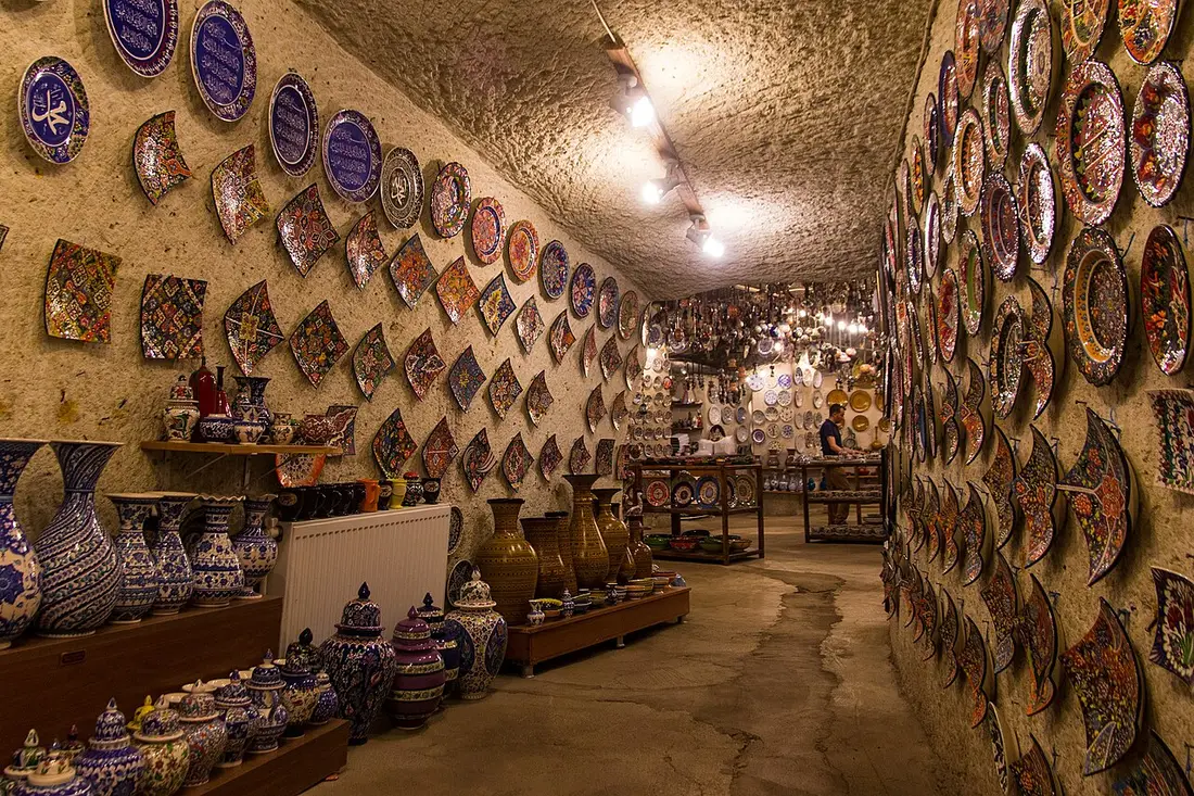
Testi kebabı
Testi is a clay jug, and kebap means roast meat. Meat and vegetables go into the pot, its mouth is sealed with dough, and it cooks for about two hours in embers, a tandır or an oven. The traditional pots come from Avanos. At the table the dough is taken off. In tourist restaurants the neck is often broken with a cleaver for show; the portal says that is not traditional.
TDK · kulturportali.gov.tr · checked 27.10.2026 · TDK · Testi Kebabı
Testi kebabı istiyorum.I would like testi kebabı.
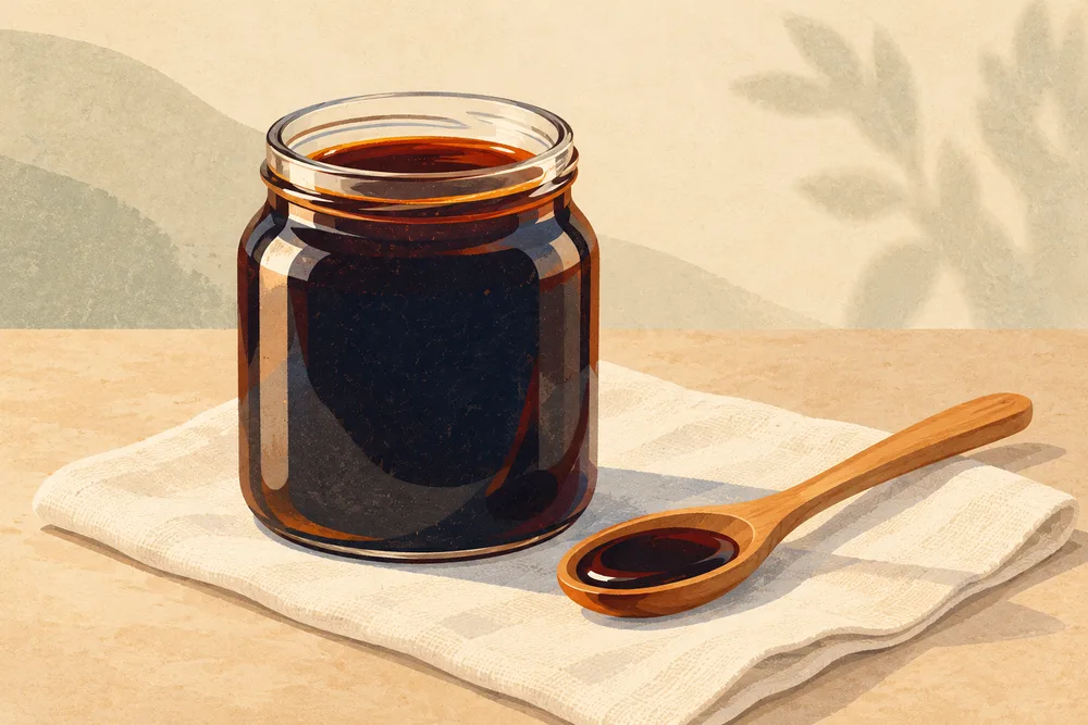
Pekmez var mı?Do you have pekmez?
Quick answers in a few lines
Which sites are open every day?
Göreme (08:00–17:45), Zelve–Paşabağlar, Derinkuyu and Kaymaklı (each 08:00–18:00), checked 27.10.2026. Hacıbektaş has its own schedule.
When is the last ticket sold?
At 17:15 at Göreme, Zelve–Paşabağlar, Derinkuyu and Kaymaklı. The Dark Church sells its last ticket at 17:45.
How deep is Derinkuyu?
About 85 m, and about a tenth of it is open to visitors.
What is a peribacası?
A fairy chimney: a landform of easily eroded stone with a pointed tower or pyramid shape, some with a cone or tray-like rock on top (TDK).
Is Kapadokya the same as Nevşehir?
No. Nevşehir is a city and a province; Kapadokya is a region, and Kapadokya Alanı is an area with its own state body.
Which airports serve the area?
Kapadokya (NAV), in Nevşehir province, and Kayseri (ASR).
How cold does it get?
The January mean is −0.1 °C and the record low −23.6 °C (February).
What is a külliye?
The whole of a mosque and the buildings built round it, such as a medrese, an imaret, a library or a hospital (TDK).
Sources and limits
Show the sources
- Göreme Archaeological Site — Ministry of Culture and Tourism, muze.gov.tr, checked 27.10.2026
- The Dark Church at Göreme Open Air Museum — Ministry of Culture and Tourism, muze.gov.tr, checked 27.10.2026
- Zelve–Paşabağlar Archaeological Site — Ministry of Culture and Tourism, muze.gov.tr, checked 27.10.2026
- Derinkuyu Underground City — Ministry of Culture and Tourism, muze.gov.tr, checked 27.10.2026
- Kaymaklı Underground City — Ministry of Culture and Tourism, muze.gov.tr, checked 27.10.2026
- Çavuşin Church — Ministry of Culture and Tourism, muze.gov.tr, checked 27.10.2026
- MuseumPass — Ministry of Culture and Tourism, muze.gov.tr, checked 27.10.2026
- Nevşehir Hacıbektaş Museum — Ministry museum portal, Turkish Museums, checked 27.10.2026
- Derinkuyu Yeraltı Şehri — Türkiye Kültür Portalı, Ministry of Culture and Tourism, checked 27.10.2026
- Göreme Milli Parkı ve Kapadokya — Türkiye Kültür Portalı, Ministry of Culture and Tourism, checked 27.10.2026
- Testi Kebabı — Türkiye Kültür Portalı, Ministry of Culture and Tourism, checked 27.10.2026
- Kapadokya Alan Başkanlığı — Ministry of Culture and Tourism, checked 27.10.2026
- Ziyaret Noktaları — Kapadokya Alan Başkanlığı, checked 27.10.2026
- Göreme National Park and the Rock Sites of Cappadocia — UNESCO World Heritage Centre, checked 27.10.2026
- NEVŞEHİR — TDV İslâm Ansiklopedisi, checked 27.10.2026
- DAMAD İBRÂHİM PAŞA KÜLLİYESİ — TDV İslâm Ansiklopedisi, checked 27.10.2026
- Kapadokya Havalimanı, Genel Bilgiler — DHMİ, checked 27.10.2026
- Kapadokya Havalimanı, Ulaşım — DHMİ, checked 27.10.2026
- Kayseri Havalimanı, Genel Bilgiler — DHMİ, checked 27.10.2026
- İl ve ilçeler istatistik, Nevşehir — MGM, the state weather service, checked 27.10.2026
- Güncel Türkçe Sözlük — Turkish Language Association (TDK), checked 27.10.2026
Hours and days are as the pages printed them on 27.10.2026 and change by season and by year. Fees are on Turkey museum ticket prices.