Waterfalls in Antalya: Düden, Kurşunlu and Manavgat
Upper and Lower Düden, Kurşunlu and Manavgat: who runs each waterfall, how to get there from Antalya, how entry works and what you see.
Table of Contents
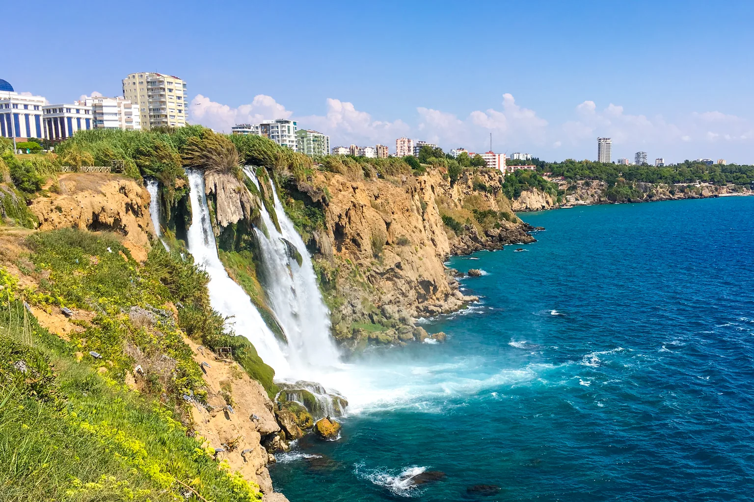
Four waterfalls lie within reach of Antalya: Upper and Lower Düden in the city itself, Kurşunlu in a nature park in the Aksu district, and Manavgat 72 km to the east. Lower Düden drops 40 m, Kurşunlu 18 m and Manavgat 4 m, and each fall has its own operator and its own way in. The tool hangs them on one wall and draws Lower Düden, Kurşunlu and Manavgat to one scale.
In short · checked 28.10.2026
Two on the Düden, one in a nature park, one 72 km east.
- Lower Düden drops 40 m into the sea in the Lara area. The Düden stream that feeds it is about 8 km long.
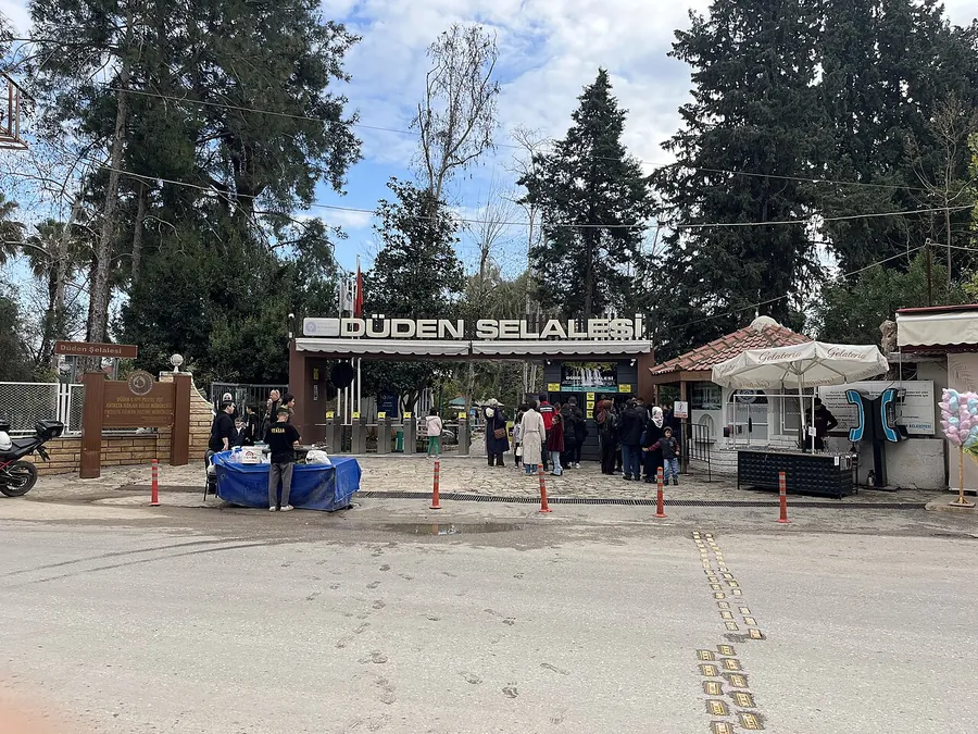
- Upper Düden lies in the Kepez district. Companies owned by the Antalya Metropolitan Municipality run it as a ground for eating, resting and picnics, and ruins of a 2,200-year-old town, Lyrboton Kome, lie in the area.
- Kurşunlu is a nature park in the Aksu district: an 18 m fall in a 2 km canyon with seven small ponds, open to visitors since 1986. It is one of the nature parks of the DKMP, the state directorate for nature conservation and national parks.
- Manavgat is 72 km from Antalya. The fall is 4 m high, and the Manavgat Municipality arranged the picnic and eating areas. Dolmuşes, shared minibuses, leave from Manavgat town.
- Entry fees and opening hours are set by each operator and can change. The tool’s Turkish lines ask for them at the gate.
Tool · pages checked 28.10.2026
The falls on one wall
Four falls hang from one line. Lower Düden, Kurşunlu and Manavgat are drawn to one scale, in metres; Upper Düden is drawn faded, without a height. Press a fall for who runs it, where it is, how to get there and what is there. The Turkish lines are for the bus, the gate and the way home, with the English beside each.
Upper Düden Kepez district
- Who runs it
- Affiliates of the Antalya Metropolitan Municipality. Büyükşehir belediyesi is the single municipality that governs a big city and its districts; an iştirak is a company the municipality owns. Booklet, September 2023
- Where
- Düdenbaşı Mah. (neighbourhood), 21. Cad. (street), Kepez, Antalya Culture Portal of the Ministry of Culture and Tourism. About 10 km from the city centre Kepez District Governorate, the state’s office in the district, 2019.
- Getting there
- By urban transport (şehir içi ulaşım araçları). Culture Portal
- What is there
- Eating and drinking, resting and picnics in a mesire alanı, a picnic and recreation ground. Also called İskender Şelalesi and Düdenbaşı Şelalesi. Booklet; Culture Portal
Booklet of the Antalya Metropolitan Municipality · Culture Portal · Kepez District Governorate · checked 28.10.2026
Yukarı Düden Şelalesi’ne bu otobüs gidiyor mu?Does this bus go to Upper Düden Waterfall?
Giriş ücretli mi? Bir kişi için ne kadar?Is there an entry fee? How much for one person?
Şehir merkezine son otobüs saat kaçta?What time is the last bus to the city centre?
Lower Düden Lara coast
- The fall
- 40 m, in several branches over a steep sea cliff (falez) into the Mediterranean. The Düden stream that feeds it is about 8 km long. Booklet
- Where
- The Lara area of Antalya. Also called Karpuzkaldıran. Booklet
- What is there
- Ruins of the ancient town Magydos are shown in the Karpuzkaldıran Özel Eğitim ve Dinlenme Tesisleri, the Karpuzkaldıran special education and recreation facilities. Booklet
Booklet of the Antalya Metropolitan Municipality · checked 28.10.2026
Aşağı Düden Şelalesi’ne bu otobüs gidiyor mu?Does this bus go to Lower Düden Waterfall?
Giriş ücretli mi? Bir kişi için ne kadar?Is there an entry fee? How much for one person?
Şehir merkezine son otobüs saat kaçta?What time is the last bus to the city centre?
Kurşunlu Aksu district
- Status
- A tabiat parkı (nature park: a protected area open to visitors) of the DKMP, the state directorate for nature conservation and national parks. DKMP 6th Regional Directorate
- Where
- Aksu district. Address: Kurşunlu Şelalesi, Fettahlı, Aksu, Antalya. Culture Portal
- Getting there
- From the 15th km of the Antalya–Mersin road turn left and drive 7 km. Booklet Also by urban transport. Culture Portal
- What is there
- A walking path, bridges, a historic water mill, a viewing terrace, picnic tables, a field restaurant and café, a kiosk, WC, a prayer room and children’s play groups; camel rides. DKMP 6th Regional Directorate
DKMP 6th Regional Directorate · Culture Portal · booklet · checked 28.10.2026
Kurşunlu Şelalesi’ne bu otobüs gidiyor mu?Does this bus go to Kurşunlu Waterfall?
Giriş ücretli mi? Bir kişi için ne kadar?Is there an entry fee? How much for one person?
Şehir merkezine son otobüs saat kaçta?What time is the last bus to the city centre?
Manavgat 72 km east
- Who runs it
- Manavgat Municipality (belediye: the town’s own authority) arranged the picnic, shopping, eating and rest areas and the viewing terrace, and runs the small café and tea stand. Rafting and canoeing are by private operators. Booklet; municipality news, 26.06.2022
- Where
- 72 km from Antalya. 3 km west of the district centre Manavgat Municipality, or 4 km booklet.
- Getting there
- Intercity coaches reach Manavgat town; buses or minibuses run from the town to the fall Manavgat District Governorate. Dolmuşes leave from Manavgat town Manavgat Municipality.
- What is there
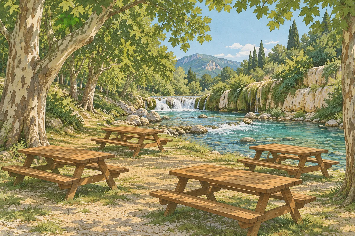
- Restaurants, a snack kiosk (büfe), sales units, rest places, WC and viewing terraces; picnics beside the river under plane trees. Manavgat District Governorate; Manavgat Municipality
Manavgat Municipality · Manavgat District Governorate · booklet · checked 28.10.2026
Manavgat Şelalesi’ne dolmuş nereden kalkıyor?Where does the dolmuş to Manavgat Waterfall leave from?
Giriş ücretli mi? Bir kişi için ne kadar?Is there an entry fee? How much for one person?
Manavgat’a son dolmuş saat kaçta?What time is the last dolmuş to Manavgat?
Nothing you press is stored or sent. Entry fees and opening hours are set by each operator and can change.
Upper Düden: where the Düden water comes up
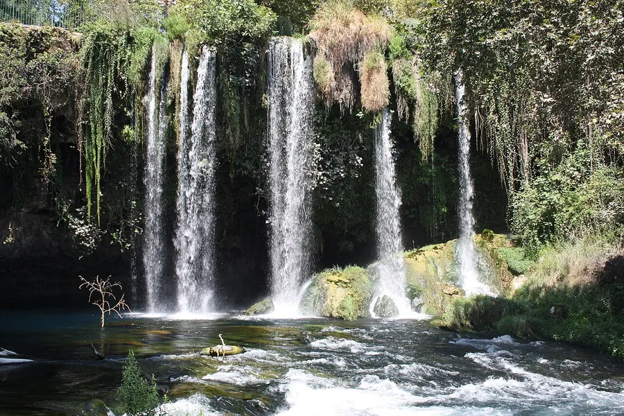
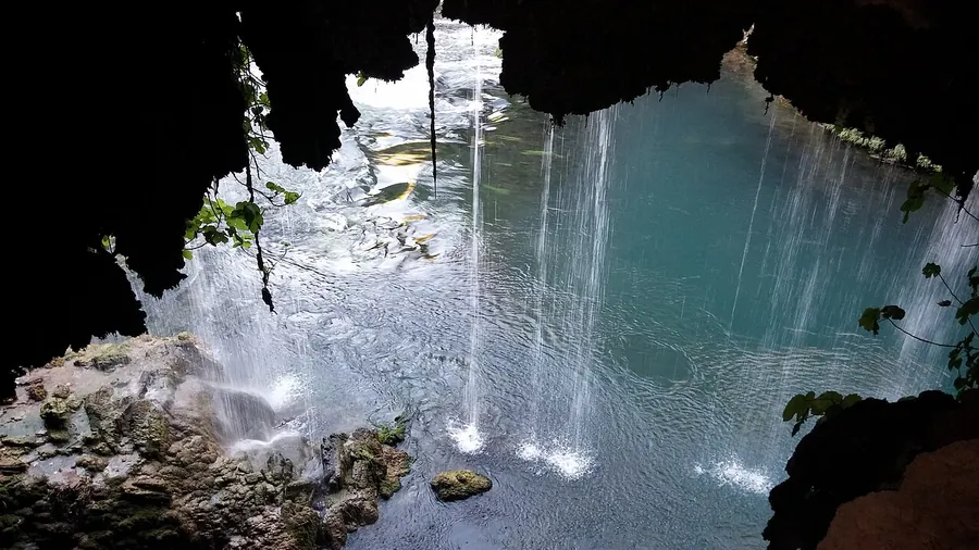
Düden Waterfall lies in the Kepez district of Antalya. It is also called İskender Şelalesi (Alexander’s Waterfall), Yukarı Düden (Upper Düden) and Düdenbaşı Şelalesi. A düden is a hole where a stream disappears into the rock, and Düdenbaşı is the place where the water comes out again.
The water’s way to the fall
- Two springsTwo karst springs (springs in limestone rock), the Pınarbaşı, feed two rivers that join and vanish into the Bıyıklı Düdeni, a swallow hole.
- 14 km undergroundIt comes up at one end of the Varsak depression and sinks at the other.
- 2 km undergroundIt reaches the surface at Düdenbaşı.
- At the fallAt least 10 m³ a second (10,000 litres) wells up, even on days when no water runs on the surface. The most is 94 m³ a second, the average 15 to 16 m³ a second.
- Over the edgeWater falling from above at Düdenbaşı comes from the Kepez hydroelectric plant.
Culture Portal · Kepez District Governorate, 07.05.2019 · checked 28.10.2026
The fall is run by affiliates (iştirak, companies the municipality owns) of the Antalya Metropolitan Municipality, Antalya Büyükşehir Belediyesi.
An older place
- Lyrboton Kome. Ruins of this ancient town, about 2,200 years old, are found in the area. It was a Hellenistic town, from the centuries after Alexander the Great, known for olive oil; an olive-oil workshop has been uncovered in recent digs, and rock tombs round the valley are read as a sign that the place was held sacred.
- Kataraktes. The ancient name of the falls. Travellers noticed them, they became a symbol of the city, and old city coins show a river god.
- İskender Şelalesi. Some sources say Alexander the Great, passing through, gave his horses water from this fall.
Booklet of the Antalya Metropolitan Municipality, September 2023 · checked 28.10.2026 · booklet (PDF)
Lower Düden: the drop into the sea
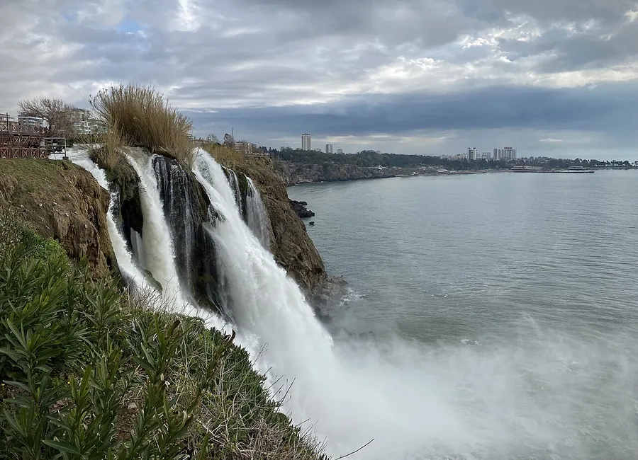
The Düden reaches the sea
Lower Düden Waterfall, Aşağı Düden Şelalesi, lies in the Lara area of Antalya. The Düden stream splits into several branches and drops 40 m over steep cliffs into the sea. The edge is a sill of travertine, a pale limestone laid down by mineral-rich water.
The Lara coast, its beaches and what lies along it are in Lara beach and Beaches in Antalya.
Booklet; Culture Portal · checked 28.10.2026 · booklet (PDF) · Culture Portal
An older town
- Magydos. In antiquity a town of this name, also given as Karpuzkaldıran, stood in the area.
- The aqueduct. Some sources say the town’s drinking water came from the Düden by aqueduct.
- The ruins. Part of the ruins is shown in the Karpuzkaldıran Özel Eğitim ve Dinlenme Tesisleri, the Karpuzkaldıran special education and recreation facilities.
Booklet of the Antalya Metropolitan Municipality, September 2023 · checked 28.10.2026
Kurşunlu: a nature park in a canyon
Kurşunlu Waterfall lies in the Aksu district of Antalya. A tabiat parkı is a nature park, a protected area open to visitors. Kurşunlu Şelalesi Tabiat Parkı is one of the nature parks of the DKMP’s 6th Regional Directorate. The area opened to visitors in 1986, was declared a nature park in 1991 and was enlarged in 2000.
Booklet and Culture Portal
33 ha, a 2 km canyon, seven ponds.
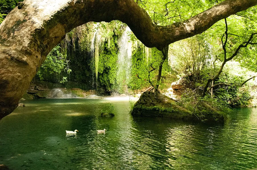
The park covers 33 hectares, or 330,000 m². The main fall drops 18 m, and small cascades join the seven small ponds along the canyon.
Counted inside the park: 3 fish, 3 amphibians, 12 reptiles, 88 birds and 22 mammals, and 261 plants, 14 of them endemic, meaning found only in one region (DKMP 6th Regional Directorate).
On the path
- Walks. A walking path with bridges, a historic water mill and a viewing terrace (seyir terası).
- Watching. Plants, rocks and wildlife. A walker may meet rabbits, squirrels, woodpeckers and tortoises.
- Camel rides. Camel rides (deve gezintisi) are among the park’s activities.
- A stop. Picnic tables, a field restaurant and café, a kiosk, a photographer, WC, a prayer room (mescit) and children’s play groups.
Checked 28.10.2026 · DKMP 6th Regional Directorate · Culture Portal · booklet (PDF)
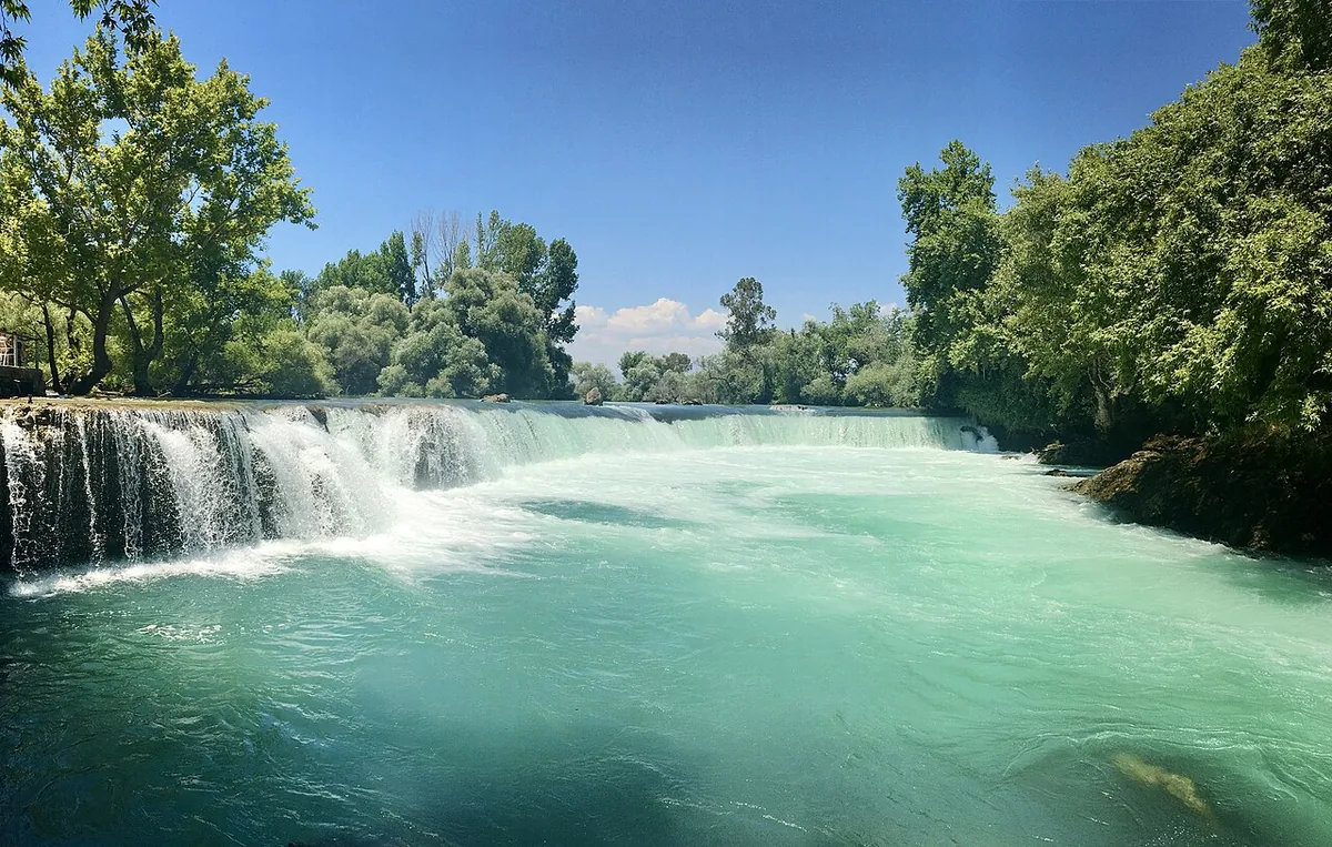
Manavgat: a wide, low fall on a river
Manavgat is three things: a district (ilçe), its main town and a river. The fall is on the river, outside the town, 72 km from Antalya. The Manavgat Municipality puts it 3 km west of the district centre, and the booklet of the Antalya Metropolitan Municipality puts it 4 km from the district.
- How high
- The booklet gives 4 m, with a high flow of water. The Manavgat District Governorate gives about 5 m for the cliffs the river drops from.
- The river
- The Manavgat River is 93 km long. It splits into small branches, passes the district centre and reaches the Mediterranean. Trout and many other fish, ducks and geese live on it, and plane trees line the banks. More rivers: Rivers in Turkey. District Governorate; booklet
- In June 2022
- The Manavgat Municipality finished landscaping the fall’s surroundings: an entrance and a square, a restaurant, sales units and toilets. Municipality news, 26.06.2022
- On the river
- Rafting and canoeing are on offer from private operators. Köprü Çayı and Köprülü Kanyon, two other nature areas, lie near. Booklet
Checked 28.10.2026 · Manavgat Municipality guide · municipality news · District Governorate · booklet (PDF)
Getting there and getting in: buses, dolmuşes and entry rules
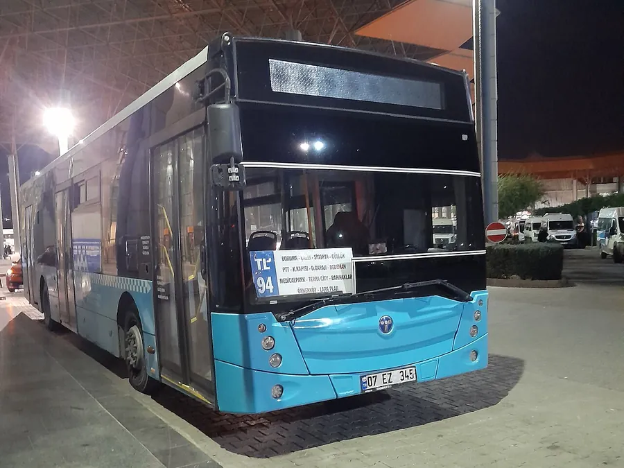
Two kinds of vehicle come up on these routes. A city bus shows its line number and its stops on a board behind the windscreen, like line 94 in the photo, with its stops in two columns. A dolmuş is a shared minibus on a set route; the word means «filled». Manavgat’s leave from Manavgat town.

DKMP entry-fee rules for protected areas, 2026
- No person fee for children under 7 and for pedestrians over 65.
- Students pay half with a student ID; their parents do not.
- Once a day. A person or vehicle fee is charged once per calendar day, and a vehicle fee covers the people inside.
- Foreign visitors pay at least 5 and at most 10 times the area’s person fee, set area by area.
- Operators of an area charge at most the tariff and may charge less.
Kurşunlu Şelalesi Tabiat Parkı is a DKMP nature park. The rules cover areas the DKMP runs and areas a public body or a municipality runs under a protocol (an agreement); each area has its own amounts. · checked 28.10.2026 · DKMP rules (PDF)
Three more falls in Antalya province
Three more falls lie farther from the city, in Serik, Alanya and Kaş.
Uçansu
Water from the Taurus falls 25 to 30 m, twice, into greenery. The name means «flying water». Turn off the Antalya–Serik–Alanya road at the Abdurrahmanlar–Gebiz junction; Akçapınar village is 17 km from Gebiz on an unpaved stretch, and in spring, when the water is high, cars may be held back at some points.
Dim Çayı
A river 60 km long that reaches the sea south of Alanya. Along the bank are restaurants, cafés and tea gardens, with swimming and fishing; the Dim Dam and Dim Cave lie in the valley. Rafting starts at Ak Köprü on a 5.5 km course rated 2 to 3 out of 10. The booklet says it can be visited all year and no entry fee is charged; in winter only the open private facilities serve.
Uçarsu
On Akdağ, 3,024 m, the highest point of the Western Taurus. The water springs at 1,800 m and drops about 50 m past rocks with a cave beneath; its name, from «flying», comes from the white cloud it recalls. It flows 4.5 km to the Çayboğazı Dam. The force changes with the snow melt on the summit, and the trip is tiring.
Quick answers in a few lines
Which fall drops straight into the sea?
Lower Düden: the Düden stream drops 40 m over steep cliffs into the Mediterranean in the Lara area.
Who runs Upper Düden?
Affiliates (iştirak) of the Antalya Metropolitan Municipality: companies the municipality owns.
How tall is Kurşunlu, and how big is the park?
18 m, in a 2 km canyon with seven small ponds. The park covers 33 hectares and opened to visitors in 1986.
How far is Manavgat Waterfall?
72 km from Antalya. From the district centre it is 3 km west (Manavgat Municipality) or 4 km (booklet).
Can I reach Manavgat Waterfall without a car?
Intercity coaches reach Manavgat town, and buses, minibuses and dolmuşes go from the town to the fall.
What is a nature park?
A tabiat parkı is a protected area open to visitors. Kurşunlu Şelalesi Tabiat Parkı was declared in 1991 and enlarged in 2000.
Do children and older visitors pay?
At protected areas under the DKMP’s 2026 rules, children under 7 and pedestrians over 65 pay no person fee.
Sources and limits
Show the pages checked
- Antalya’nın Şelaleleri (September 2023) — Antalya Metropolitan Municipality, checked 28.10.2026
- Düden Şelalesi — Culture Portal, Ministry of Culture and Tourism, checked 28.10.2026
- Kurşunlu Şelalesi — Culture Portal, Ministry of Culture and Tourism, checked 28.10.2026
- Gürül Gürül Akan Suyuyla Düden Şelalesi (07.05.2019) — Kepez District Governorate, checked 28.10.2026
- Tabiat Parkları — DKMP 6th Regional Directorate, Ministry of Agriculture and Forestry, checked 28.10.2026
- Ek-21 Korunan Alanlar Ücret Tarifesi Uygulama Usul ve Esasları, 2026 — DKMP, Ministry of Agriculture and Forestry, checked 28.10.2026
- Gezi Rehberi — Manavgat Municipality, checked 28.10.2026
- Manavgat Şelalesi’nde çevre düzenleme çalışmaları tamam (26.06.2022) — Manavgat Municipality, checked 28.10.2026
- Manavgat Şelalesi — Manavgat District Governorate, checked 28.10.2026
General information on places and rules that change; ask the operator before you go.