Rivers in Turkey: Lengths, Dams and Where to Raft
The main rivers of Turkey: how long each one is, where it reaches the sea, the big dams on them and the rivers people raft.
Table of Contents
Türkiye has 25 river basins and 15 main rivers. The Kızılırmak, at 1,151 km, is the longest river that rises and reaches the sea inside the country. The Euphrates runs 1,263 km inside Türkiye, then leaves before it reaches the sea.
Rivers of Türkiye, in short
Five things to know.
- How many: DSİ, the State Hydraulic Works, lists 25 river basins, 15 main rivers, 861 dams in operation and 320 natural lakes. A basin is the land whose water runs to one river or one sea.
- The longest: the Kızılırmak, 1,151 km, rises and reaches the Black Sea inside Türkiye. The Euphrates is longer inside the country, 1,263 km, but it leaves Türkiye before it reaches the sea.
- Three groups: eight rivers rise and reach the sea inside Türkiye; five rise in Türkiye and reach the sea on another country’s coast; two, the Meriç and the Asi, rise in another country and reach the sea on Türkiye’s coast.
- Dams: the biggest reservoirs are Atatürk (817 km²) and Keban (675 km²) on the Euphrates, and Ilısu (313 km²) on the Tigris.
- Rafting: the Köprüçay in Köprülü Canyon National Park has a guided course of about 14 km that takes 3 to 4 hours.
All 15 rivers on one map and how long each one runs
Tap a river on the map, or its ribbon in the list under it. A pen draws the river from its source to its mouth, and the tag shows its length and facts. Tap a second river and the table compares the two. Every ribbon is cut to the scale bar of the map, so a longer ribbon is a longer river. Each length is the part inside Türkiye.
The river table
Tap a river, see how long it runs
| River | Length inside Türkiye | Where it rises and ends |
|---|---|---|
| Euphrates | 1,263 km | Rises in Türkiye and reaches the sea on another country’s coast |
| Kızılırmak | 1,151 km | Rises in Türkiye and reaches the sea on its coast |
| Sakarya | 824 km | Rises in Türkiye and reaches the sea on its coast |
| Büyük Menderes | 584 km | Rises in Türkiye and reaches the sea on its coast |
| Seyhan | 560 km | Rises in Türkiye and reaches the sea on its coast |
| Aras | 548 km | Rises in Türkiye and reaches the sea on another country’s coast |
| Yeşilırmak | 519 km | Rises in Türkiye and reaches the sea on its coast |
| Tigris | 512 km | Rises in Türkiye and reaches the sea on another country’s coast |
| Ceyhan | 509 km | Rises in Türkiye and reaches the sea on its coast |
| Çoruh | 354 km | Rises in Türkiye and reaches the sea on another country’s coast |
| Gediz | 275 km | Rises in Türkiye and reaches the sea on its coast |
| Kura | 189 km | Rises in Türkiye and reaches the sea on another country’s coast |
| Meriç | 187 km | Rises in another country and reaches the sea on Türkiye’s coast |
| Küçük Menderes | 129 km | Rises in Türkiye and reaches the sea on its coast |
| Asi | 88 km | Rises in another country and reaches the sea on Türkiye’s coast |
The 15 rivers in three groups where each one rises and ends
Most of Türkiye’s rivers rise inside the country and reach the sea inside it too. A few cross a border on the way. A river’s “source” is where it starts, and its “mouth” is where it meets the sea. The 15 main rivers fall into three groups by that journey. Each length below is the part inside Türkiye.
- Rise and reach the sea in Türkiye (8)
- Kızılırmak 1,151 km, Sakarya 824 km, Büyük Menderes 584 km, Seyhan 560 km, Yeşilırmak 519 km, Ceyhan 509 km, Gediz 275 km, Küçük Menderes 129 km.
- Rise in Türkiye, reach the sea on another country’s coast (5)
- Euphrates 1,263 km, Aras 548 km, Tigris 512 km, Çoruh 354 km, Kura 189 km.
- Rise in another country, reach the sea on Türkiye’s coast (2)
- Meriç 187 km, Asi 88 km.
A river that crosses a border is longer in total than its part inside Türkiye.
The basins of the big rivers
A basin is the whole area that drains to a river. Of the 25 basins in Türkiye, the Euphrates–Tigris basin is the biggest and the Kızılırmak basin is the second biggest. The table below gives the area of eight basins.
| Basin | Area (km²) |
|---|---|
| Büyük Menderes | 25,987 |
| Ceyhan | 26,875 |
| East Black Sea | 22,844 |
| Euphrates–Tigris | 177,792 |
| Kızılırmak | 78,180 |
| Sakarya | 58,160 |
| Yeşilırmak | 38,733 |
| Çoruh | 20,488 |
Rivers of the Black Sea Kızılırmak, Yeşilırmak, Sakarya and the east
The Kızılırmak
The Kızılırmak (“Red River”) takes its name from the red soil and rock of its basin, which the river washes red.
1,151 km from source to mouth. Each tick on the line is 100 km.
- Source Kızıldağ, in İmranlı district of Sivas province.
- Sivas
- Avanos
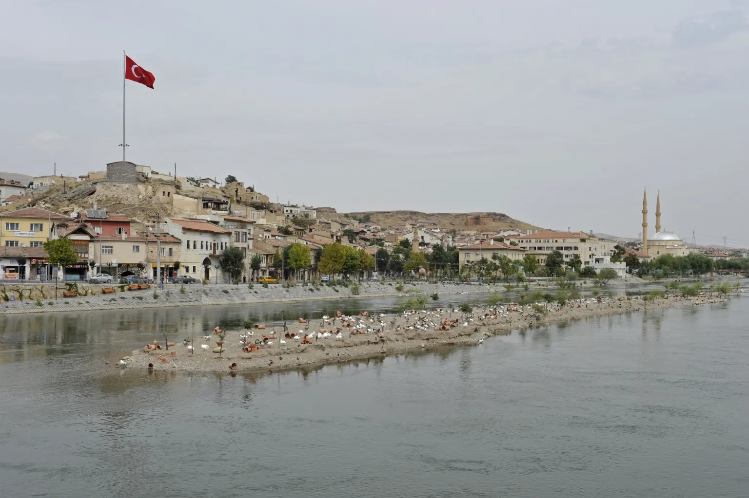
The Kızılırmak at Avanos, with rows of clay pots on a sandbar. Photo: Dosseman, 22 September 2011, Wikimedia Commons; CC BY-SA 4.0, file page. - Kırıkkale
- Osmancık The river turns sharply north-west here.
- Kargı South of the town the river turns sharply east.
- Durağan
- Bafra
- Black Sea
Tributaries. The Delice, the Devrez and the Gökırmak are its main tributaries.
Basin. 78,180 km², the second largest after the Euphrates–Tigris basin. Eighteen provinces share it, and Sivas holds the biggest part.
The Yeşilırmak
“Yeşilırmak” means “Green River”.
519 km from source to mouth. Each tick on the line is 100 km.
- Source The Köse mountains, south-west of Suşehri in Sivas province.
- Amasya province The river enters it from the south.
- Çekerek A 256 km river from Yozgat joins here.
- Amasya
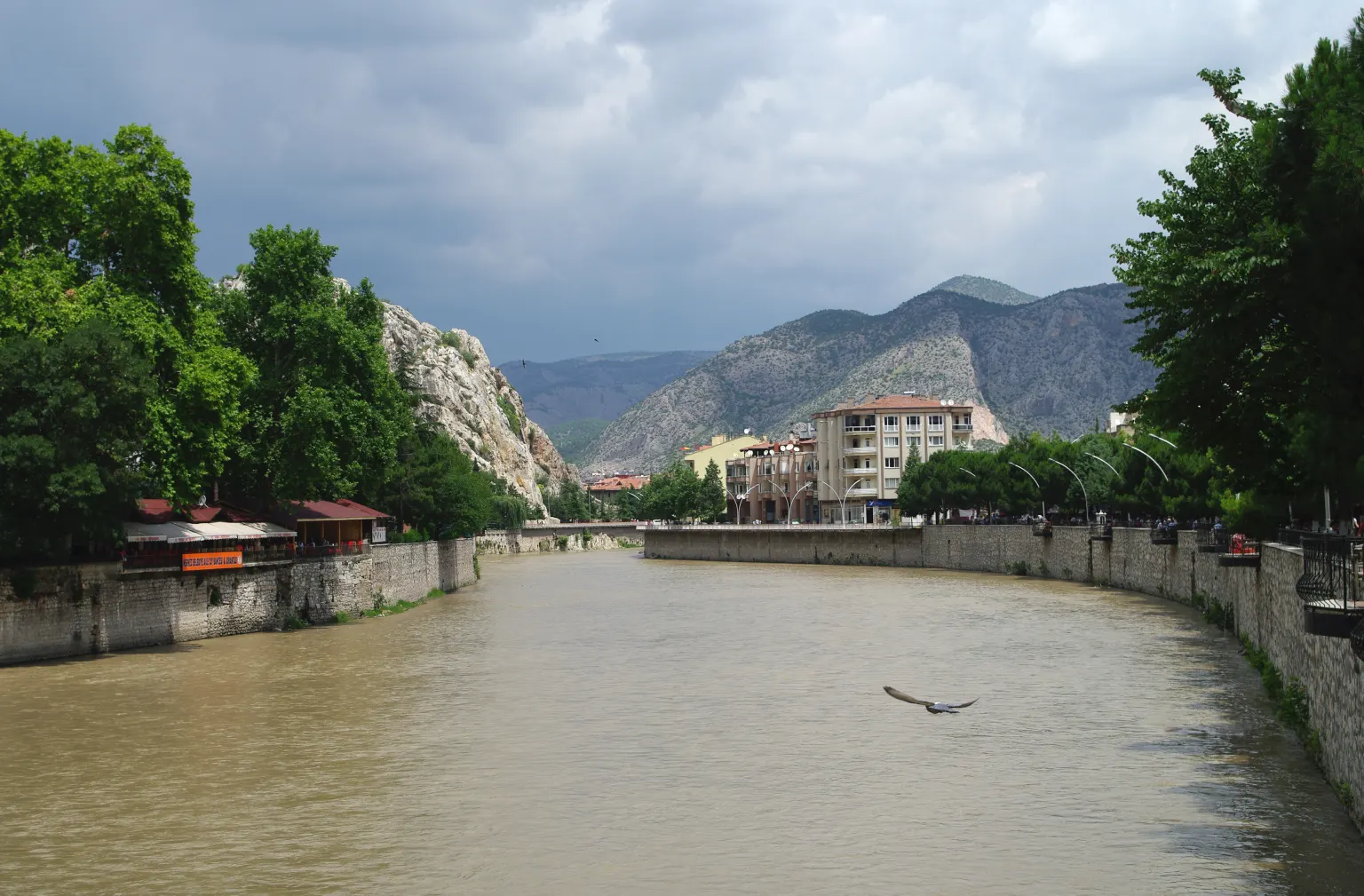
The Yeşilırmak in Amasya, between stone embankments. Photo: Zeynel Cebeci, 18 June 2010, Wikimedia Commons; CC BY-SA 4.0, file page. - Tersakan
- Kelkit Its largest arm. It joins where the districts of Taşova and Erbaa meet.
- Black Sea At Civa Burnu, near Çarşamba in Samsun province.
Dams. Among its dams are Almus (80 m high), Ataköy, Hasan Uğurlu (175 m) and Suat Uğurlu.
Basin. 38,733 km², about 5% of Türkiye, in 11 provinces: Tokat, Samsun, Amasya, Çorum, Sivas, Yozgat, Gümüşhane, Giresun, Erzincan, Ordu and Bayburt.
The Sakarya
824 km from source to mouth. Each tick on the line is 100 km.
- Source Springs at Sakaryabaşı, south of Çifteler in Eskişehir province.
- A turn north The river runs south-east, then turns north and forms the border between Ankara and Eskişehir provinces for a stretch.
- Porsuk 448 km long.
- Ankara Çayı
- Sarıyar Dam The first of three dams, one after the other.
- Gökçekaya Dam
- Yenice Dam
- Bilecik province Below the dams the river runs west, then turns north along its border.
- Sakarya The river passes east of the city.
- Black Sea In Karasu district.
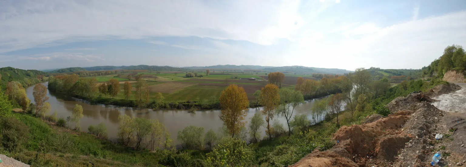
The Sakarya in a wide bend near Karasu. Photo: Acar54, 13 April 2014, Wikimedia Commons; CC BY-SA 4.0, file page.
Basin. 58,160 km², about 7% of Türkiye. Ten provinces share it: Ankara holds 28.2% of it and Eskişehir 21.7%.
Shape. The basin looks like a rectangle with the long side running west to east, and its average height is 508 m. Mountains ring it: the Bolu Mountains (2,499 m) to the north, Uludağ (2,543 m) to the west, and Emir Dağı (2,307 m) and Murat Dağı (2,309 m) to the south.
The East Black Sea
In the far north-east the story is rain.
22,844 km²
Eleven provinces share it, among them Rize, Trabzon, Artvin and Giresun
1,198 mm
a year, on average
566 m³
every second, on average
Peaks along the coast
1,198 mmof rain a year
Short, steep rivers
Black Sea
- Almost all the rivers of this basin rise on the peaks of the mountains that run along the coast. They are short and drop fast.
- Snow and heavy rain feed them, so their beds never dry.
- Harşit. 160 km long, the main river of the basin. It reaches the sea in Giresun province.
- Fırtına. In Rize province, one of the many short streams.
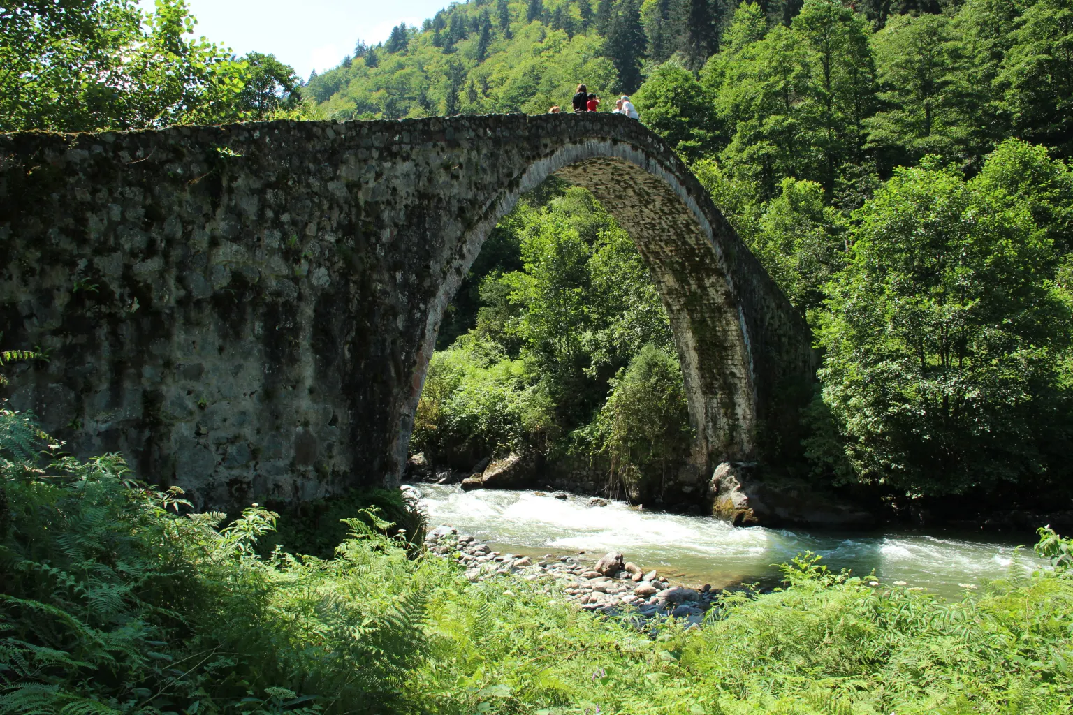
The steep beds carry a lot of sand and gravel to the sea, and after a downpour the streams flood fields, roads and bridges.
Rivers of the Aegean and the Mediterranean Menderes, Gediz, Seyhan and Ceyhan
The Büyük Menderes
The Büyük Menderes means “Great Meander”.
584 km, the longest river of the Aegean region. Each tick on the line is 100 km.
- Source Springs on the plateaus between Sandıklı and Dinar, in Afyonkarahisar province, and near Çivril and Honaz.
- Baklan plain The river flows west along its northern edge.
- Çal It turns north to Çal, then west again.
- Adıgüzel Dam The river fills its lake.
- Banaz, Dandalaz, Akçay, Çine The Banaz from Uşak, the Dandalaz and the Akçay from Denizli and the Çine from Muğla.
- Aegean Sea
Basin. 25,987 km²; Afyonkarahisar, Uşak, Denizli, Muğla and Aydın lie in it.
Küçük Menderes. The “Little Meander” is much shorter, 129 km, and also reaches the Aegean.
The Gediz
275 km from source to mouth. Each tick on the line is 100 km.
- Source The slopes of the Murat mountains, near Çukurviran village, about 26 km east of Gediz town.
- Kütahya
- Uşak
- Alaşehir A stream that joins north-east of Salihli.
- Gediz plain
- İzmir Bay Its delta holds the İzmir Bird Sanctuary, where flamingos can be seen.
The Seyhan
560 km from source to mouth. Each tick on the line is 100 km.
- Göksu It rises near Sandık Dere Tepesi (2,610 m).
- Zamantı It rises from springs on the slopes of Karaca Tepe (2,079 m).
- Ergenuşağı The two arms meet here and form the Seyhan.
- Çatalan lake
- Seyhan lake
- Seyhan Regulator
- Adana
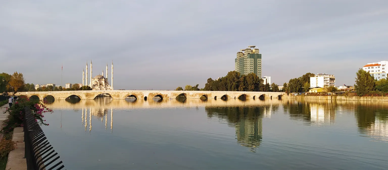
The Seyhan at Adana, with the old stone bridge. Photo: Özgür Esen, 20 November 2022, Wikimedia Commons; CC BY-SA 4.0, file page. - Mediterranean Sea
The Ceyhan
509 km from source to mouth. Each tick on the line is 100 km.
- Source Pınarbaşı, 3 km south-east of Elbistan.
- Kahramanmaraş province The river runs through deep valleys.
- Menzelet Dam One of the many dams in its valleys.
- Kısık canyon It begins where the Menzelet lake ends and is still natural.
- Çukurova plain The river builds a wide delta here.
- Gulf of İskenderun
Basin. 26,875 km², reaching from the Gulf of İskenderun far into inner Anatolia. Kahramanmaraş and Osmaniye lie almost entirely inside it, and parts of Kayseri, Sivas, Adıyaman, Gaziantep, Malatya, Adana and Hatay lie in it too.
The Euphrates and the Tigris two rivers, one large basin
Both rivers rise in Türkiye and leave it before they reach the sea, which lies on another country’s coast.
1,263 km
inside Türkiye, the longest stretch of any river on the list
512 km
inside Türkiye
177,792 km²
22.69% of Türkiye, with 22 provinces
The Euphrates
Three big dams stand on the Euphrates: Keban and Karakaya upstream, and the Atatürk Dam below them.
1,263 km inside Türkiye. Each tick on the line is 100 km.
- Source The Karasu and the Murat meet north of Keban district and form the Euphrates.
- Keban Dam Lake of 675 km². It holds back silt that would otherwise fill the Atatürk reservoir.
- Karakaya Dam Lake of 268 km². It holds back silt too.
- Atatürk Dam The third big dam.
- 1983 Work on the dam began.
- 13 January 1990 The lake began to fill.
- 25 July 1992 The dam opened.
- 10 September 1994 The last turbine started.
- 1995 Irrigation started. By 2024 it reached about 450,000 hectares, against a plan for 800,000.
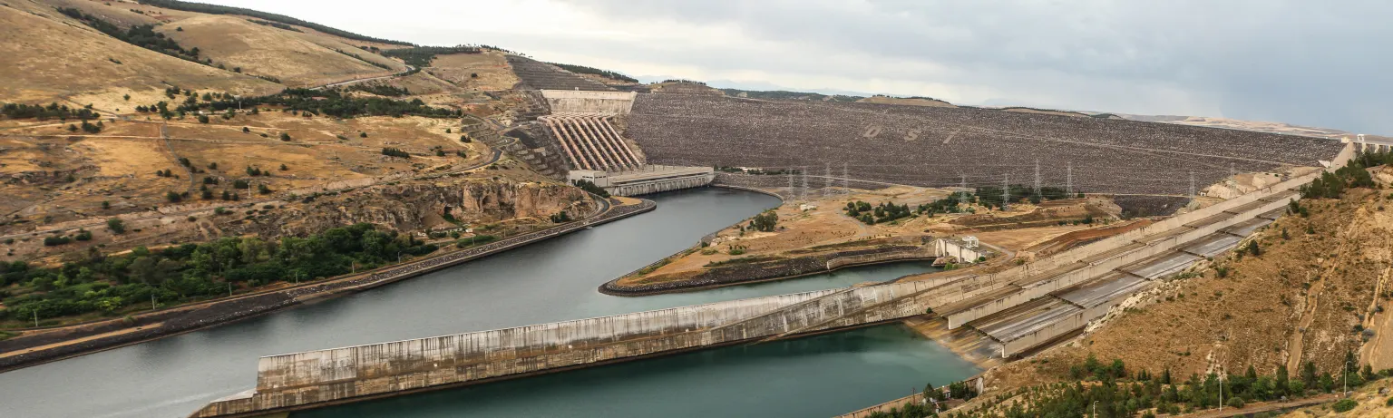
The Atatürk Dam on the Euphrates. Photo: Bernard Gagnon, 24 May 2014, Wikimedia Commons; CC BY-SA 3.0, file page. - Atatürk lake It covers 817 km², the third largest lake in Türkiye after Lake Van and Tuz Gölü.
- Holds 48.7 billion m³ of water, about 26% of the country’s total storage capacity.
- The power plant has 8 turbines and 2,400 MW; it can make 8.9 billion kWh a year.
- Fish are farmed in the lake, and piers carry passengers and cargo.
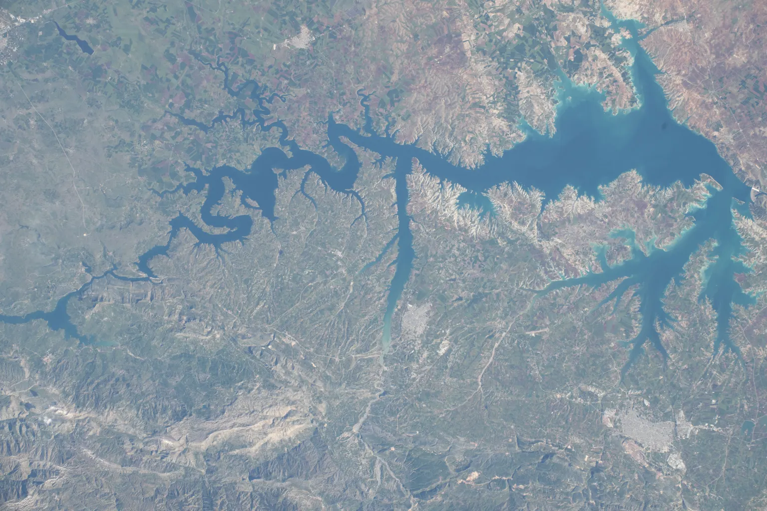
The Atatürk reservoir and its many arms, seen from the International Space Station. Photo: NASA Johnson Space Center, 19 May 2026, Wikimedia Commons; public domain, file page. - Halfeti
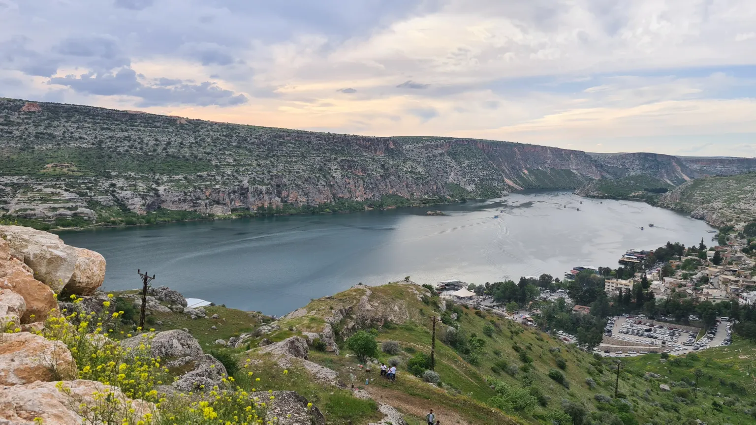
The Euphrates at Halfeti, between high rock walls. Photo: Mtbey, 22 April 2023, Wikimedia Commons; CC BY-SA 4.0, file page. - Border The Euphrates leaves Türkiye before it reaches the sea.
- Syria The river runs on through Syria. The sea it reaches lies on another country’s coast.
The Tigris
The Tigris has the largest hydropower potential in Türkiye after the Euphrates.
512 km inside Türkiye. Each tick on the line is 100 km.
- Source
- Hasankeyf
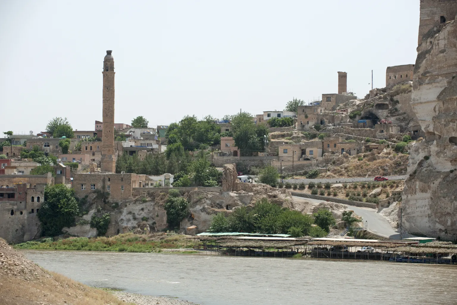
Hasankeyf above the Tigris, photographed in 2010. Photo: Dosseman, 17 June 2010, Wikimedia Commons; CC BY-SA 4.0, file page. - Ilısu Dam Lake of 313 km². The first power came on 19 May 2020.
- A rockfill dam faced with concrete, 135 m high from its foundation.
- The crest is 2,327 m long, with 24 million m³ of fill.
- The reservoir stores 10.6 billion m³, the third largest store in the country after Atatürk and Keban.
- In four years the plant made 9.7 billion kWh.
- Border The Tigris leaves Türkiye before it reaches the sea.
- Iraq The river runs on through Iraq. The sea it reaches lies on another country’s coast.
How much water Türkiye has rain, use and the gap between regions
The climate of Türkiye is semi-arid, and rain is uneven. The east of the Black Sea coast gets 1,200 to 2,500 mm a year. The land around Tuz Gölü gets 250 to 300 mm. Across the whole country the average is 574 mm, about 450 billion m³ of water a year.
574 mm
the average each year across Türkiye
112 billion m³
94 billion from rivers and lakes, 18 billion from groundwater
57 billion m³
44 billion on irrigation, 13 billion for drinking water and industry
1,346 m³
of usable water in 2020, down from 1,652 m³ in 2000
By the water each person can use, Türkiye is among the countries under water stress. Farmland covers 24 million hectares. About 8.5 million hectares could be irrigated with the water the country has, and 6.65 million hectares were open to irrigation by the end of 2019.
Dams and lakes what the rivers are used for
Türkiye’s rivers have steep beds. That makes them good for hydropower, because fast water turns turbines, and poor for boats. The country has 861 dams in operation.
- Lake Van3,713 km²
- Tuz Gölü1,300 km²
- Atatürk817 km²
- Keban675 km²
- Beyşehir656 km²
- Eğirdir482 km²
- Ilısu313 km²
- Karakaya268 km²
- Hirfanlı263 km²
Even the biggest reservoirs are small beside Lake Van, 3,713 km², and Tuz Gölü, 1,300 km². Atatürk, Keban, Ilısu and Karakaya are on the Euphrates and the Tigris, and Hirfanlı is the fifth biggest reservoir by area, 263 km². The natural lakes number 320; the next after Van and Tuz are Beyşehir (656 km²) and Eğirdir (482 km²).
Where to raft one guided course, one fast river
The Köprüçay
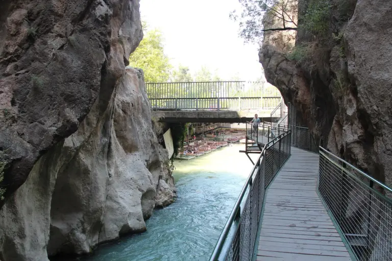
The Köprüçay runs through Köprülü Canyon in Antalya province. The canyon is known for its rock formations, plants and animals.
about 14 km
the course of the guided tours on the Köprüçay
3 to 4 hours
for the whole course
since 1973
Köprülü Canyon
The Çoruh
People raft the Çoruh. It is the fastest-flowing river in Türkiye.
354 km inside Türkiye. Each tick on the line is 100 km.
- Source The Mescit mountains in Erzurum province.
- Bayburt
- Erzurum
- Rafting
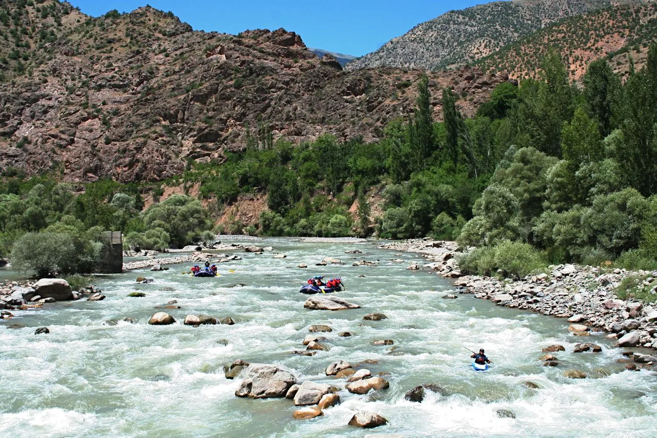
Rafts and a kayak on the Çoruh in 2007. Photo: Ahmet Bektas, 10 July 2007, Wikimedia Commons; CC BY 3.0, file page. - Artvin province
- Yusufeli Dam 275 m high, opened on 22 November 2022. Its lake has room for 2.3 billion m³ of water.
- Border The Çoruh leaves Türkiye here, at about 50 m above sea level.
- Georgia It reaches the Black Sea at Batumi.
A river is not the same all year
The speed, the water and the silt of Türkiye’s rivers change through the year, because rain differs by region and by month and the beds have different slopes. A river that is gentle in one month can run very differently in another.
Rivers that arrive and rivers that leave Meriç, Asi, Aras, Kura and Çoruh
The Meriç and the Ergene
Two rivers on the list begin in another country and reach the sea on Türkiye’s coast.
187 km inside Türkiye. Each tick on the line is 100 km.
- Bulgaria
- Border
- Edirne
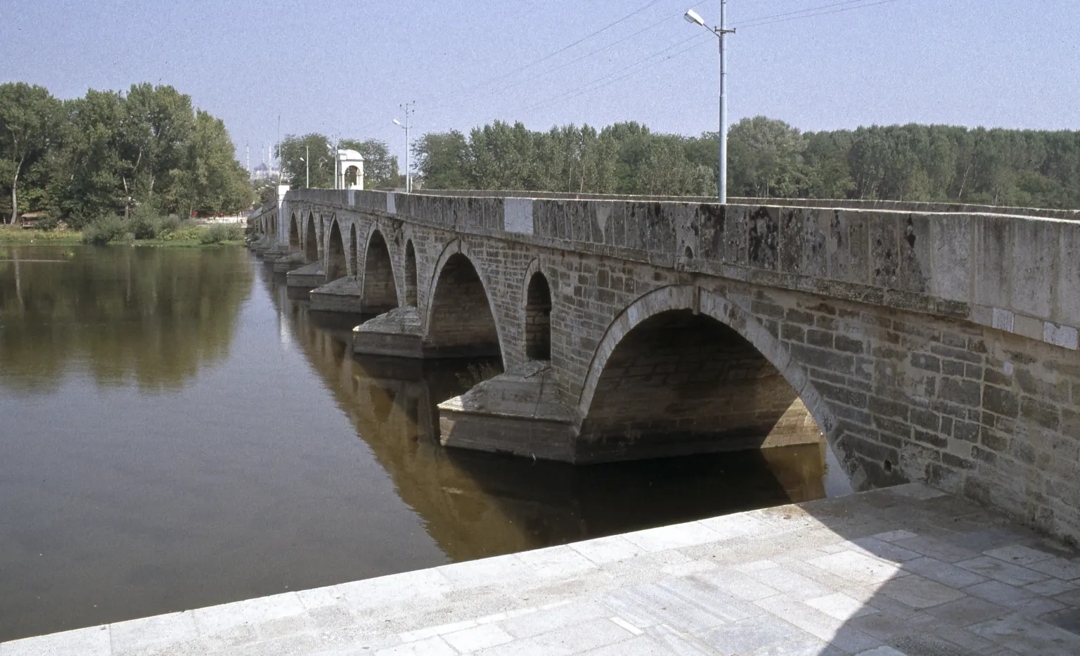
Bridges over the Tunca and the Meriç in Edirne. Photo: Dosseman, 20 March 2017, Wikimedia Commons; CC BY-SA 4.0, file page. - Ergene 283 km long. It rises in the Istranca mountains.
- Gulf of Saros The Meriç and the Ergene reach the sea together.
Ergene basin. It takes in most of Tekirdağ, Kırklareli and Edirne, and rain there averages 623 mm a year.
The Asi
The Asi is the shortest river on the list, 88 km inside Türkiye. Only its mouth is marked on the map.
453 km in all. Each tick on the line is 100 km.
- Bekaa Valley The Asi rises in Lebanon. About 40 km of the river lie in Lebanon.
- Syria 325 km of the river lie in Syria.
- Homs
- Hama
- The border For a stretch the river forms the border between Syria and Türkiye.
- Türkiye The river enters Türkiye near Eşrefiye. 88 km of it lie in Türkiye.
- Amik plain It joins the Küçük Asi.
- Mediterranean Sea 6 km south-west of Samandağ.
The Aras and the Kura
Two more rivers rise in Türkiye and leave it, like the Euphrates, the Tigris and the Çoruh. They reach the sea on another country’s coast.
548 km inside Türkiye. Each tick on the line is 100 km.
- Aras
- Border The river leaves Türkiye here.
- Armenia, Azerbaijan and Iran
189 km inside Türkiye. Each tick on the line is 100 km.
- Kura
- Border The river leaves Türkiye here.
- Georgia
Common questions short answers
Which is the longest river in Türkiye?
There are two true answers. The Kızılırmak, 1,151 km, is the longest river that rises and reaches the sea inside Türkiye. The Euphrates is 1,263 km long inside the country, but it leaves Türkiye before it reaches the sea.
How many rivers does Türkiye have?
The country is divided into 25 river basins, and the list of main rivers has 15 names: eight that reach the sea inside Türkiye, five that leave it, and two that arrive from another country.
Why do two texts give different lengths for one river?
A length depends on what is measured: the part inside Türkiye, the whole river, or the river with its branches. The table uses one list for every river, so its lengths compare fairly. Other texts give these figures:
- Euphrates, Tigris, Aras, Çoruh and Kura: these rivers run on beyond Türkiye, so each length here is only the part inside it.
- Çoruh: 354 km in the list; 466 km for the whole river, 24 km of it in Georgia, in the flood plan summary.
- Kızılırmak: 1,151 km in the list and in the basin brochure, and 1,263 km for the main stream in the flood plan summary. Both texts call it the longest river of Türkiye; the summary does not say why its figure is different. The brochure puts its basin at 78,180 km² and the summary at 82,221 km².
- Sakarya: 824 km in the list. The basin brochure puts it at 720 km, leaving out springs at its start that are now dry; the flood plan summary puts the main river alone at 687 km.
- Gediz: 275 km in the list, and 327.7 km for the main branch in the flood plan summary.
- Asi: 88 km inside Türkiye in the list. The whole river is 453 km: about 40 km in Lebanon, 325 km in Syria and 88 km in Türkiye.
What is a river basin?
The land whose rain and streams all drain to one river or one sea. Türkiye has 25 basins.
Can boats use Türkiye’s rivers?
Not much. The beds are steep, so the rivers suit power plants better than transport. A large reservoir is different: on the Atatürk lake, piers carry passengers and cargo.
How much water does Türkiye use, and for what?
The country can use about 112 billion m³ a year and uses 57 billion m³: 44 billion on irrigation and 13 billion for drinking water and industry.
Sources
Lengths and counts change when the lists are updated.
Open the sources
- Toprak ve Su Kaynakları (land and water resources: basins, rivers, lakes, dams, rain, water use) — State Hydraulic Works (DSİ), checked 23 October 2026
- Atatürk Barajı (news item of 25 July 2024) — State Hydraulic Works (DSİ), checked 23 October 2026
- Ilısu Barajı ve HES (news item of 20 May 2024) — State Hydraulic Works (DSİ), checked 23 October 2026
- Kızılırmak Havzası Tanıtım (basin brochure) — Ministry of Agriculture and Forestry, General Directorate of Water Management, checked 23 October 2026
- Sakarya Havzası Tanıtım (basin brochure) — Ministry of Agriculture and Forestry, General Directorate of Water Management, checked 23 October 2026
- Yeşilırmak Havzası Tanıtım (basin brochure) — Ministry of Agriculture and Forestry, General Directorate of Water Management, checked 23 October 2026
- Büyük Menderes Havzası Tanıtım (basin brochure) — Ministry of Agriculture and Forestry, General Directorate of Water Management, checked 23 October 2026
- Ceyhan Havzası Tanıtım (basin brochure) — Ministry of Agriculture and Forestry, General Directorate of Water Management, checked 23 October 2026
- Fırat-Dicle Havzası (basin brochure) — Ministry of Agriculture and Forestry, General Directorate of Water Management, checked 23 October 2026
- İlimiz Hakkında (the province of Elazığ: its rivers and lakes) — Ministry of Environment, Urbanisation and Climate Change, Elazığ Provincial Directorate, checked 23 October 2026
- Çoruh Havzası Tanıtım (basin brochure) — Ministry of Agriculture and Forestry, General Directorate of Water Management, checked 23 October 2026
- Çoruh Havzası Taşkın Yönetim Planı, Yönetici Özeti (flood plan summary) — Ministry of Agriculture and Forestry, General Directorate of Water Management, checked 23 October 2026
- Yusufeli Barajı ve HES hizmete alındı (news item of 22 November 2022) — State Hydraulic Works (DSİ), checked 23 October 2026
- Doğu Karadeniz Havzası Tanıtım (basin brochure) — Ministry of Agriculture and Forestry, General Directorate of Water Management, checked 23 October 2026
- Meriç-Ergene Havzası Tanıtım (basin brochure) — Ministry of Agriculture and Forestry, General Directorate of Water Management, checked 23 October 2026
- Taşkın Yönetim Planları (the page that links the flood plan summaries) — Ministry of Agriculture and Forestry, General Directorate of Water Management, checked 23 October 2026
- Yeşilırmak Havzası Taşkın Yönetim Planı, Yönetici Özeti (flood plan summary) — Ministry of Agriculture and Forestry, General Directorate of Water Management, checked 23 October 2026
- Ceyhan Havzası Taşkın Yönetim Planı, Yönetici Özeti (flood plan summary) — Ministry of Agriculture and Forestry, General Directorate of Water Management, checked 23 October 2026
- Sakarya Havzası Taşkın Yönetim Planı, Yönetici Özeti (flood plan summary) — Ministry of Agriculture and Forestry, General Directorate of Water Management, checked 23 October 2026
- Kızılırmak Havzası Taşkın Yönetim Planı, Yönetici Özeti (flood plan summary) — Ministry of Agriculture and Forestry, General Directorate of Water Management, checked 23 October 2026
- Gediz Havzası Taşkın Yönetim Planı, Yönetici Özeti (flood plan summary) — Ministry of Agriculture and Forestry, General Directorate of Water Management, checked 23 October 2026
- Büyük Menderes Havzası Taşkın Yönetim Planı, Yönetici Özeti (flood plan summary) — Ministry of Agriculture and Forestry, General Directorate of Water Management, checked 23 October 2026
- Asi Havzası Taşkın Yönetim Planı, Yönetici Özeti (flood plan summary) — Ministry of Agriculture and Forestry, General Directorate of Water Management, checked 23 October 2026
- Seyhan Havzası Taşkın Yönetim Planı, Yönetici Özeti (flood plan summary) — Ministry of Agriculture and Forestry, General Directorate of Water Management, checked 23 October 2026
- Doğu Karadeniz Havzası Taşkın Yönetim Planı, Yönetici Özeti (flood plan summary) — Ministry of Agriculture and Forestry, General Directorate of Water Management, checked 23 October 2026
- Turkish coastlines provide a variety of fascinating outdoor activities (Köprülü Canyon, Gediz Delta) — Türkiye Tourism Promotion and Development Agency, checked 23 October 2026
- Natural Earth 1:10m rivers, lake centerlines and country borders (public domain); the map is a simplified drawing of these lines — Natural Earth, checked 23 October 2026