Mount Ararat (Ağrı Dağı): Location, Height and Climb Rules
Where Mount Ararat is, how high its two cones stand, the national park around them, the climbing rule and the weather of Ağrı and Iğdır by month.
Table of Contents
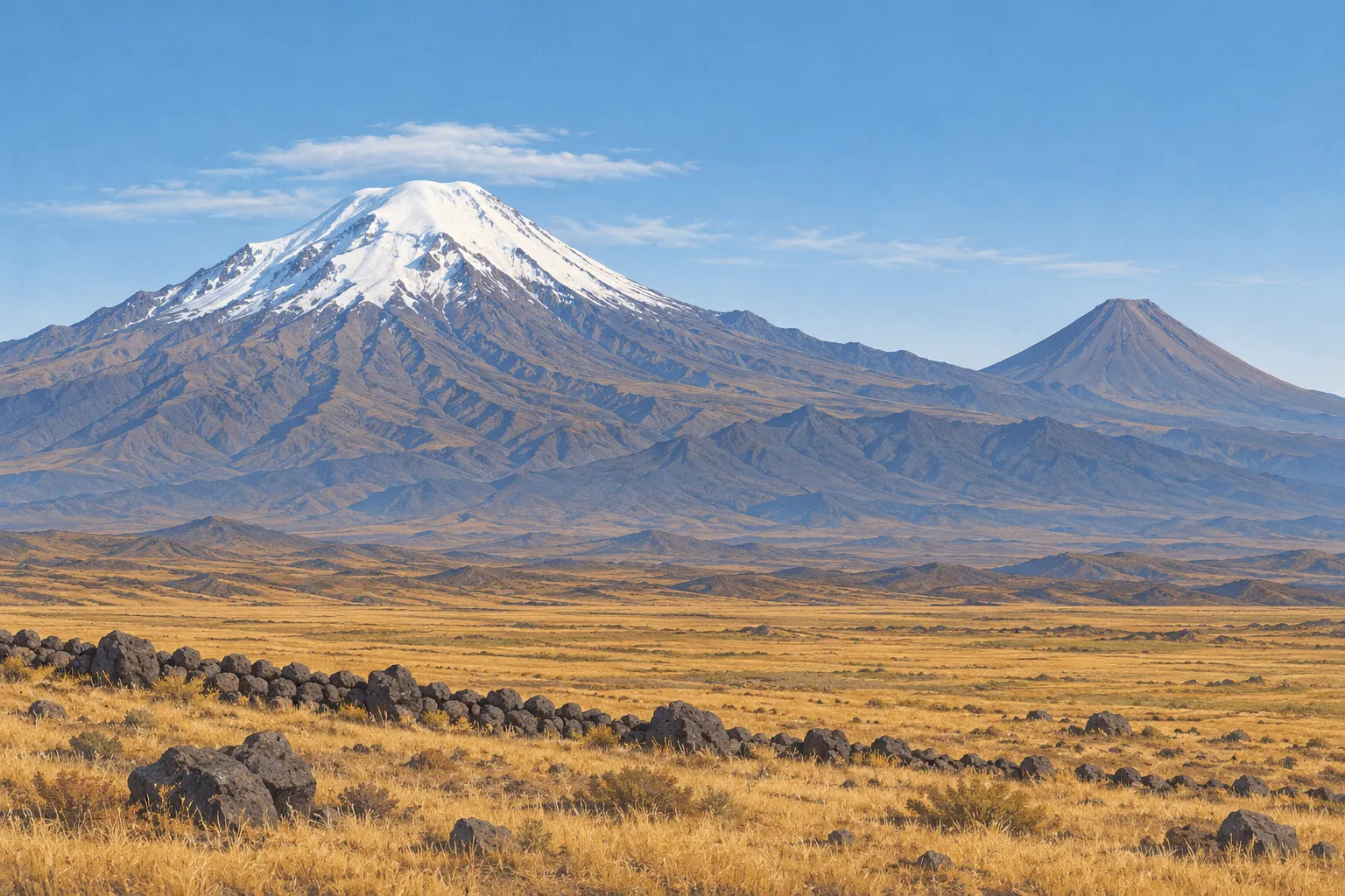
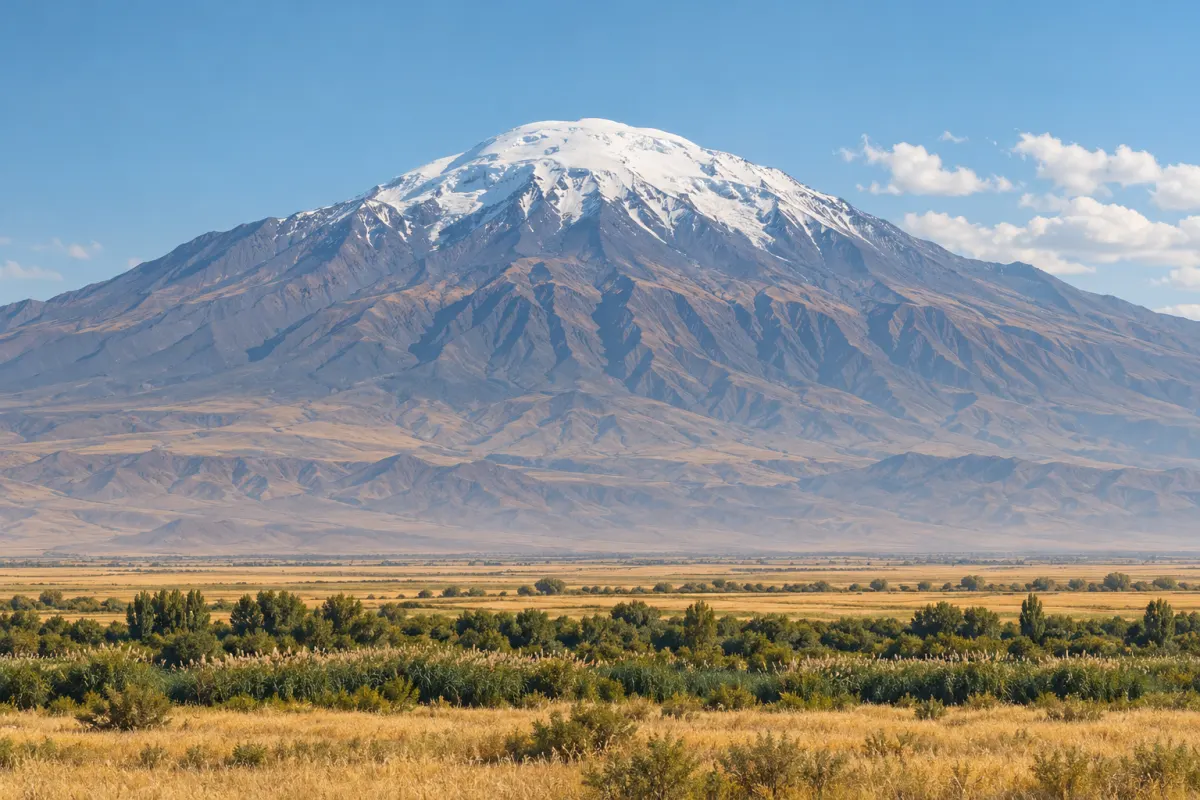
Mount Ararat is two volcanoes side by side in the eastern provinces of Ağrı and Iğdır: Büyük Ağrı, the higher, and Küçük Ağrı, both inside one national park.
In short · checked 20.10.2026
Mount Ararat is a national park with two cones, and climbing it goes through a licensed guide or agency.
- Where: in the provinces of Ağrı and Iğdır, inside Ağrı Dağı National Park, declared 17.11.2004.
- Height: Büyük Ağrı 5,137 m and Küçük Ağrı 3,896 m, as the Ağrı tourism directorate gives them.
- Climbing: Canada’s travel advice, updated 29 September 2026, says the mountain is a designated special military zone and you must hire a locally licensed guide or agency.
- Weather: MGM’s monthly averages for the towns of Ağrı and Iğdır, 1940–2025, are in the drawing below. They describe the towns, not the summit.
Mount Ararat through the year
The two cones are drawn to scale from the heights below; the sky and the figures come from MGM’s station averages for the towns of Ağrı and Iğdır, not from the mountain and not from a forecast.
Press a stone to change the month
The sky is drawn from the two towns’ averages together: the sun grows with the sunshine hours, there is one cloud for about every 3 rainy days, and frost lies on the steppe thinly where one town’s average low is below 0 °C and fully where both are.
January
Ağrı
- Mean high, °C
- −5.2
- Mean low, °C
- −15.4
- Rain, mm
- 42.9
- Rainy days
- 11.6
- Sunshine, hours a day
- 2.3
Iğdır
- Mean high, °C
- 2.1
- Mean low, °C
- −7.8
- Rain, mm
- 14.6
- Rainy days
- 5.7
- Sunshine, hours a day
- 2.5
February
Ağrı
- Mean high, °C
- −3.3
- Mean low, °C
- −14.3
- Rain, mm
- 46.6
- Rainy days
- 11.1
- Sunshine, hours a day
- 3.2
Iğdır
- Mean high, °C
- 5.6
- Mean low, °C
- −5.3
- Rain, mm
- 15.6
- Rainy days
- 5.8
- Sunshine, hours a day
- 3.9
March
Ağrı
- Mean high, °C
- 2.4
- Mean low, °C
- −7.7
- Rain, mm
- 53.6
- Rainy days
- 12.3
- Sunshine, hours a day
- 4.3
Iğdır
- Mean high, °C
- 12.7
- Mean low, °C
- 0.4
- Rain, mm
- 22.6
- Rainy days
- 7.0
- Sunshine, hours a day
- 5.3
April
Ağrı
- Mean high, °C
- 12.0
- Mean low, °C
- 0.8
- Rain, mm
- 71.0
- Rainy days
- 14.2
- Sunshine, hours a day
- 5.7
Iğdır
- Mean high, °C
- 19.9
- Mean low, °C
- 6.3
- Rain, mm
- 35.2
- Rainy days
- 10.4
- Sunshine, hours a day
- 6.1
May
Ağrı
- Mean high, °C
- 18.8
- Mean low, °C
- 5.3
- Rain, mm
- 70.0
- Rainy days
- 15.6
- Sunshine, hours a day
- 7.3
Iğdır
- Mean high, °C
- 24.7
- Mean low, °C
- 10.7
- Rain, mm
- 47.5
- Rainy days
- 13.5
- Sunshine, hours a day
- 7.5
June
Ağrı
- Mean high, °C
- 24.4
- Mean low, °C
- 8.3
- Rain, mm
- 43.1
- Rainy days
- 9.9
- Sunshine, hours a day
- 9.5
Iğdır
- Mean high, °C
- 29.6
- Mean low, °C
- 14.6
- Rain, mm
- 31.2
- Rainy days
- 9.8
- Sunshine, hours a day
- 9.5
July
Ağrı
- Mean high, °C
- 29.4
- Mean low, °C
- 12.2
- Rain, mm
- 22.1
- Rainy days
- 5.8
- Sunshine, hours a day
- 10.0
Iğdır
- Mean high, °C
- 33.4
- Mean low, °C
- 18.2
- Rain, mm
- 14.1
- Rainy days
- 5.4
- Sunshine, hours a day
- 10.1
August
Ağrı
- Mean high, °C
- 30.2
- Mean low, °C
- 12.0
- Rain, mm
- 12.7
- Rainy days
- 3.9
- Sunshine, hours a day
- 9.7
Iğdır
- Mean high, °C
- 33.3
- Mean low, °C
- 17.4
- Rain, mm
- 9.4
- Rainy days
- 3.6
- Sunshine, hours a day
- 9.7
September
Ağrı
- Mean high, °C
- 25.5
- Mean low, °C
- 7.0
- Rain, mm
- 18.8
- Rainy days
- 4.5
- Sunshine, hours a day
- 8.8
Iğdır
- Mean high, °C
- 29.0
- Mean low, °C
- 12.4
- Rain, mm
- 11.5
- Rainy days
- 3.7
- Sunshine, hours a day
- 8.5
October
Ağrı
- Mean high, °C
- 17.4
- Mean low, °C
- 2.1
- Rain, mm
- 53.7
- Rainy days
- 8.8
- Sunshine, hours a day
- 6.6
Iğdır
- Mean high, °C
- 21.1
- Mean low, °C
- 6.2
- Rain, mm
- 26.3
- Rainy days
- 7.6
- Sunshine, hours a day
- 5.9
November
Ağrı
- Mean high, °C
- 8.0
- Mean low, °C
- −3.4
- Rain, mm
- 45.9
- Rainy days
- 8.3
- Sunshine, hours a day
- 4.4
Iğdır
- Mean high, °C
- 12.8
- Mean low, °C
- 0.4
- Rain, mm
- 18.4
- Rainy days
- 5.9
- Sunshine, hours a day
- 4.0
December
Ağrı
- Mean high, °C
- −1.5
- Mean low, °C
- −10.4
- Rain, mm
- 44.0
- Rainy days
- 10.7
- Sunshine, hours a day
- 2.4
Iğdır
- Mean high, °C
- 4.9
- Mean low, °C
- −4.3
- Rain, mm
- 13.9
- Rainy days
- 6.0
- Sunshine, hours a day
- 2.4
MGM’s Ağrı page and its Iğdır page give the monthly averages for 1940–2025 (checked 20.10.2026). The stations are in the two towns; neither stands on the mountain.
The two cones
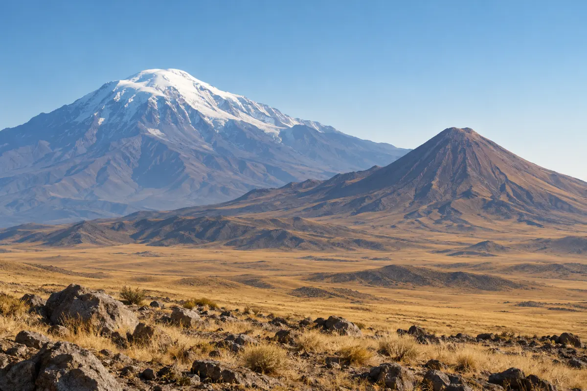
The Ağrı tourism directorate gives Büyük Ağrı, the Atatürk Summit, as 5,137 m and Küçük Ağrı, the İnönü Summit, as 3,896 m, and puts the Serdarbulak Pass, at 2,687 m, between them (checked 20.10.2026).
Heights
Two summits, one pass
- Büyük Ağrı
- 5,137 m, the Atatürk Summit
- Küçük Ağrı
- 3,896 m, the İnönü Summit
- Between them
- The Serdarbulak Pass, 2,687 m
- Each
- Regarded by the directorate as a volcanic cone
The directorate adds that Büyük Ağrı is known as an extinct volcano but is regarded as active in international literature. It says Büyük Ağrı was active around 3000 BC and that the latest eruptions of Küçük Ağrı fell in the Quaternary period.
Summit ice
11 small glaciers, 39 % less ice.
The directorate lists 11 small glaciers on the summit and says research observed a 39 % fall in glacier volume between 1987 and 2015 (checked 20.10.2026).
The national park
Ağrı Dağı National Park
What the park lists
- Declared
- 17.11.2004, as the national parks directorate’s list gives it
- Size
- 88,015 ha
- Provinces
- Ağrı and Iğdır
- Districts
- Doğubayazıt in Ağrı; Aralık and Karakoyunlu in Iğdır
- Run by
- The 13th Regional Directorate of the national parks directorate
The national parks directorate’s list and the Ağrı tourism directorate give these figures (checked 20.10.2026).
The directorate says the park lies where the borders of Türkiye, Iran, Nakhchivan and Armenia meet. It lists 21 plant species found only on Ağrı Dağı, a relict birch forest, and animals such as the lynx and the bearded vulture, and it notes airports in both provinces and camp sites, mountain houses and other facilities in and around Doğubayazıt.
The rule for climbing
Canada’s travel advice for Türkiye, updated 29 September 2026, says Mount Ararat, between the eastern provinces of Ağrı and Iğdır, is a designated special military zone. It says you must hire a locally licensed guide or agency if you intend to hike in the area, and that a licensed company will get the necessary permits on your behalf and assign a registered mountaineer to accompany you.
Border areas
The same advice says visitors must obtain permission from the local Governor’s Office to visit areas near the borders with Iraq and Iran, and that if you visit with a travel agent or tour group you should confirm with them whether you need an individual permit.
The Ağrı tourism directorate says that for security reasons climbs are possible only on certain routes, and that special guidelines for climbing Ağrı Dağı were published in 2015 (checked 20.10.2026).
Adventure travel: Canada’s advice
- Prepare: get detailed information on the activity and the environment, stay on marked trails and consider hiring an experienced guide from a reputable company.
- Cover and tell: buy travel insurance that covers these activities, and share your itinerary with a friend or family member if you are alone.
- Know the signs: symptoms of high-altitude illness, dehydration and heatstroke can be fatal.
Weather of Ağrı and Iğdır
MGM’s tables give the monthly averages for the stations of Ağrı and Iğdır, 1940–2025, and the lowest and highest temperatures recorded in that time (checked 20.10.2026). They describe the two towns; no station stands on the mountain.
What the averages show
- Frost nights: the average daily low is below 0 °C in Ağrı from November to March and in Iğdır from December to February.
- Lowest on record: −45.6 °C in Ağrı (January) and −30.3 °C in Iğdır (December).
- Highest on record: 40.2 °C in Ağrı (August) and 42.0 °C in Iğdır (August).
| Month | Mean high, °C | Mean low, °C | Rain, mm | Rainy days | Sunshine, hours a day |
|---|---|---|---|---|---|
| January | −5.2 | −15.4 | 42.9 | 11.6 | 2.3 |
| February | −3.3 | −14.3 | 46.6 | 11.1 | 3.2 |
| March | 2.4 | −7.7 | 53.6 | 12.3 | 4.3 |
| April | 12.0 | 0.8 | 71.0 | 14.2 | 5.7 |
| May | 18.8 | 5.3 | 70.0 | 15.6 | 7.3 |
| June | 24.4 | 8.3 | 43.1 | 9.9 | 9.5 |
| July | 29.4 | 12.2 | 22.1 | 5.8 | 10.0 |
| August | 30.2 | 12.0 | 12.7 | 3.9 | 9.7 |
| September | 25.5 | 7.0 | 18.8 | 4.5 | 8.8 |
| October | 17.4 | 2.1 | 53.7 | 8.8 | 6.6 |
| November | 8.0 | −3.4 | 45.9 | 8.3 | 4.4 |
| December | −1.5 | −10.4 | 44.0 | 10.7 | 2.4 |
| Month | Mean high, °C | Mean low, °C | Rain, mm | Rainy days | Sunshine, hours a day |
|---|---|---|---|---|---|
| January | 2.1 | −7.8 | 14.6 | 5.7 | 2.5 |
| February | 5.6 | −5.3 | 15.6 | 5.8 | 3.9 |
| March | 12.7 | 0.4 | 22.6 | 7.0 | 5.3 |
| April | 19.9 | 6.3 | 35.2 | 10.4 | 6.1 |
| May | 24.7 | 10.7 | 47.5 | 13.5 | 7.5 |
| June | 29.6 | 14.6 | 31.2 | 9.8 | 9.5 |
| July | 33.4 | 18.2 | 14.1 | 5.4 | 10.1 |
| August | 33.3 | 17.4 | 9.4 | 3.6 | 9.7 |
| September | 29.0 | 12.4 | 11.5 | 3.7 | 8.5 |
| October | 21.1 | 6.2 | 26.3 | 7.6 | 5.9 |
| November | 12.8 | 0.4 | 18.4 | 5.9 | 4.0 |
| December | 4.9 | −4.3 | 13.9 | 6.0 | 2.4 |
Noah’s Ark and the name Ararat
Genesis 8:4 says the ark came to rest “on the mountains of Ararat”, in the plural. Quran 11:44 says the ship came to rest on al-Jūdī.
The Ağrı tourism directorate links Ağrı Dağı with the Flood of the holy books and says it is believed the ark came to rest there. It adds that whether the ship remains found there formed in a landslide is still debated (checked 20.10.2026).
For the other places of the Bible in Türkiye, see 10 Biblical Sites in Turkey.
Quick answers
Where is Mount Ararat?
In Türkiye’s eastern provinces of Ağrı and Iğdır. The Ağrı tourism directorate says Ağrı Dağı National Park lies where the borders of Türkiye, Iran, Nakhchivan and Armenia meet.
Do I need a permit or a guide to climb Mount Ararat?
Canada’s travel advice for Türkiye, updated 29 September 2026, says the mountain is a designated special military zone and you must hire a locally licensed guide or agency. It says a licensed company obtains the necessary permits and assigns a registered mountaineer to accompany you.
How high is Mount Ararat?
The Ağrı tourism directorate gives Büyük Ağrı as 5,137 m and Küçük Ağrı as 3,896 m (checked 20.10.2026).
Is Mount Ararat a national park?
Yes. It lies in Ağrı Dağı National Park, declared on 17.11.2004, which covers 88,015 ha in the provinces of Ağrı and Iğdır.
Where did Noah’s Ark land?
Genesis 8:4 says on “the mountains of Ararat” and Quran 11:44 says on al-Jūdī. The Ağrı tourism directorate says it is believed the ark came to rest on Ağrı Dağı, and that whether the ship remains found there formed in a landslide is still debated.
Sources
- Doğa Turizm (Nature Tourism) – Ağrı Provincial Directorate of Culture and Tourism, checked 20.10.2026
- Milli Parklar (National Parks) – Directorate General for Nature Conservation and National Parks, checked 20.10.2026
- Ağrı station averages – Turkish State Meteorological Service (MGM), 1940–2025, checked 20.10.2026
- Iğdır station averages – Turkish State Meteorological Service (MGM), 1940–2025, checked 20.10.2026
- Türkiye travel advice – Government of Canada, updated 29 September 2026, checked 20.10.2026
- Genesis 8:4 – Hebrew Bible, text on Sefaria, checked 20.10.2026
- Quran 11:44 (Surah Hud) – Quran, text on Quran.com, checked 20.10.2026