Hiking in Turkey: Marked Routes and National Parks
The long-distance routes the Culture Routes Society keeps, the Datça section of the Carian Trail, and DKMP’s facts on two national parks.
Table of Contents
Türkiye has long-distance walking routes with painted marks and signs, and national parks that charge an entry fee. The Culture Routes Society (Kültür Rotaları Derneği), a small not-for-profit society with an office in Antalya, keeps 20 such routes Society, among them the Lycian Way (760 km), the St Paul Trail (500 km) and the Evliya Çelebi Way (about 330 km on foot). Dilek and Sultan Sazlığı national parks charge ₺75.00 a person in 2026 under the tariff of the General Directorate of Nature Conservation and National Parks (Doğa Koruma ve Milli Parklar Genel Müdürlüğü, DKMP) of the Ministry of Agriculture and Forestry DKMP Ek-2.
In short · checked 31.10.2026
Marked routes, and parks with a gate.
- Routes: the Culture Routes Society keeps 20 long-distance routes, and 4 of them cross a border Society. Lycian Way 760 km, Carian Trail 800 km, Phrygian Way 506 km, St Paul Trail 500 km, Evliya Çelebi Way about 330 km on foot.
- Marks: paint on rocks and signs. The Society renews marks at least every 2 years on a new route and every 4–5 years later Society.
- Dilek: 27,598 ha, 804 plant species, open, no guide required DKMP.
- Sultan Sazlığı: 24,523 ha, a Ramsar site since 13 July 1994, 247 bird species, open, no guide required DKMP.
- Entry: ₺75.00 a person at both parks in 2026; students on foot pay half, and children under 7 and people over 65 on foot pay nothing. Visitors who are not Turkish citizens pay 5 to 10 times the person fee, set for each area; the Turkish line to ask for it is in chapter 9 DKMP Ek-21.
The waymark post
Six routes on one post, two national parks on the plates.
Press an arm, a stone or a plate. The arm swings level and the number counts to its length; the lamp lights the seasons the Society gives, and the card has the figures with the page that owns each one.
Lycian Way Likya Yolu
A waymarked walking path along the coast of Lycia, from Fethiye to Antalya.
- Length
- 760 km, 35 days Society
- From, to
- Fethiye to Antalya: the start is at Ölüdeniz, the end at Geyikbayırı.
- Opened
- Laid out and waymarked in 1999. The Society calls it Türkiye’s first long-distance walking route.
- Marks
- Way-marked. Local trails that join it are «marked in yellow and red».
- Season
- February–May or September–November, the Society says. The lamp shows spring and autumn.
St Paul Trail Aziz Paul Yolu
A waymarked walking path from Perge, near Antalya, to Yalvaç, north-east of Lake Eğirdir.
- Length
- 500 km, 27 days Society
- Branch
- A second branch starts at Beşkonak, the entrance to Köprülü Kanyon National Park, and joins the first at the Roman site of Adada.
- Height
- From sea level up to 2,200 m, with two optional peaks at about 2,800 m.
- Opened
- 2008.
- Season
- Spring and autumn, the Society says; July and August are hot.
Evliya Çelebi Way Evliya Çelebi Yolu
A route to walk, cycle or ride, following the early stages of Evliya Çelebi’s journey to Mecca in 1671.
- On foot
- About 330 km, about 22 days, plus rest days Society
- On horseback
- About 650 km, about 25 days, plus rest days.
- Opened
- 2011, the 400th anniversary of Evliya Çelebi’s birth.
- First ride
- In 2009 a six-week ride re-enacted the journey from the İzmit Gulf to Simav.
- Season
- The Society’s menu lists the route for autumn.
Carian Trail Karia Yolu
A long-distance walking path through Muğla and Aydın provinces, named after the Carian civilization.
- Length
- 800 km Society
- Where
- Southwest Türkiye, in the provinces of Muğla and Aydın; the finish is at Karpuzlu, below the ancient city of Alinda Society
- Marks
- «Signed and waymarked according to international standards».
- Ground
- Old caravan roads paved with stone, and mule paths, join the villages.
- Season
- The Society’s menu lists the route for spring.
Phrygian Way Frig Yolu
A walking route through the Phrygian valleys, with three starting points that meet at Yazılıkaya.
- Length
- 506 km Society
- Starts
- Gordium (Polatlı, Ankara), Seydiler (Afyonkarahisar) and Yenice Farm (Ahmetoğlu village, Kütahya).
- Marks
- Marked to international standards.
- Completed
- 2013, by a small team of volunteers.
- Season
- Spring and autumn, the Society says; its menu lists the route for autumn.
Hittite Trail Hitit Yolu
17 trekking routes on old roads around Hattusa, Alacahöyük and Şapinuva.
- Length
- 17 trekking routes covering 236 km; counting the alternative roads, 385 km Society
- Bike trails
- Six mountain-bike trails over 406 km.
- Marks
- Marked along the old roads of the trading caravans.
- Drawn up
- Planned by the Çorum Governorship; finished in October 2010.
- Season
- The Society’s menu lists the route for spring.
Dilek Peninsula–Büyük Menderes Delta National Park Dilek Yarımadası–Büyük Menderes Deltası Milli Parkı
A national park in Aydın province, opposite the Greek island of Samos.
- Area
- 27,598 ha: 10,985 ha of peninsula and 16,613 ha of delta DKMP
- Declared
- 19 May 1966 on DKMP’s list DKMP
- Living things
- 804 plant species, 28 mammal species and 42 reptile species DKMP
- Gate
- Open. A guide is not required DKMP
- Fee, 2026
- ₺75.00 a person (Ege-2, first category) DKMP Ek-2
Sultan Sazlığı National Park Sultan Sazlığı Milli Parkı
A marsh and national park in Kayseri province, below Mount Erciyes.
- Area
- 24,523 ha as a national park since 2006; 17,200 ha of it is a Ramsar site since 13 July 1994 DKMP
- Birds
- 247 bird species on DKMP’s page; 251 on the Kayseri directorate’s page Kayseri directorate
- Where
- In the districts of Develi, Yahyalı and Yeşilhisar, 90 km south of Kayseri DKMP
- Gate
- Open. A guide is not required DKMP
- Fee, 2026
- ₺75.00 a person (İç Anadolu-2, first category) DKMP Ek-2
The words of walking
Walking pages in Türkiye use a handful of Turkish words. Each stays in Turkish letters here, with its plain meaning.
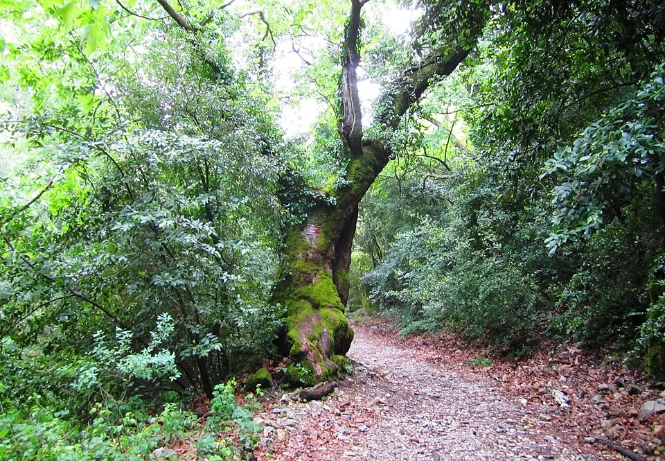
The words
- doğa yürüyüşü
- A nature walk. The Culture Portal, the travel site of the Ministry of Culture and Tourism, titles its page on Dilek «Doğa Yürüyüşü (Trekking)» Culture Portal.
- patika
- A footpath. The same page describes a patika climb of 2 to 3 hours at Dilek.
- yürüyüş yolu · kültür rotası
- A walking path · a culture route. The Society’s name, Kültür Rotaları Derneği, reads «Culture Routes Society»; dernek means society or association.
- işaret
- A mark, a sign. A waymark is a mark that shows where a route goes.
- milli park
- A national park. DKMP lists 54 DKMP.
- tabiat parkı
- A nature park, a second kind of protected area that DKMP keeps. Its home page names Karabük Çamlık as the 279th nature park DKMP.
- sazlık
- A reed bed, a marsh of reeds. Sultan Sazlığı reads «the Sultan’s reed bed».
- giriş ücreti
- An entry fee: giriş is entry and ücret is fee.
The routes the Society keeps
The Culture Routes Society is a small not-for-profit society. Its members open and look after long-distance routes for walking, biking and horse riding, protect old roads and help the villages along the routes Society. Its office is in Antalya.
The Society’s count
20 long-distance routes, 4 cross a border.
Count: the page on all routes says the Society «currently maintains 20 long-distance trekking routes in Turkey» Society. The route menu of the same site lists 24 names.
Across a border: Abraham’s Path, Sultans Trail, Via Egnatia and Via Eurasia, in the menu’s group of international routes.
Other groups in the menu: coastal, nature and historical routes, biking routes and horse-riding routes.
Lycian Way
Roman roads, old footpaths and mule trails
Most of the route follows Roman roads, old footpaths and mule trails. The ground is often hard and stony and the slopes are often steep; the Society says the route is not suited to mountain bikes. About 25 remote historical sites lie along it Society. The route now takes in the St Nicholas Ways, a network of paths linking ruined Byzantine monasteries above Demre. Each night can be spent in a village house, a pension or a small hotel, except on 3 high-level sections. Dalaman airport is 2 hours from the start at Ölüdeniz, and buses run daily from Geyikbayırı to Antalya.
St Paul Trail
Roman roads, footpaths and forest tracks
The route runs along Roman roads, footpaths and forest tracks, and in places it suits mountain bikes. Eğirdir is a major hub for transport and lodging on the way. On many nights a walker can sleep in a village house or a small pension; on the longer sections the Society says walkers have to camp Society.
- Phrygian Way
- It begins at Gordium, the Phrygians’ capital, follows the valley of the Porsuk river and reaches Yazılıkaya, where the trail splits in two: one branch ends at Yenice Farm, by the Kütahya–Eskişehir highway, the other at Seydiler, by the Afyonkarahisar–Ankara highway Society.
- Sultans Trail
- About 2,100 km from the edge of Vienna to the tomb of the Sultan, Süleyman the Magnificent, behind the Süleymaniye Mosque in Istanbul; the Turkish section is 330 km, and in Türkiye the route can also be cycled. The Society says it can be walked almost year round Society.
- The Kaçkar
- Eight long hiking trails of 3 to 6 days over the passes of the Kaçkar Mountains in the north-east, and 7 waymarked day walks in the Hevek valley from Olgunlar to Barhal. The long trails are not waymarked; the treeline is at about 2,100 m, and high passes are open only from July to September unless snowshoes are used Society.
- Biking and riding
- The Society’s menu lists biking routes (Evliya Çelebi Way, Hittite Trail, Phrygian Way, Gastronomy Route, Independence Trail, Sarıkamış Trails, Yenice Forest Trails) and horse-riding routes (Evliya Çelebi Way, St Paul Trail) Society. Cycling on these and other roads is covered in Cycling in Turkey.
How a route is marked
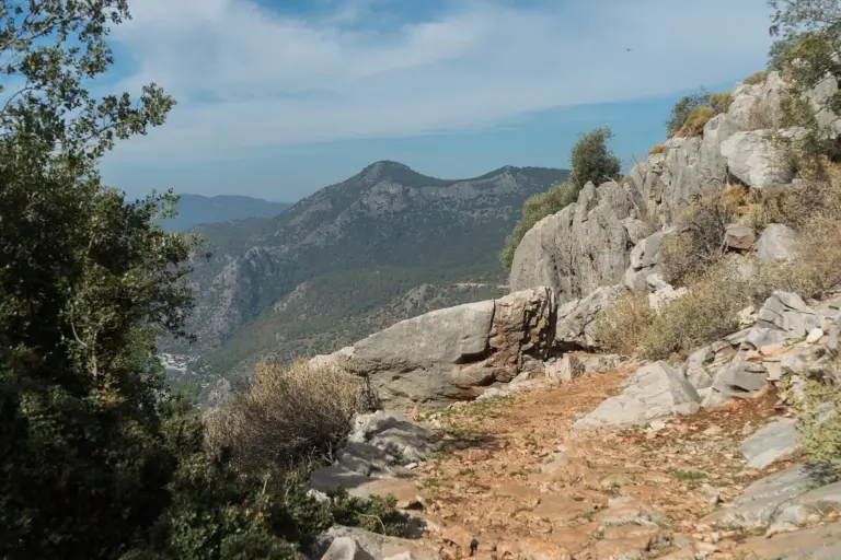
The Society credits Kate Clow with researching, designing and waymarking the Lycian Way in 1999 Society. In the photo below, the waymark is a stripe of paint on a rock.
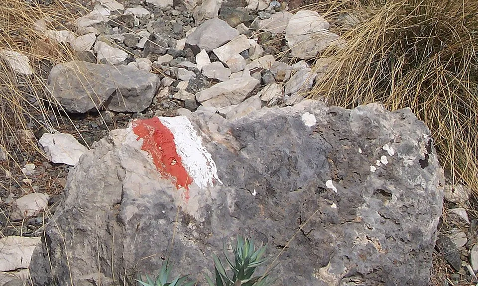
Red and white
The mark in the photo
The photo shows a red-and-white painted mark. It is the one on the boulder in the waymark post when the Lycian Way is picked.
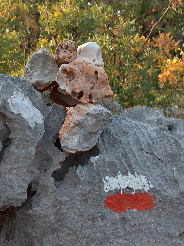
Yellow and red
- Local trails
- At three places along the Lycian Way there are groups of local walking routes «marked in yellow and red»: the Fethiye trails network, which is no longer maintained, Kemer Trails, kept by Kemer Municipality, and Konyaaltı Trails, kept by Konyaaltı Municipality Society.
- On the way
- Some of them are part of the Lycian Way or connect to it, so a walker «may see red and yellow signs» Society.
- cairn
- «Cairn» is the English word for a pile of stones set up as a marker; one sits on top of the rock in the photo.
How often marks are renewed Society:
- A new route. Waymarking is renewed at least every 2 years.
- A route that has worn in. It is renewed every 4–5 years.
- At any time. New road building, dams, landslides and fallen trees can affect sections of a route.
- Early in the year. The Society says problems are likeliest then, after the winter rains.
The Datça section of the Carian Trail
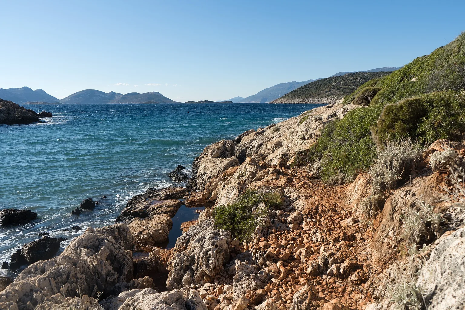
The Carian Trail is 800 km long and runs through the provinces of Muğla and Aydın Society. The Society’s page on its sections describes several parts of it. One is the Datça Peninsula, a narrow strip of land that ends at Cape Crio in the west, «where the Aegean meets the Mediterranean sea» Society.
- Datça. The walking section starts in the harbour town of Datça and heads south and west.
- The headlands. It follows rugged coastal headlands.
- Knidos and Deveboynu. It reaches the ancient city of Knidos and the Deveboynu lighthouse (Deveboynu feneri) at the end of the cape; from there the view takes in the Greek islands of the Dodecanese.
- The northern shore. It turns east along the northern shore, which has almost no settlements, and passes Sedir island.
- Inland. It descends along an avenue of tall eucalyptus trees and passes an ancient tomb of Idyamos.
- Akyaka. It ends at the resort of Akyaka Society.
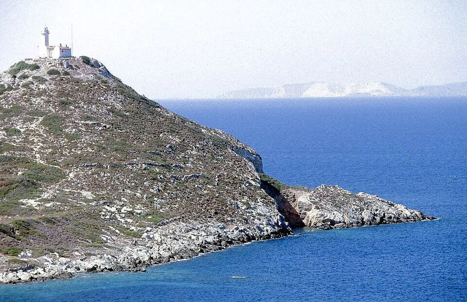
The peninsula
- Reşadiye
- The peninsula is also called the Reşadiye Peninsula, a name from the early twentieth century that honours Sultan Mehmed V Reşad; a village close to Datça bears the name too Society.
- dağ keçesi
- A wild mountain goat. Much of the peninsula is under protection; these goats and endemic plants live in the maquis forests above the northern shore Society.
- badem · bal · balık
- Almonds · honey · fish. The Society calls them the «three B’s» of the town and its region Society.
- Knidos
- The original site of Knidos was at Burgaz, 1.5 km north-east of Datça; the city moved in the 4th century BC «for commercial reasons», to profit from growing sea trade Society.
- By bus
- Regular buses run between Datça and Marmaris, which connects to all major cities in Türkiye. Buses also leave Datça for Hayıtbükü, Ovabükü and Palamutbükü Society.
- By boat
- From June a car ferry sails daily between Datça and Bodrum; in the other months the service is limited Society.
- By air
- Dalaman and Bodrum are the nearest airports, each more than 3 hours away by road Society.
National parks and nature parks
A national park (milli park) and a nature park (tabiat parkı) are both protected areas of DKMP. DKMP lists 54 national parks, each with its province, its regional directorate (bölge müdürlüğü) and its date of declaration DKMP.
- Dilek Yarımadası–Büyük Menderes Deltası
- No. 14 on the list: Aydın province, the 4th Regional Directorate (4. Bölge Müdürlüğü), 19 May 1966 DKMP.
- Sultan Sazlığı
- No. 34 on the list: Kayseri province, the 7th Regional Directorate (7. Bölge Müdürlüğü), 17 March 2006 DKMP.
Ramsar
A wetland of international importance
A Ramsar site is a wetland named under the Ramsar Convention. DKMP’s booklet on the sites counts 14 in Türkiye and lists Sultan Sazlığı among them, with 17,200 ha declared on 13 July 1994 DKMP. The park is bigger than the Ramsar part (chapter 7).
Dilek Peninsula and the Menderes Delta
Dilek Peninsula–Büyük Menderes Delta National Park (Dilek Yarımadası–Büyük Menderes Deltası Milli Parkı) lies in Aydın province, opposite the Greek island of Samos. DKMP’s 4th Regional Directorate says the peninsula was declared in 1966 and the delta in 1994 DKMP.
The park in four figures
27,598 ha, 804 plant species.
Area: 27,598 ha, of which 10,985 ha is the peninsula and 16,613 ha the delta DKMP.
Plants: 804 species, 6 of them local endemics and 18 endemic to Türkiye.
Animals: 28 mammal species and 42 reptile species; the wild boar (yaban domuzu) is among the animals named.
Height: Dilek Tepe, 1,237 m, with an average height of 650 m on the peninsula.
The two parts, to scale
Widths follow the hectares DKMP.
- Why it is protected
- DKMP’s page names a Council of Europe «Flora Biogenetic Reserve» and the Bern, Rio and Barcelona conventions DKMP.
- Walking
- The same page says the park has «various walking and cycling routes» and viewpoints DKMP.
- The gates
- The park’s two units, Güzelçamlı (Güzelçamlı Şefliği) and Doğanbey (Doğanbey Şefliği), are listed as open, and a guide is not required DKMP. A şeflik is a unit of the directorate led by a chief (şef).
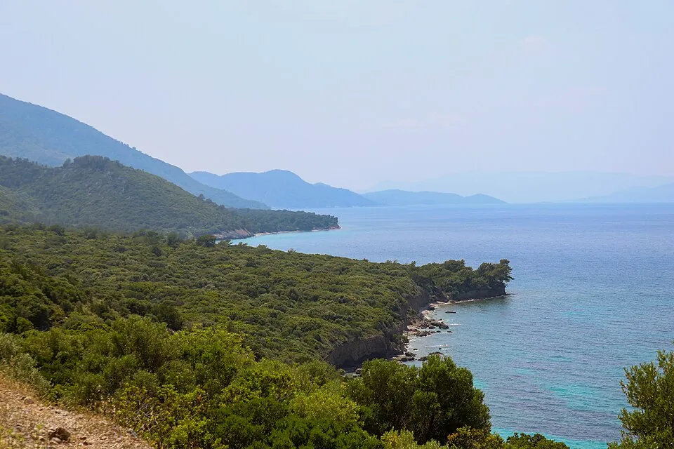
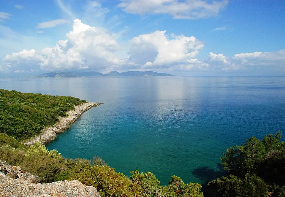
The walk from Doğanbey, as the Culture Portal describes it Culture Portal:
- By bus. 60 to 70 minutes from the Söke direction to old Doğanbey village, with a park directorate facility.
- The village. It lies 2 to 3 km from the delta, 60 to 70 m above the sea.
- The climb. A patika of 2 to 3 hours rises through a canyon, past fountains and plane trees, and through one of Türkiye’s two natural cypress forests.
- The ridge. Views reach the Menderes Delta, Lake Bafa, Miletus, the Beşparmak mountains, Myus and Azap Gölü; then the asphalt road runs along the park.
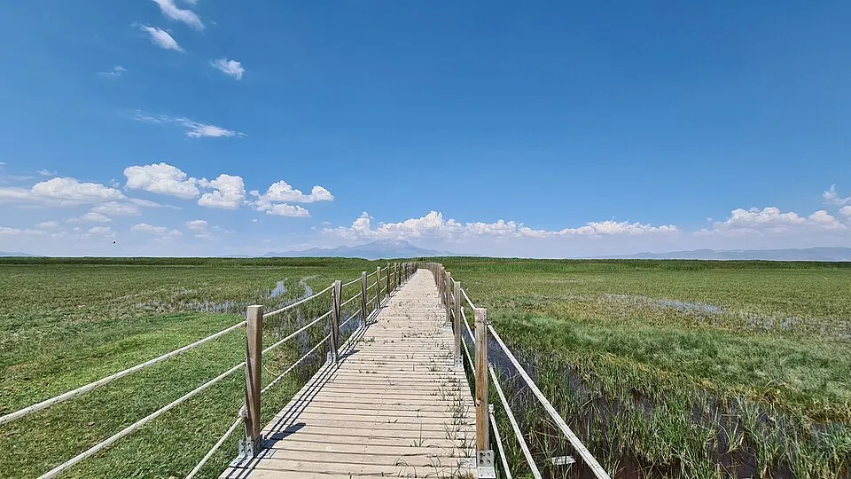
Sultan Sazlığı, the marsh
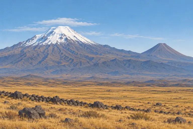
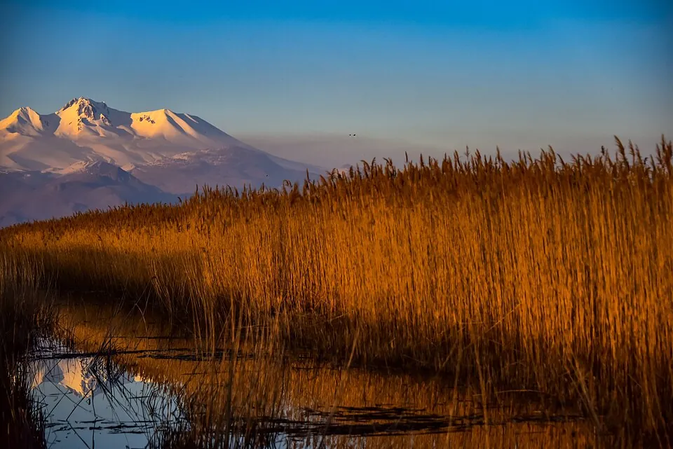
Sultan Sazlığı lies in the districts of Develi, Yahyalı and Yeşilhisar in Kayseri province, 90 km south of Kayseri, at an elevation of about 1,000 m with a continental climate DKMP. Mount Erciyes (3,916 m) sits in its catchment.
The marsh in four figures
24,523 ha, 247 bird species.
Park: 24,523 ha, a national park since 2006; before that it was a nature conservation area DKMP.
Ramsar: 17,200 ha declared on 13 July 1994; the site meets 5 of the 9 criteria for wetlands of international importance.
Birds: 247 species; two main bird migration routes cross the area.
Flamingos: more than 200,000 were recorded in 1998.
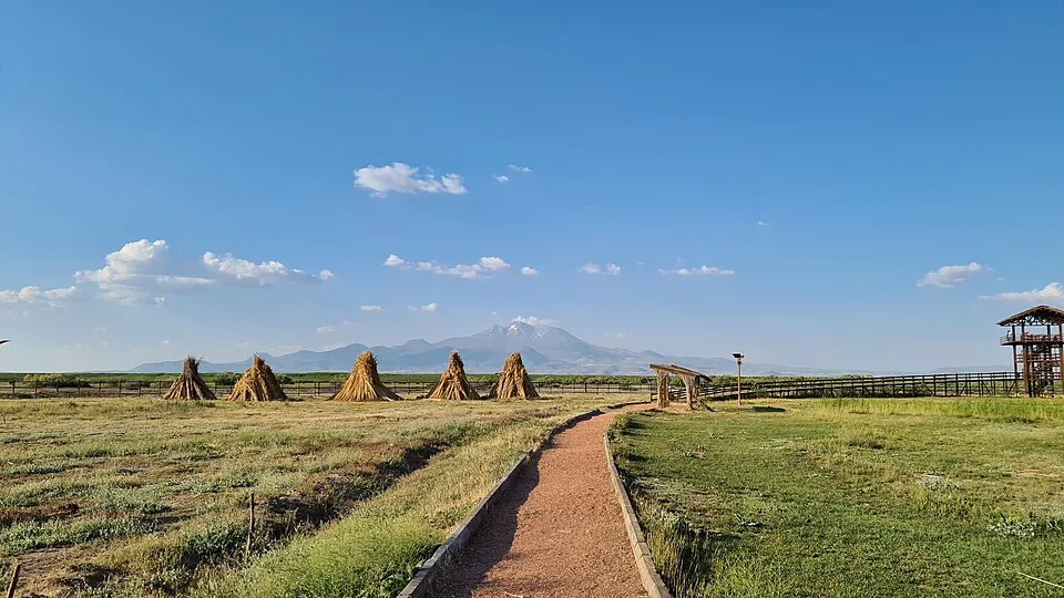
What DKMP lists
- Facilities
- A birdwatching tower and a visitor centre DKMP. The 7th Regional Directorate lists three areas: the Ovaçiftlik visitor and information centre (Ziyaretçi ve Tanıtım Merkezi), Sindelhöyük and Soysallı Pınarları (pınar is a spring) DKMP.
- Gate
- Open, and a guide is not required DKMP.
- People
- Local people harvest reeds and farm; most of the protected area is owned and managed by the state DKMP.
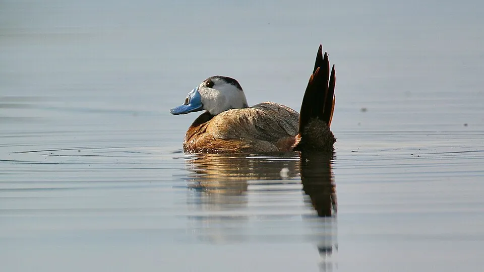
- Birds named
- White-headed duck (dikkuyruk), ferruginous duck, imperial eagle, flamingo, spoonbill and stork; more than 20,000 birds are there each September and October DKMP.
Where the pages differ
- Bird species
- 247 on DKMP’s booklet DKMP. The Kayseri directorate of culture and tourism writes that a 1986 study recorded 251 species, of which more than 80 were found breeding Kayseri directorate.
- Distance
- 90 km south of Kayseri on DKMP’s booklet, and 18 km from Yeşilhisar, 24 km from Yahyalı and 35 km from Develi DKMP; 70 km south of Kayseri on the directorate’s page Kayseri directorate.
- Area
- 24,523 ha is the park; 17,200 ha of it is the Ramsar site DKMP.
Entry and fees in 2026
DKMP’s 2026 tariff for protected areas sorts parks into geographic groups and categories. Dilek is listed under Aydın in the group Ege-2, and Sultan Sazlığı under Kayseri in the group İç Anadolu-2; both are in the first category (I. Kategori) DKMP Ek-1. The person-entry tariff prints ₺75.00 for the first category in both groups DKMP Ek-2.
The person fee, 2026
₺75.00 a person, and rules for who pays less.
Students on foot pay half with a student ID. The discount does not apply to vehicles of the 3rd to 6th class or to trips through a travel company or agency DKMP Ek-21.
Free on foot: children under 7 and people over 65.
Once a day: the fee is taken once per calendar day.
Visitors who are not Turkish citizens pay 5 to 10 times the person fee, set for each area by the Directorate General DKMP Ek-21.
- Vehicles
- A vehicle fee covers the vehicle and everyone in it, so no person fee is added DKMP Ek-21. The vehicle tariff is a separate list on DKMP’s tariff page.
- Licensed mountaineers
- They pay no fee outside 1 June–31 October, the period DKMP declares as high fire risk, if they have the directorate’s permission and show their licence stamped for the season DKMP Ek-21.
- Saklıkent
- Saklıkent National Park in Muğla is in the group Ege-1, where the first category is ₺85.00 DKMP Ek-2. The gorge and its walk are in Saklıkent Gorge.
Operator-run areas
Where an operator runs a protected area, the tariff is the highest price the operator may charge. A gate run under a contract needs the directorate’s permission before it charges visitors who are not Turkish citizens DKMP Ek-2.
Turkish to ask and copy
Press Copy to put a Turkish line on the clipboard, ready to show or paste.
- Park açık mı? Giriş ücreti ne kadar?Is the park open? How much is entry?
- Öğrenci indirimi var mı?Is there a student discount?
- Yabancı ziyaretçiler için giriş ücreti ne kadar?How much is entry for visitors from abroad?
- Rehber almak zorunlu mu?Is a guide required?
- Yürüyüş yolu işaretli mi?Is the walking path marked?
- Bu yürüyüş yolunun başlangıç noktası nerede?Where does this walking route start?
- açık · kapalı
- Open · closed.
- ne kadar
- How much.
- indirim
- A discount. Öğrenci is a student.
- zorunlu
- Required, compulsory. Zorunlu mu? asks «is it required?».
- işaretli
- Marked, with a mark on it. İşaretli mi? asks «is it marked?».
- başlangıç noktası
- The starting point.
Sources
Facts, dates and figures on this page come from these pages, each read on 31.10.2026. Pictures are from Wikimedia Commons with the author, date and licence in each caption; they are scaled down and cropped only.
- Milli Parklar — Directorate General for Nature Conservation and National Parks (DKMP), Ministry of Agriculture and Forestry, checked 31.10.2026
- T.C. Tarım ve Orman Bakanlığı Doğa Koruma ve Milli Parklar Genel Müdürlüğü — DKMP, home page, checked 31.10.2026
- Dilek Yarımadası Büyük Menderes Deltası Milli Parkı (PDF) — DKMP, 4th Regional Directorate, file dated 04.10.2023, checked 31.10.2026
- Dilek Yarımadası Büyük Menderes Deltası Milli Parkı (spreadsheet) — DKMP, 4th Regional Directorate, checked 31.10.2026
- Doğa Yürüyüşü (Trekking) – Dilek Yarımadası Milli Parkı — Ministry of Culture and Tourism, Culture Portal, checked 31.10.2026
- Türkiye’nin Önemli Sulak Alanları: Ramsar Alanlarımız (PDF) — DKMP booklet, 2013, checked 31.10.2026
- Milli Parklar — DKMP, 7th Regional Directorate, checked 31.10.2026
- Sultan Sazlığı — Kayseri Provincial Directorate of Culture and Tourism, checked 31.10.2026
- Korunan Alanlar Ücret Tarifesi — DKMP, tariff page for 2026, checked 31.10.2026
- Ek-1 Coğrafi Grup ve Kategorilere Göre Korunan Alanlar Listesi-2026 — DKMP (PDF), checked 31.10.2026
- Ek-2 2026 Yılı Korunan Alanlar Şahıs Girişi Ücret Tarifesi — DKMP (PDF), checked 31.10.2026
- Ek-21 Korunan Alanlar Ücret Tarifesi Uygulama Usul ve Esasları – 2026 — DKMP (PDF), checked 31.10.2026
- Culture Routes Society — Culture Routes Society (Kültür Rotaları Derneği), checked 31.10.2026
- All Routes — Culture Routes Society (Kültür Rotaları Derneği), checked 31.10.2026
- Lycian Way — Culture Routes Society (Kültür Rotaları Derneği), checked 31.10.2026
- St Paul Trail — Culture Routes Society (Kültür Rotaları Derneği), checked 31.10.2026
- Evliya Çelebi Way — Culture Routes Society (Kültür Rotaları Derneği), checked 31.10.2026
- Carian Trail — Culture Routes Society (Kültür Rotaları Derneği), checked 31.10.2026
- Carian Trail Sections — Culture Routes Society (Kültür Rotaları Derneği), checked 31.10.2026
- Phrygian Way — Culture Routes Society (Kültür Rotaları Derneği), checked 31.10.2026
- Hittite Trail — Culture Routes Society (Kültür Rotaları Derneği), checked 31.10.2026
- Sultans Trail — Culture Routes Society (Kültür Rotaları Derneği), checked 31.10.2026
- The Kaçkar — Culture Routes Society (Kültür Rotaları Derneği), checked 31.10.2026
- Independent trekkers (questions and answers) — Culture Routes Society (Kültür Rotaları Derneği), checked 31.10.2026
- Kültür Rotaları Derneği (Turkish pages) — Culture Routes Society (Kültür Rotaları Derneği), checked 31.10.2026