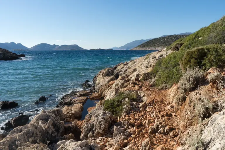
Lycian Way in Turkey: Route, Stages, Parks and Ruins
A 760 km waymarked footpath from Ölüdeniz to Geyikbayırı: its stages, dated route changes, national parks, ancient sites and seasons.
Table of Contents
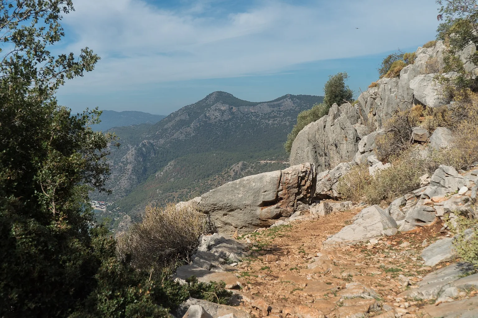
The Lycian Way (Likya Yolu) is a way-marked footpath around the coast of Lycia, the historical name of the Tekke Peninsula, which juts into the Mediterranean on the south coast of Türkiye. The Culture Routes Society (Kültür Rotaları Derneği) states 760 km in 35 days, from Ölüdeniz to Geyikbayırı. The Society credits Kate Clow with researching, designing and waymarking it in 1999.
In short · checked 01.11.2026
760 km on foot, from Ölüdeniz to Geyikbayırı.
- Route: 760 km in 35 days, way-marked, on Roman roads, old footpaths and mule trails.
- Beds: a place to sleep every night in village houses, pensions or small hotels, except on 3 high-level sections.
- Parks: The national parks directorate lists the Likya Yolu among the sights of Beydağları Sahil Milli Parkı (a national park, declared 1972). The 2026 entry figures are in the parks chapter.
- Sites: the pages of the Ministry of Culture and Tourism for Patara, Myra, Olympos and Phaselis showed on 01.11.2026: open 08:00, close 19:00.
- Months: the Society advises February to May and September to November.
Try it · The rock tomb
Open a door
Eight stone doors, eight stretches of the Lycian Way. Open one for its beds, parks, ruins, updates and a Turkish line to copy. The numbers are the guidebook’s stage numbers, as they appear on the Society’s Accommodation page. Each row ends with its owner: the Society, the Ministry of Culture and Tourism or the General Directorate of Nature Conservation and National Parks (Doğa Koruma ve Milli Parklar Genel Müdürlüğü, DKMP).
Illustration: a rock-cut tomb front in the Lycian style. It is not a map and has no scale.
Stages 1–3
- BedsSociety, checked 01.111: Fethiye, Ovacık, Kirme, Faralya · 2: Kabak · 3: Alınca
- ParkDKMP, checked 31.10Ölüdeniz–Kıdrak Tabiat Parkı (a nature park, Muğla), category 1. Parks
- BusSociety, undatedFethiye otogar (the intercity bus station) to Ölüdeniz, Faralya and Kabak. Undated on the Society’s page.
Stages 4–6
- BedsSociety, checked 01.114b: Gey · 4a/b: Bel · 4a: Sidyma · 5: Gavurağılı · 6: Pydnai–Letoon
Stages 7–9
- BedsSociety, checked 01.117: Üzümlü · 8: Akbel/İslamlar · 8: Gelemiş/Patara · 9: Kalkan
- SiteMinistry, checked 01.11Patara ören yeri (a site of ruins), Gelemiş. Hours and facts
- BusSociety, undatedPatara beach, west end, to the Xanthos bridge, Esen and Fethiye. Undated on the Society’s page.
Stages 10–13
- BedsSociety, checked 01.1110: Bezirgan · 11: Gökçeören · 12: Çukurbağ, Yeniköy · 13: Kaş
Stages 14–18A
- BedsSociety, checked 01.1114: Limanağızı · 15: Boğazcık · 16: Aperlae, Üçağız · 17: Kekova/Simena · 18A: Hoyran · 17A: Kapaklı · 17B: Andriake, Demre · Beymelek
- SiteMinistry, checked 01.11Myra ören yeri, Alakent, Demre. Hours and facts
- UpdateSociety, checked 01.11April–May 2017, Üçağız–Demre: route changes at İstlada, Kapaklı, Hoyran and Gürses; signposts not yet erected.
- UpdateSociety, undatedFake waymarks on Kaş–Boğazcık and at Boğazcık, where businesses re-mark the route.
Stages 19–21
- BedsSociety, checked 01.1119: Finike · 20: Karaöz · 21: Adrasan
- ParkDKMP, checked 31.10Adrasan–Sazak Koyu tour route, in Beydağları Sahil Milli Parkı (a national park). Parks
- BusSociety, undatedKumluca otogar to Mavikent and Karaöz. Undated on the Society’s page.
Stages 22–24
- BedsSociety, checked 01.1122: Olympos, Çıralı · Tekirova/Çıralı · 23b: Tekirova · 24b: Kemer · 23a: Ulupınar, Beycik · 24a: Yayla Kuzdere
- ParkDKMP, checked 31.10Beydağları Sahil Milli Parkı · Tekirova Tabiat Parkı, category 2 · Çıralı Yanartaş Mola Noktası (a rest point), category 1. Parks
- SiteMinistry, checked 01.11Olympos, Yazır, and Phaselis, Tekirova (ören yeri, sites of ruins). Hours and facts
- BusSociety, undatedOlympos main-road stop to Çıralı. Undated on the Society’s page.
- UpdateSociety, checked 01.11After 13 September 2020: Çıralı–Tekirova signs renewed.
- UpdateSociety, undatedFake waymarks at Beycik; no water on the Tahtalı slopes over Yukarı Beycik. Route changes
Stages 25–29
- BedsSociety, checked 01.1125a: Gedelme · 25b: Göynük Yaylası · 26: Göynük · 27: Hisarçandır · 28: Çitdibi · 29: Geyikbayırı
- ParkDKMP, checked 31.10Göynük Kanyonu Tur Güzergahı, category 1 · Göynük Çomaklar Çadırlı Kamp Alanı (a tent camp area), category 2. Parks
- BusSociety, undatedAntalya intercity otogar to Geyikbayırı. Undated on the Society’s page.
- UpdateSociety, checked 01.115–13 September 2020: a volunteer team of four renewed waymarks in the east. New signs on Üçsöğüt Plateau–Gedeller–Sarısu, the alternative end stage.
- UpdateSociety, checked 01.11July 2020, stage 28 (Elmayanı–Çitdibi): the forest-road part moved to a path with red-and-white waymarks. No water on the new route.
The route, a footpath around Lycia
The way follows mainly Roman roads, old footpaths and mule trails. The Society describes the ground as often hard and stony underfoot, with steep gradients in many places, and states that the route is not suitable for mountain bikes. It describes the route as Türkiye’s first long-distance walking route, made to identify and protect old roads. Society, checked 31.10
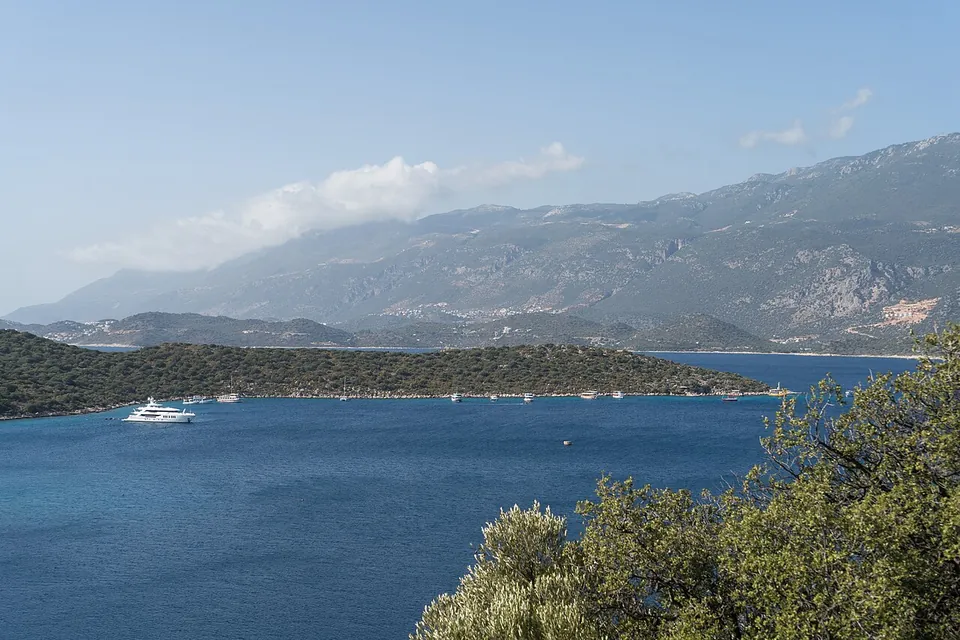
Start, end and what lies between
- Start
- Ölüdeniz, 2 hours from Dalaman airport.
- End
- Geyikbayırı, with daily buses to Antalya.
- Sites
- About 25 remote historical sites.
- St Nicholas Ways
- A network of paths connecting ruined Byzantine monasteries over Demre, linked to the Lycian Way.
- Local routes
- At three places there are groups of local walking routes marked in yellow and red. Some are linked to the Lycian Way, so yellow-and-red signs can be seen.
Except on 3 high-level sections, a place to sleep can be found every night in village houses, pensions (pansiyon, small guest houses) or small hotels. The Society states that independent trekkers find plenty of wild camping places with water nearby. No DKMP page read says whether camping outside a camp area (kamp alanı) is allowed in a park. Society, checked 31.10
The Society’s English guidebook was released in December 2022, with three walking maps. The Society keeps the route on OpenStreetMap, and the route is in its own phone app. Society, checked 01.11
Route changes, dated and undated
The Society states that the Lycian Way changes frequently: new roads, quarries, building, land purchase and landslides are the causes it names. Society, checked 01.11
- September 2020 5–13 September: a volunteer team of four renewed waymarks and cleared bushes in the east. New signs on Üçsöğüt Plateau–Gedeller–Sarısu, the alternative end stage, now also in the phone app, ending at the Sarısu bus stop. Çıralı–Tekirova signs were renewed afterwards. Society, checked 01.11
- July 2020 Stage 28 (Elmayanı–Çitdibi): the forest-road part between Elmayanı and Üçsöğüt moved to a path with red-and-white waymarks, in the phone app with new GPS data. The summit of TaştanAtıcı Peak is optional. There is no water on the new route; the nearest source is at Üçsöğüt. Society, checked 01.11
- April–May 2017 Üçağız–Demre: the İstlada ruins, with graves and a church, are on the route. A sea detour of 1.5 km at Kapaklı. Kapaklı–Hoyran runs through the village centre and up the Roman road; Kapaklı–Andriake keeps the original coast route. The Hoyran ruins were cleared. From Hoyran to the Davazlar Trysa junction, then Trysa–Gürses–Myra. Signposts were not yet erected. Society, checked 01.11
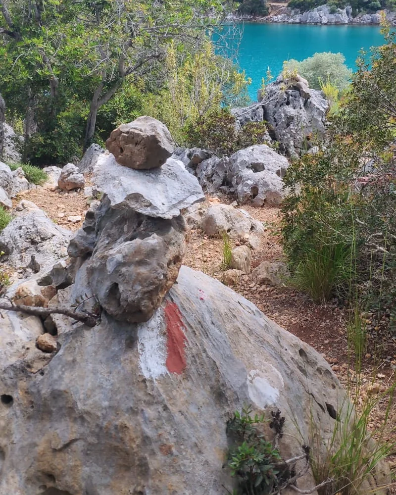
Undated
- Waymarks
- Fake waymarks on Kaş–Boğazcık, at Boğazcık and at Beycik. Businesses re-mark the route there.
- Water
- No water on the Tahtalı slopes over Yukarı Beycik. The Society’s advice there: camp before the yayla, a summer pasture, or stay in Beycik.
- End of the route
- From Elmayanı a marked path to Üçsöğüt Yaylası, then left down a valley to Hisarçandır; a new yellow-red path to Gedeller and the Sarısu bus garage. The Lycian Way continues through Çitdibi and past the ruins of Typalia and Trebenna to Geyikbayırı.
The Society’s FAQ for all its routes: waymarks are renewed at least every 2 years when new and every 4–5 years later. Society, checked 31.10
National parks, and the 2026 entry figures
Türkiye’s protected areas have several statuses, among them national park (milli park), nature park (tabiat parkı), nature conservation area and nature monument. The General Directorate of Nature Conservation and National Parks (Doğa Koruma ve Milli Parklar Genel Müdürlüğü, DKMP) sets their entry fees. DKMP, checked 31.10
- Beydağları Sahil Milli Parkı
- The Beydağları coast national park (sahil means coast). Declared in 1972; it covers the Konyaaltı–Kemer and Kumluca districts of Antalya province, in DKMP’s 6th Region, list no. 10.
- In Lycia
- The park lies in the east of the region known in antiquity as Lycia. Its most important settlements are the cities of Phaselis (Tekirova) and Olympos.
- To see
- The Likya Yolu; the ancient cities of Phaselis (Tekirova), Olympos, Chimaera and Gagai; Çıralı Yanartaş; islands; Adrasan Limanı (Adrasan harbour); Gelidonya Feneri (Gelidonya lighthouse).
- Inside
- 15 day-use areas (günübirlik kullanım alanı), 3 camp areas (Göynük, Kındılçeşme and Göynük Kanyonu Çomaklar Mevkii), 3 tour routes (Antik Likya Yolu; Adrasan–Sazak Koyu; Kesme Boğazı–Sumakseniri Damları–Antik Likya Yolu), 3 rest points (mola noktası: Göynük Kanyonu, Yanartaş, Sazak Koyu), a walking path in Göynük Kanyonu, 2 viewpoints, wildlife observation points, climbing areas and 2 paragliding take-off areas.
- Activities
- The park’s activity list includes tent camping (çadırlı kamp) and nature walks (doğa yürüyüşleri).
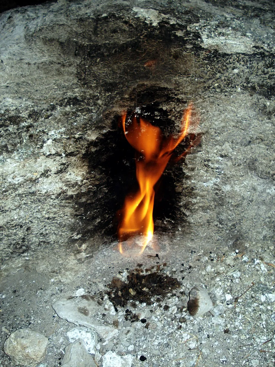
The Chimaera
Natural gas comes out of cracks in the mountains a few kilometres west of Olympos and has burned for centuries. DKMP names it Likya’nın Sönmeyen Ateşi, the Fire of Lycia that never goes out, and it appears in the myth of Bellerophon as Chimaira (Yanan Taş, “burning stone”).
Five areas in DKMP’s 2026 list of protected areas share a name with a place of the route. Each has a geographic group and a category, and the two set the fee.
| Area | Group | Category |
|---|---|---|
| Ölüdeniz–Kıdrak Tabiat Parkı (nature park), Muğla | EGE-1 (İzmir, Muğla) | 1. Kategori |
| Çıralı Yanartaş Mola Noktası (rest point), Antalya | AKDENİZ-1 (Antalya) | 1. Kategori |
| Göynük Kanyonu Tur Güzergahı (tour route), Antalya | AKDENİZ-1 (Antalya) | 1. Kategori |
| Tekirova Tabiat Parkı (nature park), Antalya | AKDENİZ-1 (Antalya) | 2. Kategori |
| Göynük Çomaklar Çadırlı Kamp Alanı (tent camp area), Antalya | AKDENİZ-1 (Antalya) | 2. Kategori |
Person entry in 2026, in Turkish lira. People who are not citizens of Türkiye pay at least 5 and at most 10 times the person fee, set per area by the Directorate General (Genel Müdürlük Oluru ile saha bazlı). DKMP, checked 31.10
| Zone | 1. Kategori | 2. Kategori | 3. Kategori |
|---|---|---|---|
| AKDENİZ-1 (Antalya) | ₺95.00 | ₺75.00 | ₺65.00 |
| EGE-1 (İzmir, Muğla) | ₺85.00 | ₺75.00 | ₺45.00 |
Tent place for 4 people, per day, in 2026, in Turkish lira.
| Zone | 1. Kategori | 2. Kategori | 3. Kategori |
|---|---|---|---|
| AKDENİZ-1 (Antalya) | ₺570 | ₺450 | ₺390 |
| EGE-1 (İzmir, Muğla) | ₺510 | ₺450 | ₺270 |
- Where it applies
- Entrances of national parks, nature parks, nature conservation areas and nature monuments, and day-use or camp areas with a separate entry control unit.
- Main gate
- A fee paid at the main gate means no extra fee at areas with no separate control unit.
- Free
- People under 7 and over 65, on foot.
- Students
- 50% off on foot, with a student ID.
- Per day
- One fee per calendar day. A vehicle fee covers the vehicle and the people in it.
- Operators
- Where an operator runs an area, the tariff is the maximum price.
- Tents
- A tent for 2–3 people pays the 4-person tariff, for 5–6 people 50% more, for 7–8 people double.
No DKMP page read says whether a person who walks through a park on the Lycian Way pays the person fee.
DKMP’s news of 17.08.2026: the Fethiye–Kaş Deniz Milli Parkı, a marine national park, has a size of 2,170,603 hectares. With the Kuzey Ege Deniz Milli Parkı it is one of the first two marine national parks of Türkiye, and a presidential decision published on 16.08.2026 gave it protected status. DKMP, checked 01.11
The Society’s conservation map (Culture Routes Society 2020) marks the route of 1999 and of 2019, first- and third-degree conservation sites in Kaş, Demre, Finike, Kumluca, Kemer and Konyaaltı, and the Lycian cities. Open the Society’s map (an image)
Ancient sites, four with a Ministry page
An ancient site is an ören yeri, a place of ruins. The Ministry of Culture and Tourism (Kültür ve Turizm Bakanlığı) has a page for each of these four sites, from west to east along the route. All four showed Her gün açık, open every day, and a ticket office that closes at 18:30.
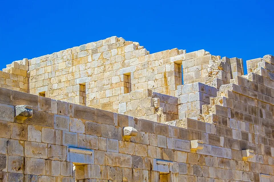
Patara
- Where
- Gelemiş, Kaş, Antalya.
- Hours
- The Ministry’s page showed on 01.11.2026: open 08:00, close 19:00.
- What
- A Roman triumphal entrance, built in 100 AD as its inscriptions suggest; Lycian-style sarcophagi west of the arch; a theatre rebuilt after the earthquake of 147 AD; a granary built by Hadrian and Sabina in the 2nd century AD; the Bouleuterion (council house) beside the theatre.
- Tradition
- The Ministry names Patara as the birthplace of St Nicholas, by tradition.
Myra
- Where
- Alakent, Demre, Antalya.
- Hours
- The Ministry’s page showed on 01.11.2026: open 08:00, close 19:00.
- What
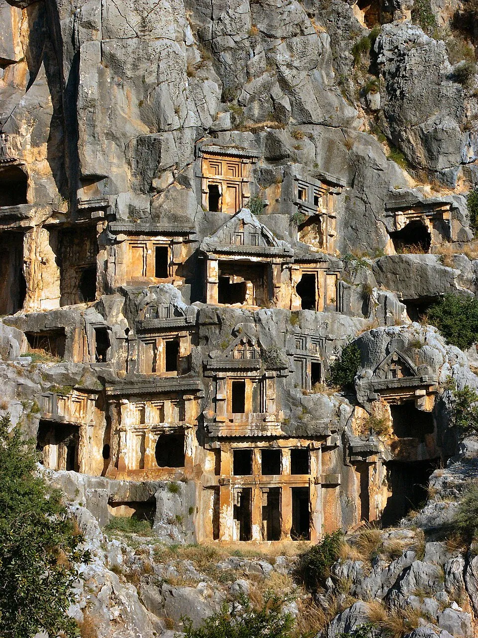
- Rock tombs, and a theatre of the Roman period built on the rock tombs. Between Kaş and Finike, tied to Andriake Harbour. The bishopric of St Nicholas. One of six important cities of the Lycian Confederation, with three votes.
Olympos
- Where
- Yazır, Kumluca, Antalya.
- Hours
- The Ministry’s page showed on 01.11.2026: open 08:00, close 19:00.
- What
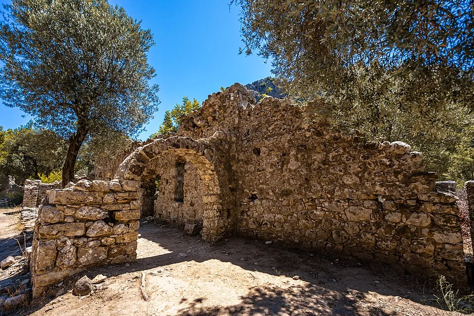
- Founded in the 3rd century BC. The ruins lie on both sides of the river: an acropolis, walls, a theatre, the river channelled between walls and the remains of a bridge. The pirate leader Zeniketes used the city as a base until 78 BC, when the Roman commander Servilius Isauricus captured it. The Ministry’s text links the site to the fire of the Chimera of myth.
Phaselis
- Where
- Tekirova, Kemer, Antalya.
- Hours
- The Ministry’s page showed on 01.11.2026: open 08:00, close 19:00.
- What
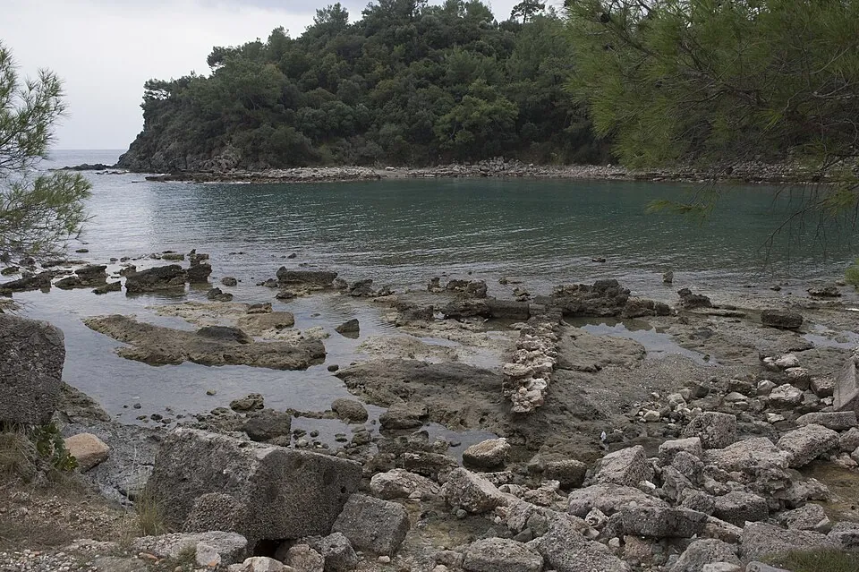
- Founded as a port city in the 7th century BC on a small peninsula, with three ports: North, Central (the War Harbour) and South. City walls along the shore; aqueducts from Tahtalı Mountain; a paved street 25 m wide; two baths; the South Harbour entrance built for Hadrian’s visit. Abandoned in the early 13th century.
One more line on the Ministry’s four pages, in Turkish. T.C. is Türkiye Cumhuriyeti, the Republic of Türkiye.
T.C. Vatandaşları için MüzeKart Geçerlidir MüzeKart is valid for citizens of Türkiye.Entry prices of museums and ruins: Museum ticket prices.
Months and water, from the Society
The Society advises walking in February to May or in September to November, and recommends February in particular, which it finds often warmer and sunnier than March. It finds summer in Lycia too hot for long walks. Society, checked 31.10
Months · from the Society
Water
- Villages
- All villages have a clean water source.
- On the way
- A walker usually passes at least one source a day.
- June to the end of October
- During and after animal migration, purify well water with iodine, tablets or boiling.
- Dry summers
- Some wells and springs dry from August on. The Carian Way, the Lycian Way and parts of central Anatolia are the driest.
- Winter
- The Society’s FAQ does not recommend trekking from mid-December to the end of January, and describes “violent storms and snowfall” over almost all of Türkiye in that period.
- Food
- At most 2 days’ food on the longest section.
- Fires
- Fires only where there are existing fireplaces.
The two ends, and a third
- Start
- Ölüdeniz, 2 hours from Dalaman airport. Society, checked 31.10
- End
- Geyikbayırı, with daily buses to Antalya. Society, checked 31.10
- Alternative end
- The stage Üçsöğüt Plateau–Gedeller–Sarısu, signed since September 2020 and in the phone app, ends at the Sarısu bus stop. Society, checked 01.11
- To the start
- From Dalaman, buses run to Fethiye otogar. Minibuses to Ölüdeniz leave from outside Fethiye otogar and pass the start. Undated on the Society’s page. Society, undated
Turkish words, and lines to copy
| Turkish | Meaning |
|---|---|
| Likya Yolu | the Lycian Way |
| patika | footpath, trail |
| işaret | sign, waymark |
| yayla | plateau, summer pasture |
| köy | village |
| çeşme | fountain, spring tap |
| pansiyon | pension, small guest house |
| kamp alanı | camp area |
| milli park | national park |
| tabiat parkı | nature park |
| ören yeri | site of ruins |
| dolmuş | shared minibus |
| otogar | intercity bus station |
| mola noktası | rest point |
| günübirlik kullanım alanı | day-use area |
| tur güzergâhı | tour route |
| giriş ücreti | entry fee |
| bilet gişesi | ticket office |
| Deniz Milli Parkı | marine national park |
| Her gün açık | open every day |
Counter lines · tap Copy
Park giriş ücreti ne kadar? How much is the park entry fee?Kamp alanı nerede? Where is the camp area?Öğrenci indirimi var mı? Is there a student discount?Yabancı ziyaretçi için giriş ücreti ne kadar? How much does a foreign visitor pay to enter?Bilet gişesi nerede? Where is the ticket office?More on turkpidya.com
Other walking routes across Türkiye: Hiking in Türkiye. The city at the end of the route: Antalya. Beydağları Sahil Milli Parkı has 2 paragliding take-off areas: Paragliding in Türkiye. Beaches of Antalya province: Beaches in Antalya.
Sources, with dates
- The Lycian Way — Culture Routes Society, checked 31.10.2026
- The Lycian Way: Route Updates — Culture Routes Society, checked 01.11.2026
- The Lycian Way: Accommodation — Culture Routes Society, checked 01.11.2026
- The Lycian Way: Transport (undated) — Culture Routes Society, checked 01.11.2026
- The Lycian Way: Books, Maps and Apps — Culture Routes Society, checked 01.11.2026
- Independent trekkers: FAQ for all routes — Culture Routes Society, checked 31.10.2026
- Conservation map of the Lycian Way (image) — Culture Routes Society, checked 01.11.2026
- Milli Parklar — DKMP, checked 31.10.2026
- Beydağları Sahil Milli Parkı — DKMP, 6th Region, checked 01.11.2026
- News of 17.08.2026: the first marine national parks — DKMP, checked 01.11.2026
- Ek-1: geographic groups and categories of protected areas, 2026 (PDF) — DKMP, checked 31.10.2026
- Ek-2: person entry fee tariff, 2026 (PDF) — DKMP, checked 31.10.2026
- Ek-21: how the fee tariff is applied, 2026 (PDF) — DKMP, checked 31.10.2026
- Ek-4: tent place fee tariff, 2026 (PDF) — DKMP, checked 01.11.2026
- Patara — Ministry of Culture and Tourism, checked 01.11.2026
- Myra — Ministry of Culture and Tourism, checked 01.11.2026
- Olympos — Ministry of Culture and Tourism, checked 01.11.2026
- Phaselis — Ministry of Culture and Tourism, checked 01.11.2026
Where a Society page carries no date, the fact is marked undated. The photographs are from Wikimedia Commons, each with its author, date, licence and file page.