Mount Nemrut: Terraces, Giant Figures and the Road Up
The seated stone figures, terraces and tomb mound of King Antiochos I on Nemrut Dağı: what stands there, who built it, and when you can go.
Table of Contents
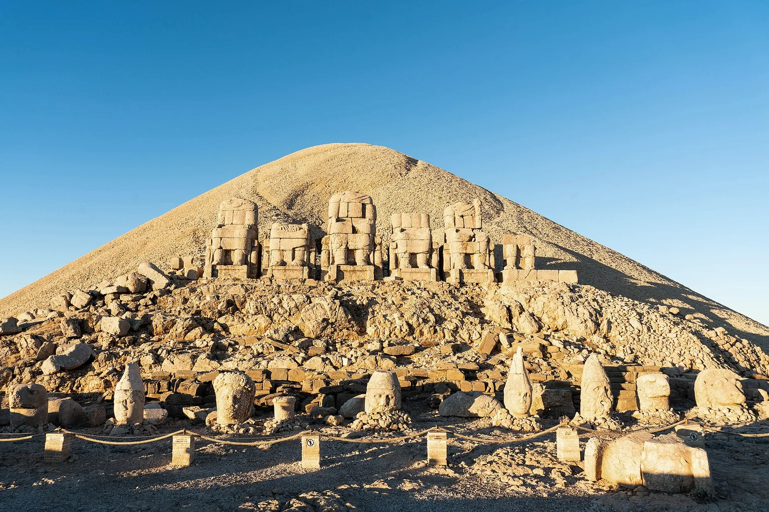
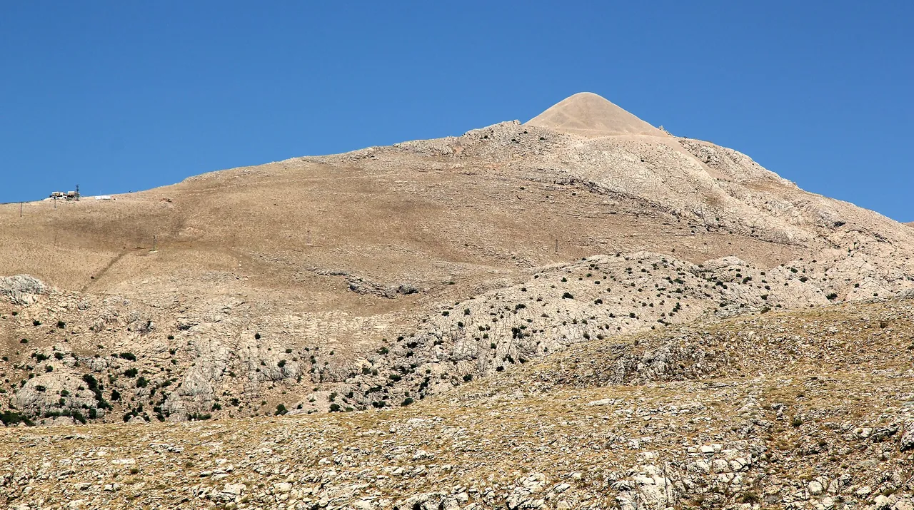
Mount Nemrut (Nemrut Dağı) is a summit of about 2,150 m in Adıyaman province, Türkiye. On it King Antiochos I of Kommagene, a kingdom that lasted about 200 years, built a mound of stone chips and, around it, terraces with seated stone figures 8–10 m high. It is a UNESCO World Heritage site (1987) and a national park (1988); the road up passes a royal tomb mound, a Roman bridge, the Kommagene summer capital and a later castle.
In short · checked 29.10.2026
A king’s tomb mound, ringed by seated stone gods.
- What: a mound of small crushed rock, about 50 m high and 150 m across, with three terraces round it. The inscriptions put the king’s tomb here; no chamber has been found.
- Who: Antiochos I of Kommagene. He declared himself a god and built the sanctuary in his lifetime, to show thanks to the gods and his ancestors.
- When to go: the season runs from mid-March to mid-November, by weather. Under the Ministry of Culture and Tourism the site is open every day, and its times follow sunrise and sunset.
- Not to confuse: this is not Nemrut Kalderası, the crater lake in Bitlis.
The terraces at first light
Pick a terrace, then a figure.
Each row is drawn as it is seen from the front: bodies cut at the shoulder, heads set down in front. The drawing is not to scale.
East terrace Doğu teras
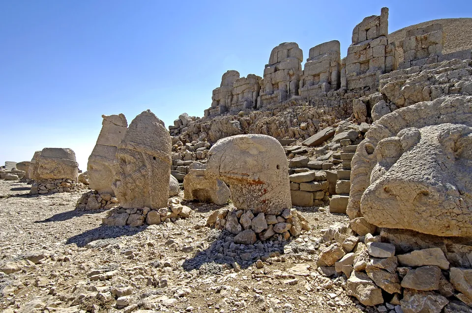
Sunrise is watched from this terrace. It is the most complete of the three and the sacred centre of the sanctuary.
Antiochos the king
The builder of the sanctuary. He declared himself a god in his lifetime. He is first in the row, on the left.
Kommagene the mother goddess
The mother goddess of the country, and the only goddess known in the pantheon.
Zeus-Orosmasdes the chief god
The chief god of the five. He sits in the middle of the row.
Apollon-Mithras
The fourth figure from the left, next to the chief god.
Herakles-Artagnes
The last figure on the right of the row.
Lion and eagle
A lion and an eagle stand on each side of the row. The lion stands for rule on earth, the eagle for rule of the sky.
- Stelae of the royal family stand on this terrace.
- A fire altar and a seated lion.
- The thrones are about 10 m high; the figures 8–10 m.
West terrace Batı teras
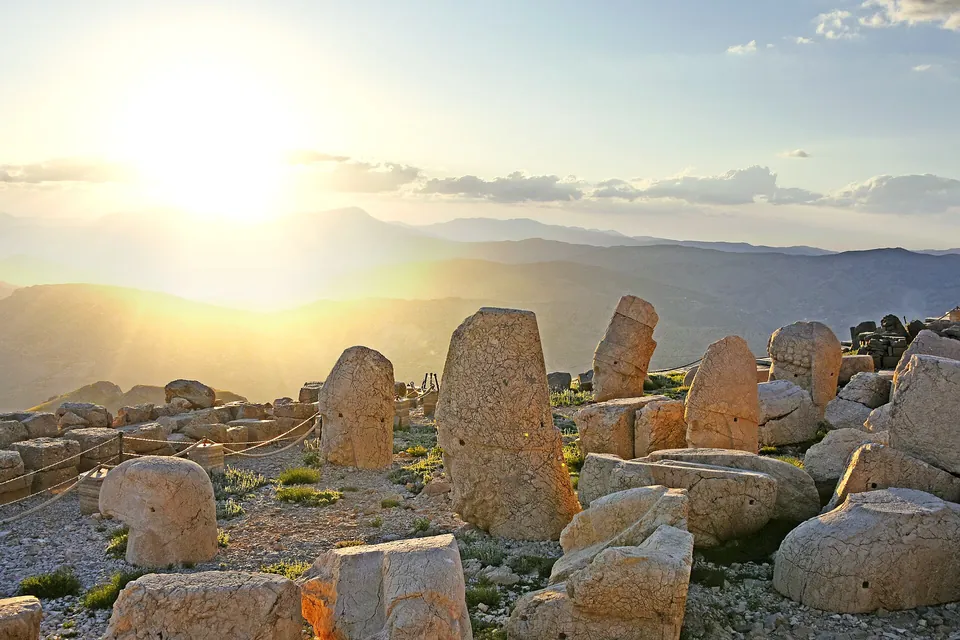
Sunset is watched from this terrace. The row is like the east one, apart from small details.
Five figures
Left to right: Antiochos, Kommagene, Zeus-Orosmasdes, Apollon-Mithras and Herakles-Artagnes. Like the east row, apart from small details.
Lion and eagle
A lion and an eagle stand on each side of the row. The lion stands for rule on earth, the eagle for rule of the sky.
Reliefs
Handshake reliefs, stelae of Macedonian kings and four reliefs of Persian ancestors.
Lion horoscope
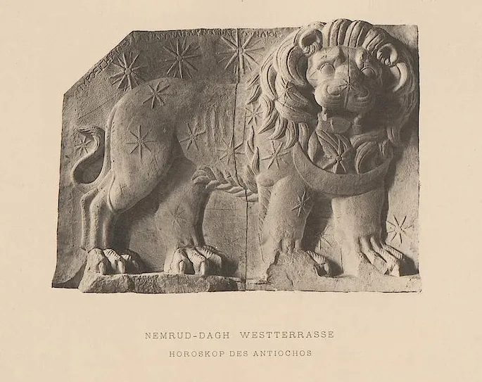
A relief of a lion set with stars. It is damaged and now protected. The date 7 July 62 BC is read on it.
North terrace Kuzey teras
A ceremonial way 180 m long, lined with stelae and bases, most of them broken or unfinished.
The way
180 m long, along the north side of the mound.
Stelae and bases
Mostly broken; some of the stelae were never finished.
The king and his mountain
Nemrut Dağı is a king’s sanctuary and his tomb on one summit. Antiochos I Theos, ruler of Kommagene, declared himself a god and had it built in his lifetime, to show thanks to the gods and to his ancestors.
The summit
About 2,150 m up, under a mound 50 m high.
The mound. A heap of small crushed rock and gravel, about 50 m high and 150 m across today.
The tomb. The inscriptions put the king’s tomb here. No burial chamber has been found; his bones or ashes are thought to lie in a chamber cut into the rock.
The figures. Seated stone figures 8–10 m high, on three terraces round the mound.
About 2,150 m: Culture Portal, the ministry’s museum page and the heritage directorate. The Adıyaman directorate puts the summit at 2,206 m.
Four words
- Nemrut Dağı
- Mount Nemrut. Dağ means mountain.
- ören yeri
- An archaeological site in the open air.
- Kommagene
- The kingdom of Antiochos I, which lasted about 200 years.
- tümülüs
- A made hill over a tomb. Here it is built of small crushed rock.
The mound and three terraces
Three terraces lie round the mound. The east terrace is the most complete and the sacred centre of the sanctuary; the west terrace holds a row like it, apart from small details; the north terrace is a ceremonial way, 180 m long.
East · sunrise
The terrace that faces the sun
The figures on this terrace face the sun, and visitors watch the sunrise from it. The thrones are about 10 m high.
West · sunset
The terrace of the reliefs
Visitors watch the sunset from this terrace. It holds the handshake reliefs, stelae of Macedonian kings, four reliefs of Persian ancestors and the lion horoscope.
The lion horoscope
A relief of a lion set with stars, on the west terrace. It is damaged and now protected. The date 7 July 62 BC is read on it.
- teras
- A terrace: a levelled platform on the mountainside.
- doğu · batı · kuzey
- East · west · north.
- gündoğumu · günbatımı
- Sunrise · sunset.
The seated figures and their names
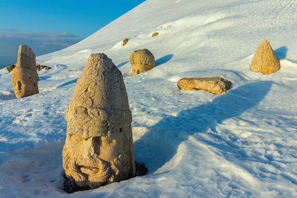
Each of the two main rows has five seated figures. Left to right they are the king Antiochos, the goddess Kommagene, Zeus-Orosmasdes, Apollon-Mithras and Herakles-Artagnes. They are carved in limestone in a Greek-Persian style and stand 8–10 m high. Their bodies have partly fallen, and their heads lie in a line on the ground in front of them.
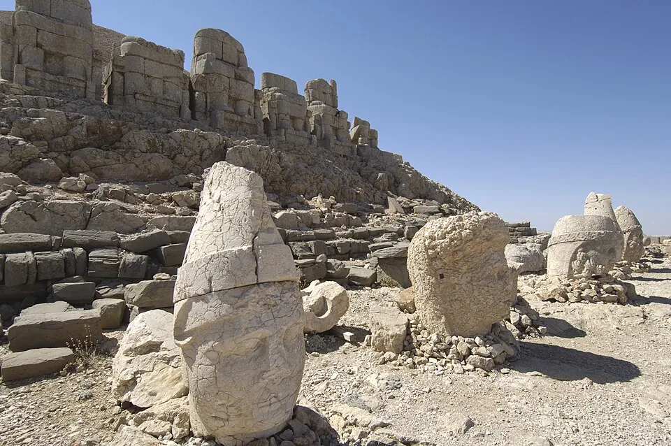
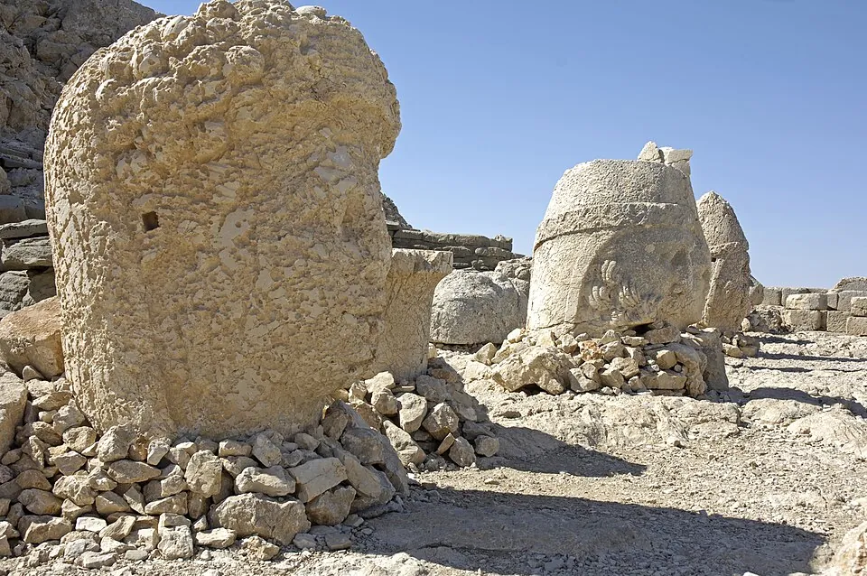
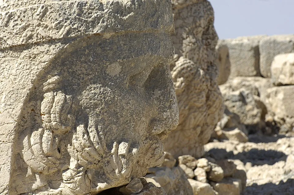
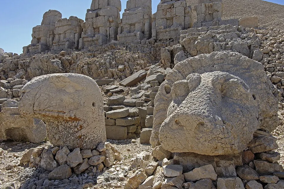
Lion and eagle
A lion and an eagle stand on each side of the row. The lion stands for rule on earth, the eagle for rule of the sky.
Double names
Three of the five carry a double name joined by a hyphen: Zeus-Orosmasdes, Apollon-Mithras and Herakles-Artagnes. Kommagene is the only goddess known in the pantheon.
The writing and the dates
On the backs of the throne bases the king had his will cut in stone. It is called the nomos: a text on religion and society.
The inscription
- nomos
- The king’s will on religion and society, cut on the backs of the throne bases.
- Length
- 237 lines (Culture Portal, Adıyaman directorate). The ministry’s English museum page and its brochure read 223.
- Early 2nd century BC. Arsames founds Arsameia, the summer capital of Kommagene.
- About 70–32 BC. Antiochos I reigns and builds the sanctuary.
- 7 July 62 BC. The date read on the lion horoscope.
- AD 193–211. Cendere Bridge is built under Septimius Severus.
- 1987. Nemrut Dağı becomes a UNESCO World Heritage site.
- 7 December 1988. The national park is declared.
Four readings of the king’s reign
- About 70–32 BC
- Culture Portal. The exact dates of the kings’ accessions are not known.
- 69–38 BC
- The ministry’s museum brochure.
- 62–32 BC
- The ministry’s national-park page.
- 7 July 62 BC
- Read on the lion horoscope as the day he took the throne (the ministry’s museum page, the Adıyaman directorate).
The readings differ. Each date stays with its owner.
The road up to the summit
Four stops lie near the mountain: a royal tomb mound, a Roman bridge, the Kommagene summer capital and a castle.
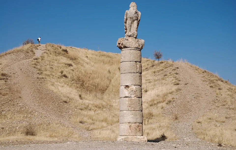
Karakuş Tümülüsü
A mound for royal women
King Mithridates II built it for his mother Isias, and other royal women were buried here later. About 110 m across; 30 m high when built, about 20 m now. Six columns stood on it, four remain, and the eagle column faces south. After Rome took Kommagene the mound was wrecked, and its stones went into Cendere Bridge.
20 km north of Kâhta · the park’s entry point
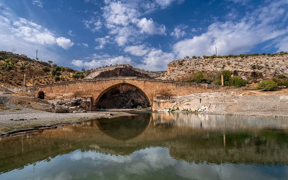
Cendere Köprüsü
A Roman bridge
Built under Septimius Severus (AD 193–211) by the XVI Legion based at Samsat. Two arches of dressed stone, laid without mortar: 120 m long, 30 m high, 7 m wide. Columns carry the names of Septimius Severus and Julia Domna; Caracalla’s column stands too, and Geta’s was removed.
About 10 km after Karakuş, at the Sincik–Kocahisar junction
The ministry’s national-park page puts the building of the bridge instead on the cities of Kommagene, in honour of Septimius Severus.
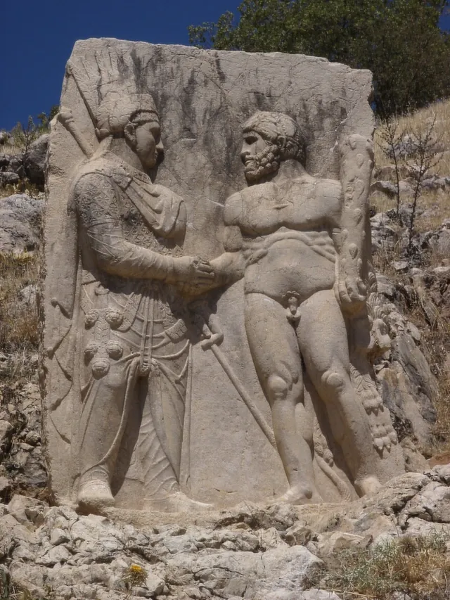
Arsameia
The Kommagene summer capital
Founded early in the 2nd century BC by Arsames. Most of what stands is Antiochos’s: palace ruins, the tomb platform of his father Mithridates I Callinicus, the longest Greek inscription found in Anatolia and a stele of Antiochos shaking hands with Herakles. A rock tunnel of about 158 m has no known purpose.
26 km from Kâhta
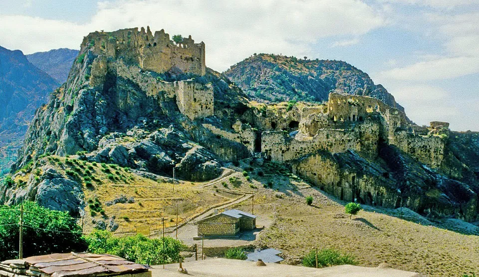
Yeni Kale
A castle of many hands
In Kocahisar village (old Kâhta), opposite the old castle on the Arsameia hill. The Culture Portal dates its beginnings to the Hittites and its present form to the Mamluks; the ministry’s museum page puts the first building in the Kommagene period, with Roman, Artuqid, Seljuk, Mamluk and Ottoman additions. Inscriptions name Mamluk rulers; hidden stairs lead down to the Kâhta stream.
20 km north of Kâhta
When you can go
The season runs from mid-March to mid-November, depending on the weather.
Hours and tickets
Open every day
Under the Ministry of Culture and Tourism the site is open every day, and its times follow sunrise and sunset, so they shift through the year.
The ministry’s tourism page adds that sunrise on the summit is quite cold, even in midsummer.
The hours are on the ministry’s Nemrut page, and the ticket on the Nemrut ticket page. Other sites: museum prices in Türkiye.
Milli park · national park
13,850 ha round the summit
Declared on 7 December 1988 under Law 2873. It takes in the tumulus and the statues, Eski Kale, Karakuş Tepesi, Cendere Bridge and Yeni Kale. No guide is needed to enter. Two walking routes start from Yolaltı village: one by Damlacık to Arsameia, one by Damlacık and Sırakaya to the tumulus.
Mount Nemrut is one of the summits on the Stargazing in Turkey chart.
Getting there: two approaches
One approach starts from Adıyaman and Kâhta, the other from Malatya.
Which side are you coming from?
- Distance
- 87 km from the centre of Adıyaman; 43 km from Kâhta, which is 34 km from Adıyaman.
- The road
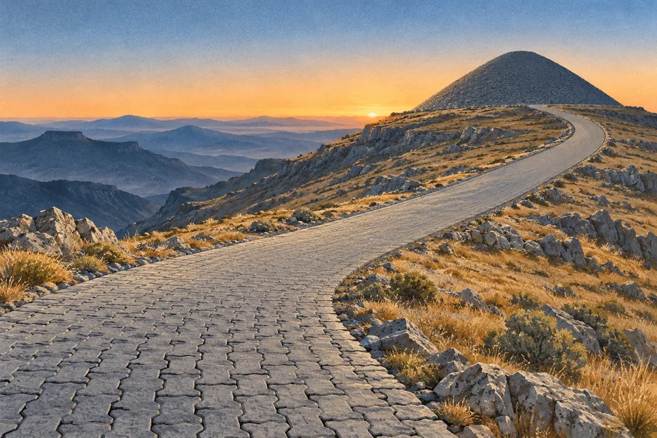
- Tarmac as far as Karadut village, then locked paving stones. Visitors go by tour or in their own vehicle.
- To Kâhta
- Intercity buses run to Kâhta, and a minibus can be hired there. Adıyaman has an airport; the airports of Şanlıurfa, Malatya and Gaziantep also serve the area.
- Information
- Kâhta Turizm Danışma Bürosu, the ministry’s tourist information office in Kâhta.
- Distance
- About 100 km from the centre of Malatya, by Pütürge and Tepehan (Malatya Culture and Tourism Directorate).
What to ask in Turkish
Press Copy to put a Turkish line on the clipboard, ready to show or paste.
- dolmuş
- A shared minibus.
- zirve
- Summit.
- otopark
- Car park.
- Nemrut Dağı ören yeri bugün ziyarete açık mı?Is the Nemrut Dağı site open to visitors today?
- Giriş saatleri gün doğumuna ve gün batımına göre değişiyor mu?Do admission times follow sunrise and sunset?
- Yol Karadut köyüne kadar açık mı?Is the road open as far as Karadut village?
- Otopark nerede?Where is the car park?
- Kâhta’dan dolmuş var mı?Is there a dolmuş from Kâhta?
- Zirvede kar var mı?Is there snow on the summit?
- Doğu ve batı terasına hangi yoldan gidilir?Which way to the east and west terraces?
Sources and where next
Facts, dates and numbers come from these state pages.
- Nemrut Ören Yeri — Ministry of Culture and Tourism, Culture Portal (updated 15.11.2024), checked 29.10.2026
- Mount Nemrut Archaeological Site — Ministry of Culture and Tourism, muze.gov.tr, checked 29.10.2026
- Adıyaman Nemrut Ören Yeri (brochure, Turkish) — Ministry of Culture and Tourism, muze.gov.tr, checked 29.10.2026
- Nemrut Dağı Ören Yeri — Adıyaman Culture and Tourism Directorate, checked 29.10.2026
- Nemrut Dağı (Adıyaman – Kahta) — Directorate General for Cultural Assets and Museums, checked 29.10.2026
- Milli Parklar — Directorate General for Nature Conservation and National Parks (DKMP), Ministry of Agriculture and Forestry, checked 29.10.2026
- Milli Parklar — Ministry of Agriculture and Forestry, 3rd Regional Directorate, checked 29.10.2026
- Adıyaman – Nemrut Dağı National Park — Ministry of Culture and Tourism, ktb.gov.tr, checked 29.10.2026
- Nemrut — Directorate General for Promotion, Ministry of Culture and Tourism, tanitma.ktb.gov.tr, checked 29.10.2026
- Karakuş Tümülüsü — Ministry of Culture and Tourism, Culture Portal (updated 05.12.2024), checked 29.10.2026
- Cendere Köprüsü — Ministry of Culture and Tourism, Culture Portal (updated 18.11.2024), checked 29.10.2026
- Arsameia Ören Yeri — Ministry of Culture and Tourism, Culture Portal (updated 28.11.2024), checked 29.10.2026
- Yeni Kale — Ministry of Culture and Tourism, Culture Portal (updated 29.11.2024), checked 29.10.2026
- Arsemeia — Ministry of Culture and Tourism, muze.gov.tr, checked 29.10.2026
- Yenikale — Ministry of Culture and Tourism, muze.gov.tr, checked 29.10.2026
- Ulaşım — Kâhta Tourist Information Office, Ministry of Culture and Tourism, checked 29.10.2026
- Nemrut Dağı yolu bu sene erken açıldı — Malatya Culture and Tourism Directorate (undated), checked 29.10.2026
Elsewhere in Türkiye: Göbekli Tepe, the Cappadocia valleys and Cappadocia hot-air balloon prices.