Göbekli Tepe: the Enclosures, the Pillars and the Dating
The round enclosures and T-shaped pillars of Göbekli Tepe near Şanlıurfa: who dug them, how old they are, and the opening hours.
Table of Contents
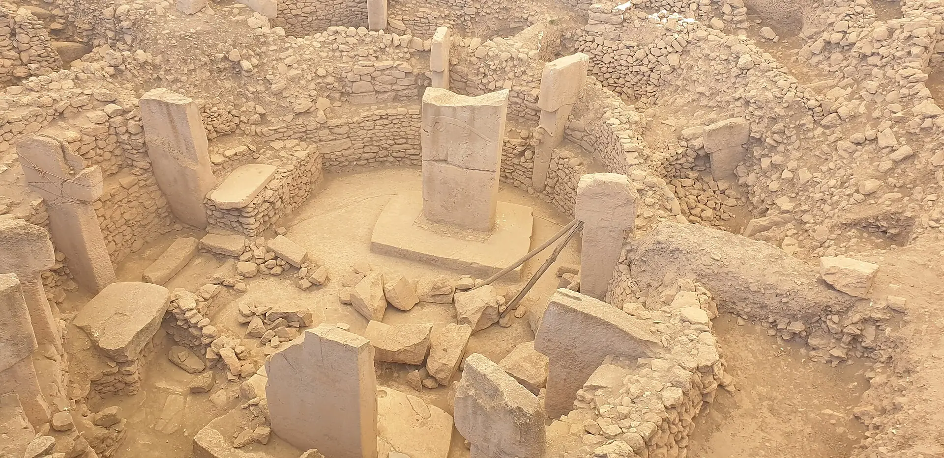
Göbekli Tepe (Göbeklitepe in Turkish) is an archaeological site on a hill about 15 to 18 km north-east of Şanlıurfa in south-eastern Türkiye. Its round enclosures ringed with T-shaped limestone pillars, some carved with animals, were built in the Neolithic, and the site has been on the UNESCO World Heritage List since 2018. Radiocarbon dates on the plaster of one enclosure fall between 9745 and 9314 BC, calibrated (German Archaeological Institute).
In short · checked 30.10.2026
Round stone enclosures with T-shaped pillars, from before pottery and farming at the site.
- What: a hill with round and oval enclosures, each ringed by T-shaped limestone pillars. About 20 are known from geomagnetic survey (ktb.gov.tr); several are dug.
- When: in use from about 9500 to about 8000 BC (DAI), before pottery and before farming at the site.
- Who: recognised in 1994 by Klaus Schmidt of the German Archaeological Institute; dug since 1995. In 2026 a new area opened in the north.
- Visit: open every day, 08:30–17:30; the ticket office closes at 17:00 (muze.gov.tr, checked 30.10.2026).
- Dates differ: Layer II is put in the 8th millennium BC (Ministry) or in the 9th (DAI).
The dig section
Dig down through the hill.
A cut through the mound, newest layer on top. Dig down to reach each older layer and its date.
Layer I Surface fill
- What: The top layer is fill on the surface, where crops were grown. muze.gov.tr
- Whole mound: Up to 15 m high and about 300 m across. DAI
- Layers: Four have been dug: this one and three of the Pre-Pottery Neolithic. muze.gov.tr The DAI works with two architectural layers, III and II. DAI
- Today: Digging goes on. In 2026 a first dig opened in the north, about 80 × 70 m, and GT1 and GT2 continue under two roofs. Ministry, 13.08.2026
Layer II Rectangular buildings
- What: Smaller buildings with rectangular plans. Mostly only the two central pillars remain; the biggest is about 1.5 m. DAI
- Dating: 8th millennium BC Ministry, 13.08.2026 · 9th millennium BC DAI
- End: The site was abandoned about 8000 BC. DAI
Layer III Round enclosures
- What: Round or oval enclosures: a wall, a ring of T-shaped pillars and two taller pillars in the middle. muze.gov.tr The pillars are 4 m in the circles and 5.5 m in the middle. DAI
- Dating: Pre-Pottery Neolithic A muze.gov.tr. Wall plaster of Enclosure D: 9745–9314 calBC. DAI
- Dug: Four enclosures muze.gov.tr or six ktb.gov.tr
- End: At the end of their use they were cleaned, part of their fittings taken out, and refilled. DAI
Plateau Limestone rock
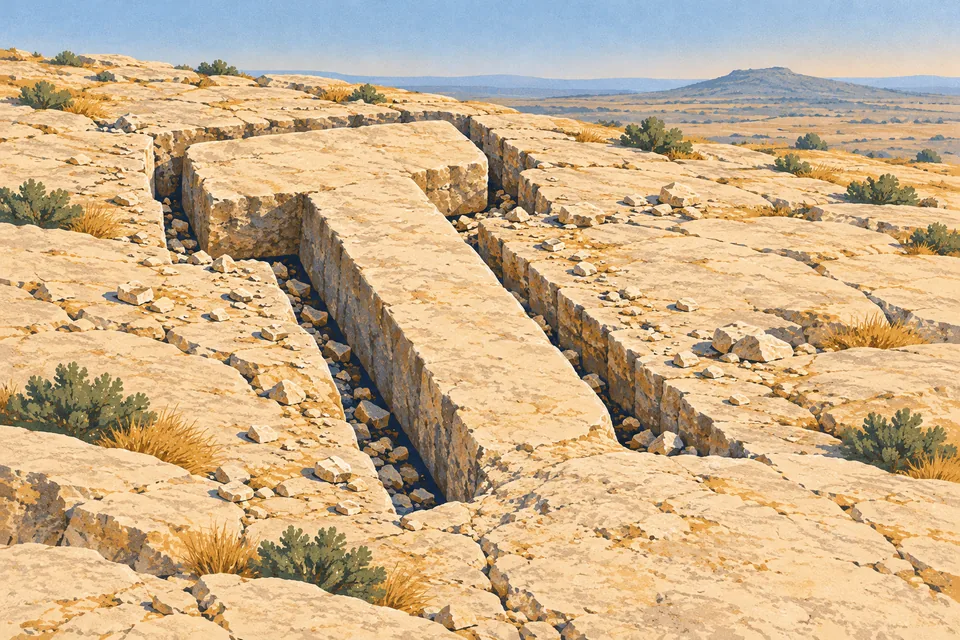
- What: The pillars were cut from the limestone plateaus round the site. Some can still be seen in the field where they were cut. muze.gov.tr
- Size: Up to 5 m muze.gov.tr · up to 6 m and up to 60 tonnes ktb.gov.tr
- Marks: Cavities and signs on the rock whose purpose is not yet understood. muze.gov.tr
- Under it all: The plateau forms the foundation of the buildings and lies under the mound. Ministry brochure
The hill and where it is
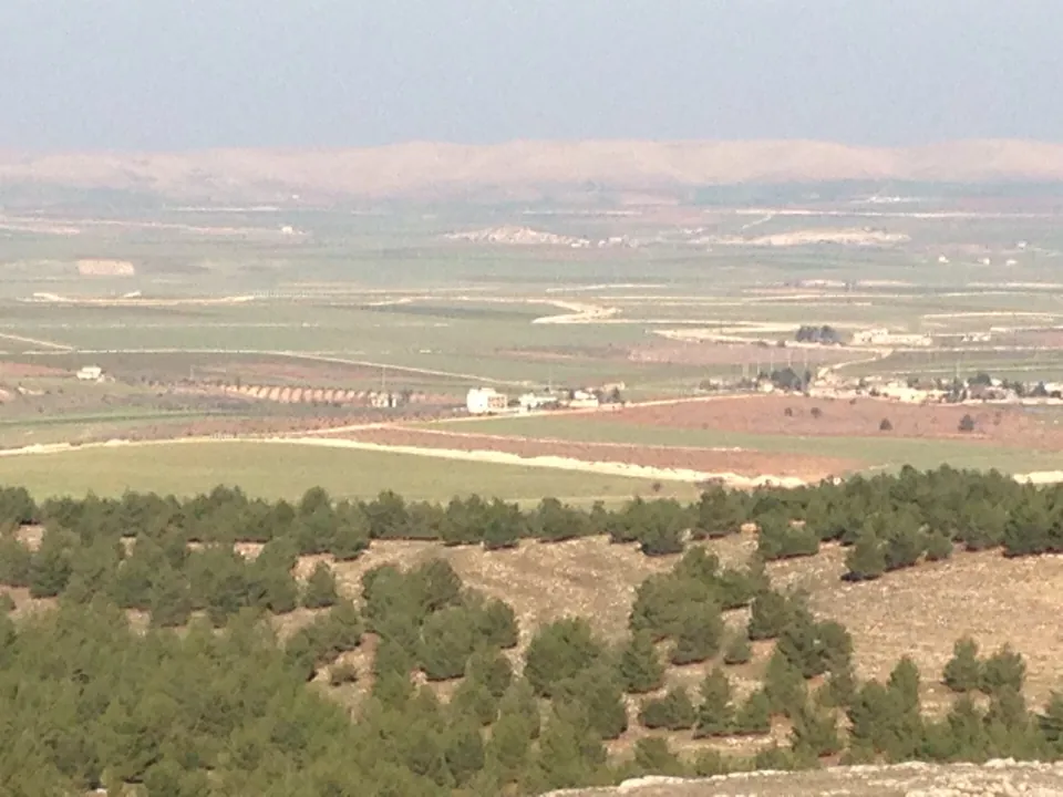
Göbekli Tepe stands on a limestone hill north-east of Şanlıurfa, near Örencik village, at an altitude of about 770 m.
The hill
A mound up to 15 m high, about 300 m across.
Distance. 15 km north-east of Şanlıurfa (muze.gov.tr) or 18 km (ktb.gov.tr, Culture Portal, KVMGM).
Height. An altitude of about 770 m, on one of the highest plateaus of the Germuş Mountains. The mound itself stands up to 15 m high (DAI).
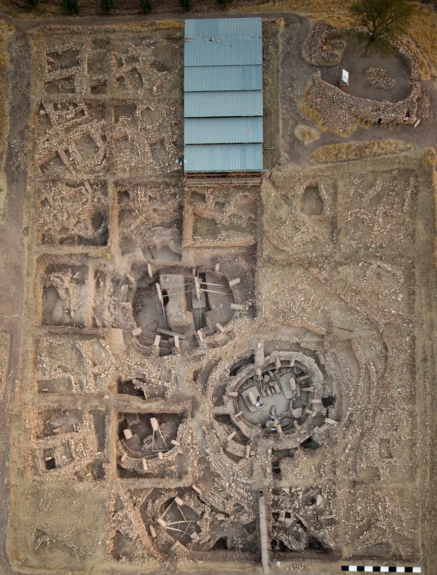
The enclosures. About 20 round and oval buildings, up to 30 m across, found by geomagnetic survey (Culture Portal, ktb.gov.tr).
Four words
- ören yeri
- An archaeological site in the open air.
- tepe
- Hill. Göbekli Tepe and Göbeklitepe are one name written two ways.
- höyük
- A mound made of the layers of a long-lived settlement.
- Şanlıurfa
- The city, often called Urfa for short. Örencik is the village near the site.
Found in 1994, dug since 1995
The hill was recorded in a survey in 1963 and taken for a cemetery. In 1994 Klaus Schmidt recognised the pillars, and digging began the next year.
- 1963. A survey by Istanbul and Chicago universities identifies the site as «V52 Neolithic settlement» (ktb.gov.tr). The limestone blocks on the hillside are taken for a cemetery (muze.gov.tr).
- 1994. Klaus Schmidt, who had worked at Nevalı Çori, recognises the «tombstones» as Neolithic T-shaped pillars. K. Schmidt, M. Akman and M. Morsch rediscover the site on a survey (DAI, DAI project).
- 1995. The first dig: a joint project of Klaus Schmidt, the Şanlıurfa Museum and the Istanbul branch of the German Archaeological Institute (DAI). Digs under the museum continue to 2006 (muze.gov.tr).
- 1996. Work starts on Enclosure A, the first round enclosure. A farmer clearing his field had dug out two pillar heads and begun to break one; he was stopped (DAI).
- 2014. Klaus Schmidt dies. An international team continues the digs (muze.gov.tr).
- 2026. A first dig opens in the north of the mound, about 80 × 70 m, while GT1 and GT2 continue under two roofs (Ministry press page, 13.08.2026).
- kazı
- Excavation, a dig.
- kazı başkanı
- The head of an excavation.
- yüzey araştırması
- A survey of the ground surface, made before any digging.
The enclosures and the T-shaped pillars
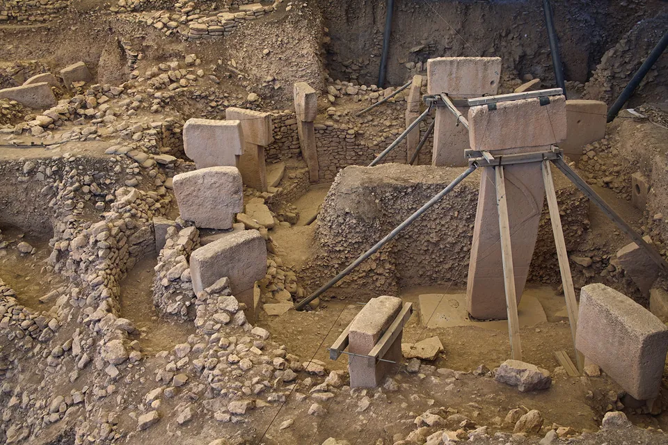
An enclosure is a round or oval building with a wall, a ring of T-shaped pillars and two taller pillars in the middle.
How an enclosure is built
- Wall. A stone wall in a circle or oval, up to 30 m across (Culture Portal).
- Ring. T-shaped limestone pillars stand at intervals in the wall; benches or walls join them (muze.gov.tr).
- Centre. Two taller pillars face each other, free-standing; 5 m high (Culture Portal).
- End. At the end of use the enclosure is refilled with soil and gravel (muze.gov.tr, DAI).
How many
Four or six dug, about 20 known
- Dug so far
- Four (muze.gov.tr) or six (ktb.gov.tr).
- Known
- About 20 (ktb.gov.tr, Culture Portal) or at least 20 (muze.gov.tr), by geomagnetic survey.
How tall
- Up to 5 m
- muze.gov.tr
- Up to 6 m, up to 60 t
- ktb.gov.tr
Words
- T biçimli sütun
- T-shaped pillar.
- dikilitaş
- A standing stone; the Ministry uses it for the same pillars in 2026.
- yapı
- A building; each enclosure is a yapı, for example D Yapısı.
- jeomanyetik ölçüm
- A reading of the ground with instruments to find buried walls.
Cut from the rock
Where the pillars came from
The pillars were cut out of the limestone plateaus round the site. Some can still be seen in the field where they were cut, and the rock holds cavities and signs whose purpose is not yet understood (muze.gov.tr).
Who built the enclosures, how pillars of up to 60 tonnes were moved and raised, and why they were buried are questions that remain open (ktb.gov.tr).
Two readings of the place
- ktb.gov.tr
- It was not used as a settlement; it served only religious purposes, and several temples stand there.
- DAI
- Recent digs show domestic activities: «a settlement site with a pronounced ritual component».
What is carved on the pillars
Some pillars carry animals in relief; others carry arms and hands, or a belt and a loincloth.
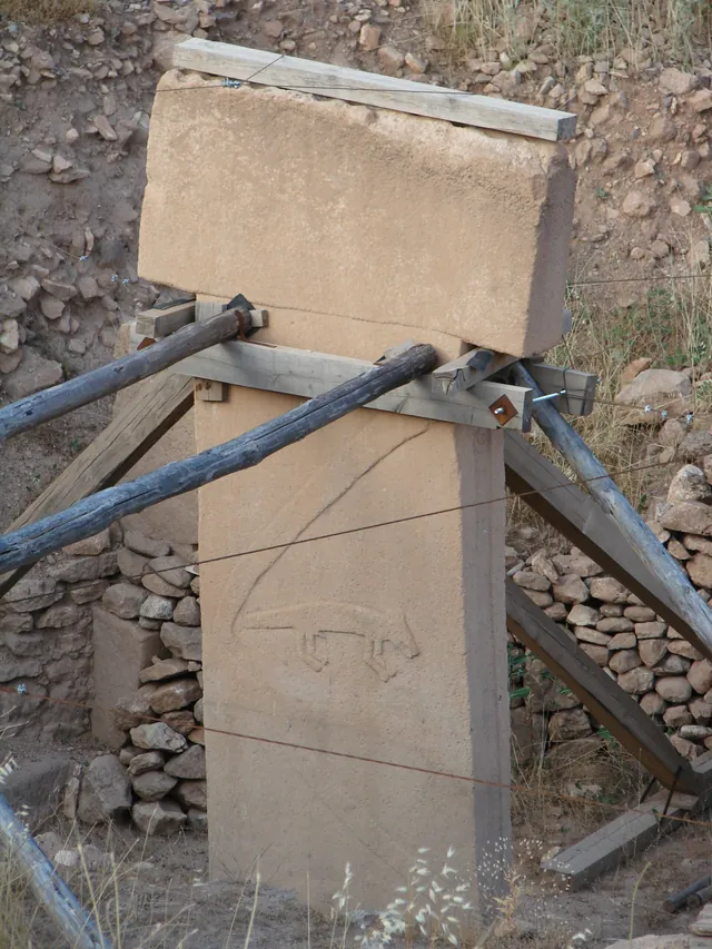
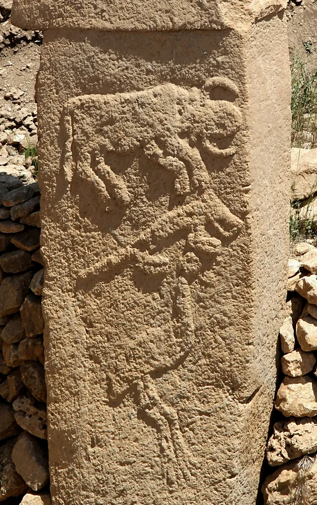
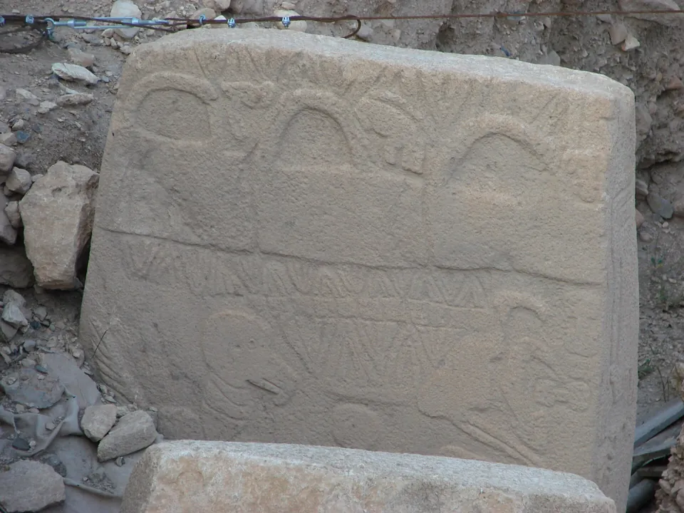
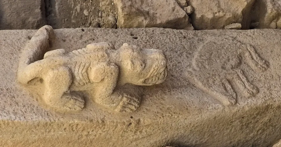
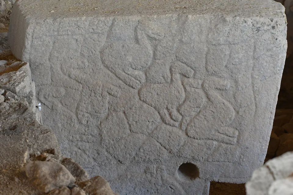
- Animals. Snakes, foxes, wild boars and birds (muze.gov.tr); some are cut in three dimensions (ktb.gov.tr).
- Pillar 1, Enclosure A. Five snakes in a groove down the front, and a net-like pattern, possibly of snakes, on one side (DAI).
- Pillar 2, Enclosure A. A bull, a fox and a crane stacked in a column on one side (DAI).
- Arms and hands. Cut in relief on some pillars, with belts and loincloths (muze.gov.tr, DAI).
Stylised people
- muze.gov.tr
- The arms and hands suggest the pillars are stylised human figures.
- DAI
- The T-shape is an abstract depiction of the human body seen from the side.
- kabartma
- Relief: a figure cut so that it stands out from the stone.
- hayvan tasviri
- A depiction of an animal.
How old it is
The site was in use from about 9500 to about 8000 BC, in the Pre-Pottery Neolithic (DAI). Radiocarbon dates of wall plaster and of charcoal give the figures (DAI).
Dates and ages
- 12,000 years ago
- Culture Portal, KVMGM.
- About 11,600 years before today
- Human activity begins and goes on for about a thousand years (Ministry brochure).
- About 9,500/9,250 to 8,000/7,750 calBC
- Pre-Pottery Neolithic A and B (DAI).
- 9745–9314 calBC
- Wall plaster of Enclosure D; charcoal near its floor: 9664–9311 calBC (DAI).
- Layer II
- 8th millennium BC (Ministry, 13.08.2026) or 9th millennium BC (DAI).
- About 8000 BC
- The site is abandoned (DAI).
Why it is hard to date
- The refill. The enclosures were refilled quickly, so charcoal in the fill can be older or younger than the walls (DAI).
- The plaster. Wall plaster is loam with a little organic matter, and is a far better source for dating than the fill; a series of 80 samples is dated (DAI).
- The order. Enclosure A seems younger than Enclosures C and D (DAI).
Words
- calBC
- Radiocarbon ages turned into calendar years BC.
- Neolitik Çağ
- The Neolithic, the late Stone Age.
- Pre-Pottery Neolithic
- The part of the Neolithic before pots; no domesticated plants or animals have been found at the site (DAI).
UNESCO
On the World Heritage List since 2018
List number 1572, cultural, under criteria (i), (ii) and (iv) (KVMGM).
The sites around it: Taş Tepeler
Taş Tepeler (Stone Hills) is the Ministry’s project of digs on Neolithic sites round Şanlıurfa; Göbeklitepe is one of the digs. Its coordinator is Prof. Necmi Karul (ktb.gov.tr, 19.08.2026).
Karahantepe
55 km from the centre of Şanlıurfa, in Tek Tek Mountains National Park. T-shaped pillars were cut from the limestone terraces there, and surface scans and geomagnetic readings show four sections (muze.gov.tr).
Sayburç
About 70 buildings found on 2,700 m² in the sixth season, dated to the middle of the 9th millennium BC. The plans pass from round to rectangular (ktb.gov.tr, 19.08.2026).
Nevalı Çori
Dug from 1983 to 1991 under Harald Hauptmann, then flooded by the Atatürk Dam. Its pillars taught Klaus Schmidt to recognise those of Göbekli Tepe (DAI).
The digs of 23.09.2021
- Digging then
- Göbeklitepe, Karahantepe, Gürcütepe, Sayburç, Çakmaktepe, Sefertepe, Yeni Mahalle Höyüğü.
- To start in 2021–2024
- Ayanlar, Yoğunburç, Harbetsuvan, Kurt Tepesi, Taşlıtepe.
- Planned
- Twelve digs in all (ktb.gov.tr, 23.09.2021).
Visiting: hours, the roof and the museum
The site is open every day. The Şanlıurfa Archaeology Museum, in the city, holds finds from the dig and a replica of it.
Göbeklitepe
Hours, checked 30.10.2026
- Open
- 08:30–17:30, every day; the ticket office gişe closes at 17:00 (muze.gov.tr).
- MüzeKart
- Valid for Turkish citizens. An audio guide sesli rehber is available.
- Address
- Göbeklitepe, Dağeteği Mahallesi, 63290.
Municipal buses run to the site (Şanlıurfa Metropolitan Municipality). Ticket prices for museums and sites across Türkiye: museum ticket prices in Türkiye.
The roofs
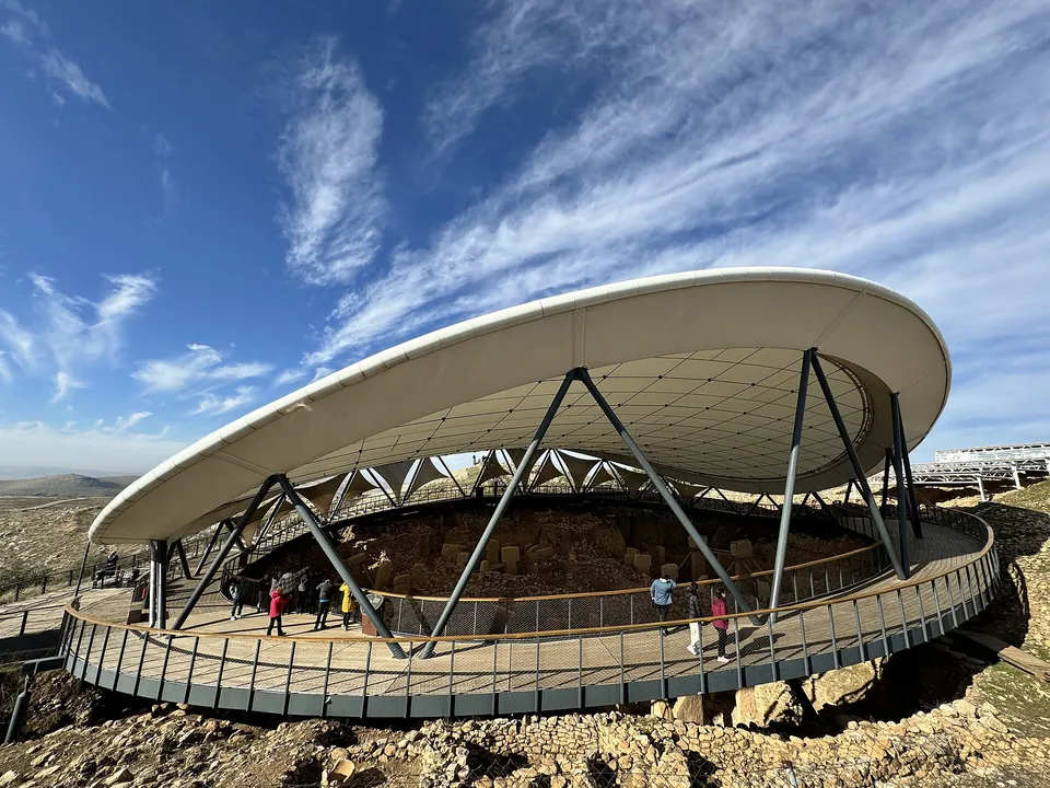
Two roofs over the digs
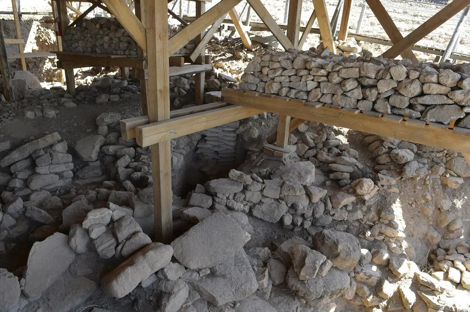
The digs at GT1 and GT2 run under two protective roofs koruma çatısı. Conservation work goes on in Buildings A, C and D. The walkways are being renewed and are to open soon (Ministry, 13.08.2026).
Şanlıurfa Archaeology Museum
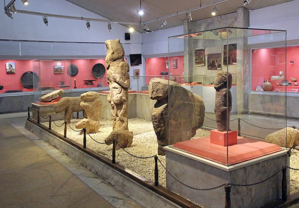
Finds and a replica
The same hours: 08:30–17:30, ticket office 17:00, every day (muze.gov.tr).
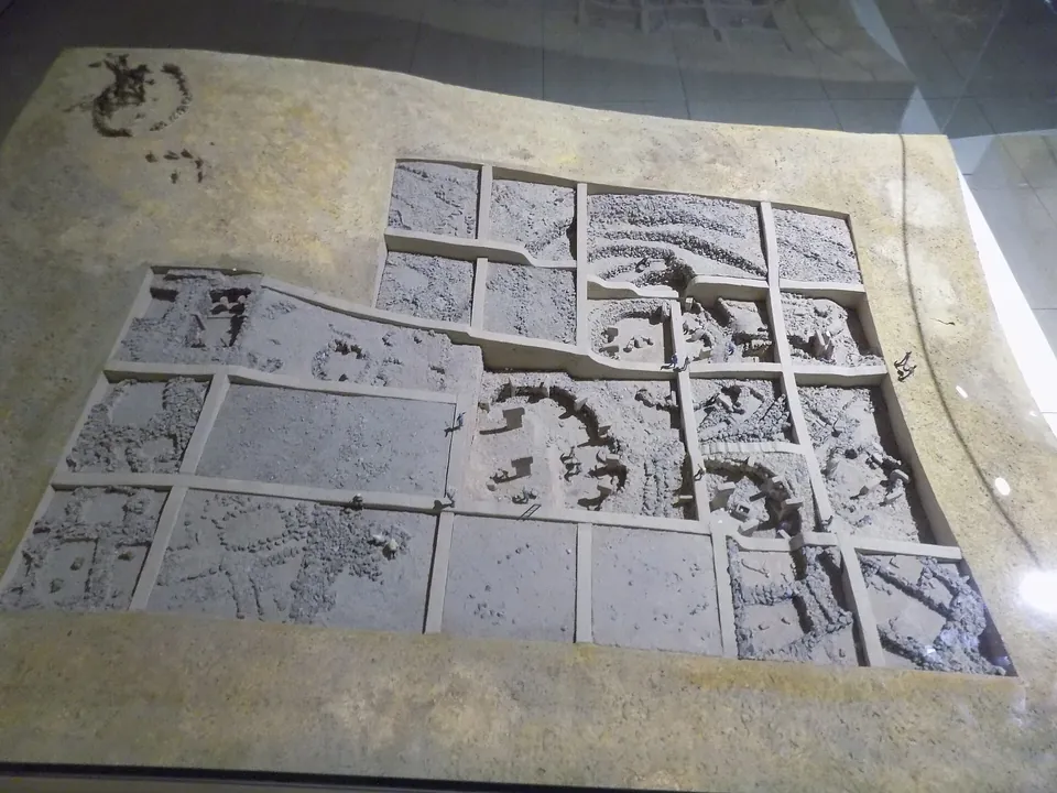
Finds from the dig: a leopard, wild boars, storks, foxes, gazelles, scorpions, snakes and headless human reliefs from the site’s buildings. A large replica maket of Göbeklitepe stands in a separate section (muze.gov.tr).
The museum garden
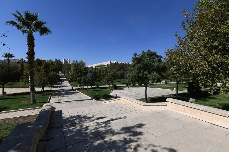
- Archaeopark. Replicas of buildings of each period, in order, between the museum and the Mosaic Museum, with ateliers and a training area for experimental digs (muze.gov.tr).
- Mosaic Museum. A separate building in the same garden, built where the Haleplibahçe mosaics were found.
- gişe
- Ticket office.
- MüzeKart
- The Ministry’s museum pass.
- sesli rehber
- Audio guide.
- koruma çatısı
- Protective roof.
- maket
- A scale model or replica.
Turkish words and lines
Press Copy to put a Turkish line on the clipboard, ready to show or paste.
- Göbeklitepe’ye nasıl gidebilirim?How can I get to Göbeklitepe?
- Göbeklitepe’ye otobüs kaçta kalkıyor?What time does the bus to Göbeklitepe leave?
- Gişe saat kaçta kapanıyor?What time does the ticket office close?
- Sesli rehber var mı?Is there an audio guide?
- Müze her gün açık mı?Is the museum open every day?
- T biçimli sütunlar nerede?Where are the T-shaped pillars?
- Göbeklitepe maketi nerede?Where is the model of Göbeklitepe?
Sources and where next
Facts, dates and numbers come from these pages of the Ministry of Culture and Tourism, the German Archaeological Institute (DAI) and the Şanlıurfa municipality.
- Göbeklitepe — Ministry of Culture and Tourism, ktb.gov.tr, checked 30.10.2026
- Göbeklitepe Archaeological Site — Ministry of Culture and Tourism, muze.gov.tr, checked 30.10.2026
- Göbeklitepe (brochure) — Ministry of Culture and Tourism, muze.gov.tr, checked 30.10.2026
- Göbeklitepe — Ministry of Culture and Tourism, Culture Portal, checked 30.10.2026
- Göbeklitepe (Şanlıurfa) — Directorate General for Cultural Assets and Museums, checked 30.10.2026
- Şanlıurfa Museum — Ministry of Culture and Tourism, muze.gov.tr, checked 30.10.2026
- Karahantepe Archaeological Site — Ministry of Culture and Tourism, muze.gov.tr, checked 30.10.2026
- Göbeklitepe’nin kuzeyinde ilk kazı (13.08.2026) — Ministry of Culture and Tourism, press, checked 30.10.2026
- Buzul Çağı’nın ardından insanlık tarihinde büyük dönüşüm (19.08.2026) — Ministry of Culture and Tourism, press, checked 30.10.2026
- Taş Tepeler tanıtım toplantısı Şanlıurfa’da yapıldı (23.09.2021) — Ministry of Culture and Tourism, press, checked 30.10.2026
- Gobeklitepe — Şanlıurfa Metropolitan Municipality, checked 30.10.2026
- How old is it? Dating Göbekli Tepe — German Archaeological Institute (DAI), checked 30.10.2026
- Göbekli Tepe (research project) — German Archaeological Institute (DAI), checked 30.10.2026
- Göbekli Tepe – the first 20 years of research — German Archaeological Institute (DAI), checked 30.10.2026
- The current distribution of sites with T-shaped pillars — German Archaeological Institute (DAI), checked 30.10.2026
Hours are checked 30.10.2026 and can change; the museum site is the first place to look before a visit.
Elsewhere in Türkiye: Mount Nemrut, another UNESCO site in south-eastern Türkiye, and Hierapolis, on the World Heritage List in the south-west.