Saklıkent Gorge: The Walk, the Entry Rules and the Road
What Saklıkent Gorge is, how the walk goes, what the national park’s entry rules say and how far it lies from Fethiye and Seydikemer.
Table of Contents
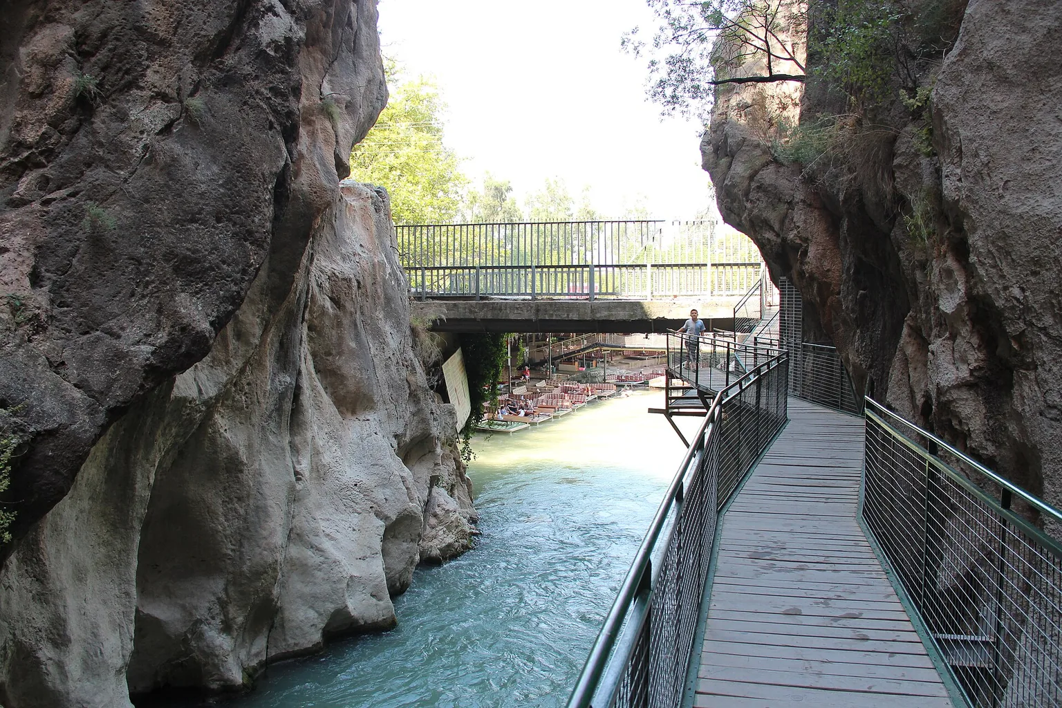
Saklıkent Gorge (Saklıkent Kanyonu) is a narrow canyon 18 km long in Seydikemer district, Muğla province, Türkiye, with water at the bottom that stays cold in summer Ministry. It lies about 40 km due east of Fethiye by the ministry’s figure, in Saklıkent National Park, declared a national park on 6 June 1996 by a Council of Ministers decision DKMP’s 4th Regional Directorate (DKMP is the Directorate General for Nature Conservation and National Parks).
In short · checked 30.10.2026
A narrow canyon, entered on a wooden bridge.
- Where: 22 km south of Seydikemer town centre Seydikemer; about 40 km due east of Fethiye Ministry.
- The walk: in on a wooden bridge about 200 m long Seydikemer, then through cold water, sometimes on suspended platforms Ministry.
- Entry rules: the 2026 person fee is ₺85.00 in the Muğla row, first category. Visitors who are not Turkish citizens pay 5 to 10 times the person fee, set per area; DKMP prints no figure for Saklıkent DKMP rules.
- Season: after April about 4 of the 16 km are walkable; in winter the river swells and the canyon cannot be crossed GoTürkiye.
Into the gorge
Four parts, in the order a visitor meets them.
The drawing looks up the gorge from its mouth. It is not to scale and shows no distances. Press a numbered pin, a part of the drawing or a tab to read what the state pages say about it.
The pages listed under Sources print no hours for the gorge, so this question goes to the gate.
1The gate giriş
Where a visit starts, and where DKMP’s 2026 entry rules apply.
- The person fee for 2026 is ₺85.00 in the Muğla row (first category). Visitors who are not Turkish citizens pay 5 to 10 times the person fee, set per area; DKMP prints no figure for Saklıkent. DKMP tariffDKMP rules
- Students on foot pay half with a student ID; children under 7 and people over 65 on foot pay nothing; the fee is taken once per calendar day. DKMP
- The full card is in chapter 5.
2The walkway tahta köprü
A wooden bridge takes visitors into the gorge.
- The bridge is about 200 m long and fixed to the steep slopes with iron bars. Seydikemer
- A ramp for disabled visitors sits at the entrance. Seydikemer
- The photo in chapter 3 shows the walkway.
3The water su
The cold part of the walk.
- The water at the bottom is cold even in summer, because sunlight hardly penetrates. Ministry
- It is possible to walk through the water, and sometimes on suspended wooden platforms. Ministry
- Cold karstic springs rise near the Eşen-valley end, and in summer the part the sun does not reach directly has a cool microclimate. Seydikemer
4The narrow part dar kesim
Where the walls close in.
- The narrowest place falls to 2 m. DKMP
- After April about 4 of the 16 km of the canyon are walkable; in winter the river swells and the canyon cannot be crossed. GoTürkiye
- The upper part of the canyon is called Tucak Boğazı. Seydikemer
What the gorge is
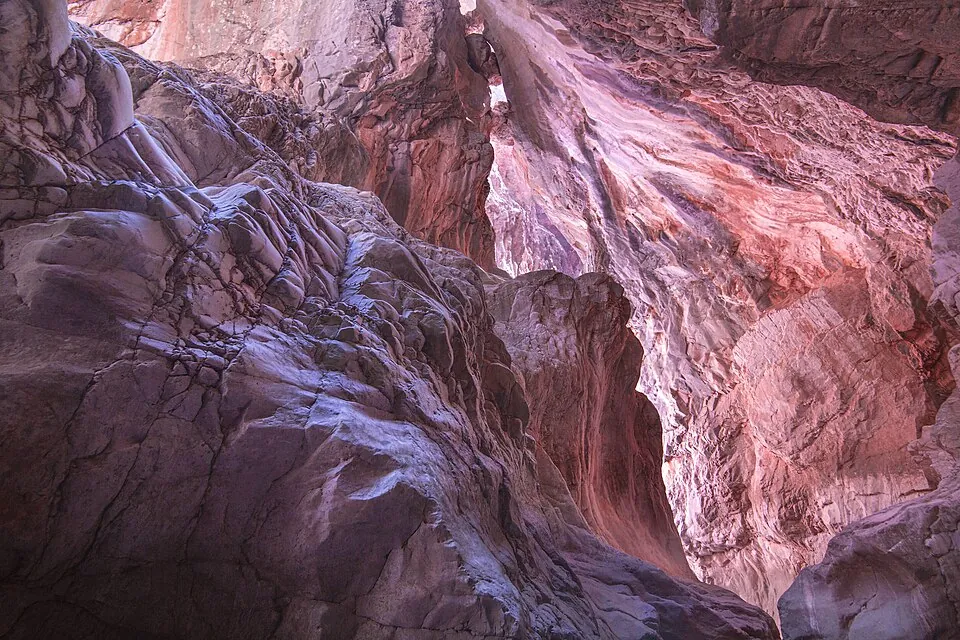
Saklıkent Gorge is a steep, deep canyon cut into limestone, a rock that water erodes easily, helped by cracks along a fault DKMP. The stream that wore it down is the Karaçay Deresi (the Karaçay stream), a branch of the Eşen Çayı (the Eşen River) Seydikemer, over thousands of years GoTürkiye.
The gorge in four figures
18 km long, 200–600 m high on average.
Length: 18 km (the ministry, Seydikemer, DKMP).
Height: 200–600 m on average (Seydikemer municipality).
From Seydikemer: 22 km south of the town centre (Seydikemer municipality).
From Fethiye: about 40 km due east (the ministry).
Where the pages differ
- Height
- 200 m, narrowest place 2 m (DKMP); 200–600 m on average (Seydikemer); about 300 m (GoTürkiye); the entrance about 300 m deep (the Fethiye brochure).
- Length
- 18 km on five pages; 14 km inward on Seydikemer’s park page; GoTürkiye gives 18 km and, in its sentence on the walk, 16 km.
- Distance
- From Seydikemer 22 km (Seydikemer, the brochure). From Fethiye about 40 km due east (the ministry), 45 km (the brochure), 50 km (GoTürkiye).
Each figure stays with its owner.
The words
- Saklıkent
- Saklı means hidden and kent means town or city; GoTürkiye renders it «hidden city».
- kanyon
- A canyon. Seydikemer municipality writes that in the 1980s a man called Çoban Ekrem (çoban means shepherd) named it «Saklıkent Kanyonu»; GoTürkiye writes that a shepherd found it in the 1980s.
- boğaz
- A gorge; the word also means a strait. The upper part is Tucak Boğazı, which reaches the floor of the Eşen valley near the Kayadibi neighbourhood (Seydikemer).
- dere · çay
- A stream · a small river. Çay also means tea.
- kaynak
- A spring.
The national park
Saklıkent National Park (Saklıkent Milli Parkı; milli park means national park) is number 40 on the list of national parks kept by DKMP, which belongs to the Ministry of Agriculture and Forestry. Its province is listed as «Muğla-Antalya» and its directorate as the 4th Regional Directorate (4. Bölge Müdürlüğü).
- Declared
- 6 June 1996, by a Council of Ministers decision (DKMP’s 4th Regional Directorate).
- Area
- 1,643 ha, on and around the Eşen Çayı, inside the borders of Antalya and Muğla provinces (DKMP).
- Status
- A strictly protected sensitive area (kesin korunacak hassas alan); its main value is the canyon (DKMP).
- Trees
- Red pine low down, black pine and cedar higher up, monument cedars around Dumanlıdağ, and endemic geophytes and cyclamens on Aktar Yaylası (yayla means mountain pasture) (DKMP).
- Staying
- Plateau stays are by reservation and camping is allowed in specific areas; the nearest accommodation is in Fethiye or Kaş (the ministry).
- Run by
- The park is under DKMP’s 4th Regional Directorate DKMP. The directorate’s Milli Parklar page (bolge4.tarimorman.gov.tr) carries the park’s information sheet.
Walking routes
As the information sheet words it
DKMP’s 4th Regional Directorate writes that the walking routes in the park are in most places quite steep, rugged, with ups and downs, and hard. Walks inside the area, it adds, must be done with area guides (alan kılavuzları) and within walking programmes (yürüyüş programları). The sheet does not say how this applies to the walk through the gorge; chapter 8 has the question to ask.
The walk, part by part
The four parts of the walk, in order:
- The gate. The park is on DKMP’s 2026 tariff (chapter 5).
- The bridge. Visitors go in by a wooden bridge about 200 m long, fixed to the steep slopes with iron bars; a ramp for disabled visitors sits at the entrance Seydikemer. After the entrance, a service bridge (servis köprüsü) leads into the canyon Fethiye brochure.
- The water. One can walk through the water, and sometimes on suspended wooden platforms Ministry.
- How far. How far one can walk depends on the season (chapter 4).
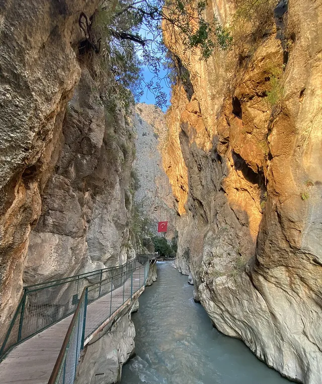
The wooden bridge
- tahta köprü
- A wooden bridge, 200 m long Seydikemer.
- engelli rampası
- The ramp for disabled visitors, at the entrance.
- yürüyüş yolu
- A walking route. DKMP’s sheet calls the routes in the park steep and hard and asks for area guides.
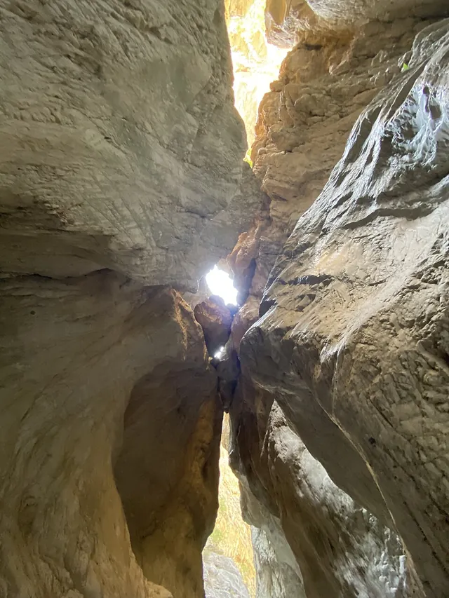
Why the water is cold
Sunlight hardly gets in
The water at the bottom stays cold even in summer, because sunlight hardly gets in Ministry. Some sections are so narrow that the sky is hard to see from inside GoTürkiye; the narrowest place is 2 m DKMP. Cold karstic springs rise near the Eşen-valley end Seydikemer.
When you can walk in
The walk depends on the snow of the Taurus Mountains, which melts and runs through the gorge on its way to the Xanthos River GoTürkiye.
After April
About 4 of the 16 km
After April, when most of the snow has melted and passed through the gorge, approximately 4 of the 16 km of the canyon are walkable (GoTürkiye).
In winter
The river swells
In winter the river swells up and it is impossible to cross the canyon (GoTürkiye).
- In summer
- Inside the canyon, where the sun does not reach directly, there is a cool microclimate (Seydikemer municipality). The water stays cold (the ministry).
- Hours
- The pages listed under Sources print no opening hours for the gorge. Ask at the gate; the Turkish line is in chapter 8.
- mevsim
- Season. Yaz is summer and kış is winter.
The entry rules for 2026
«Saklıkent Milli Parkı» is in the first category (I. Kategori) of DKMP’s 2026 tariff for protected areas, twice: under Antalya (group Akdeniz-1) and under Muğla (group Ege-1) DKMP Ek-1. The person-entry tariff sets a fee for each group DKMP Ek-2; the box below has the Muğla row.
The person fee, 2026
₺85.00 in the Muğla row, and a rule for visitors from abroad.
Visitors who are not Turkish citizens pay 5 to 10 times the person fee, set per area by the directorate general. DKMP prints no figure for Saklıkent (DKMP’s application rules).
Students on foot pay half with a student ID. The discount does not apply to vehicles of the 3rd to 6th class or to trips booked through a travel company or agency.
Free on foot: children under 7 and people over 65. Once a day: the fee is taken once per calendar day.
The Antalya row of the same tariff prints ₺95.00 for the first category; the park is listed under both provinces.
- Disabled visitors
- Free passage with a disability card from the Ministry of Family and Social Services or a report from the Ministry of Health (DKMP).
- Vehicles
- A vehicle fee covers the vehicle and everyone in it. The vehicle tariff is a separate list on DKMP’s tariff page.
- Other groups
- The application rules list other groups as well (DKMP).
Operator-run areas
Where an operator runs a protected area, DKMP’s rules make the tariff the highest price the operator may charge. Areas let by tender follow the tender contract (DKMP’s application rules).
- giriş ücreti
- Entry fee. Ücret is fee and giriş is entry.
- şahıs girişi · araç girişi
- Person entry · vehicle entry.
- yaya
- On foot.
- gişe · bilet
- Ticket window · ticket.
- öğrenci · kimlik
- Student · identity card.
The road from Fethiye
The Muğla culture and tourism directorate’s Fethiye brochure (2015) gives 45 km from Fethiye to Saklıkent and 22 km from Seydikemer, with 29 km between Fethiye and Seydikemer. The tabs below give the ways in.
How are you travelling?
- otogar
- The intercity bus station. The bus terminal in the centre of Fethiye has buses to every part of Türkiye Brochure. For one coach company, see Kamil Koç Bus.
- dolmuş
- A shared minibus on a set route. Minibuses leave from behind the Yeni Cami for Çalış and Gemiler Bay, and from Köprübaşı for other districts and villages Brochure; no line to Saklıkent is printed.
- durak
- A stop.
- Ask
- The Turkish question for the terminal, where the dolmuş to Saklıkent leaves from, is in chapter 8.
- From the south
- By the Kalkan–Yeşilova road that leads to Palamut village Ministry.
- From the north
- By the Kemer road Ministry.
- Distance
- 45 km from Fethiye (the brochure); 50 km (GoTürkiye); about 40 km due east (the ministry).
- Hiring a car
- Hiring a car in Türkiye is covered in Car Rental in Turkey.
Tlos, on the way
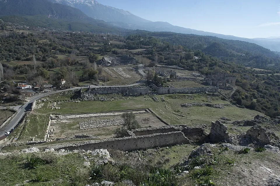
Tlos is an ancient city in Seydikemer district, within the limits of Yakaköy (Culture Portal). The brochure puts it on the road to Saklıkent, 45 km from Fethiye and 15 km from Seydikemer; the Culture Portal puts it 40 km east of Fethiye and says to take the asphalt road that turns east at Güneşli village when going toward Saklıkent.
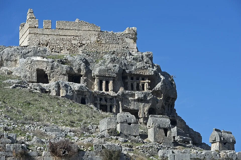
Hours
Open until 20:00 in the 2026 season
In the 2026 season (1 May–1 October) Tlos was open until 20:00 (the KVMGM list; KVMGM is the ministry’s directorate general for cultural assets and museums). The list gives no hours for the rest of the year. The Turkish question is in chapter 8.
- What
- The Culture Portal calls Tlos one of the oldest settlements of the Lycian region: «Dalawa» in Hittite texts and «Tlawa» in Lycian inscriptions. Settlement runs from the Neolithic to the Iron Age, and the city was one of Lycia’s main bishoprics until the 12th century.
- What stands
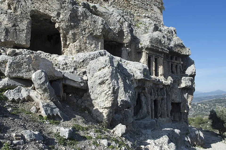
- An acropolis hill with steep slopes about 500 m high. At its foot are some seating rows, a stadium, a bath, a theatre and church ruins; the theatre is called the most important building still standing. Rock-cut temple tombs line the slope up to the castle, the grandest being the tomb of Bellerophon, which shows the winged horse Pegasus fighting the Chimera (Culture Portal).
- Listing
- Tlos is part of «Likya Uygarlığı Antik Kentleri (Antalya ve Muğla)», which was put on the UNESCO World Heritage Tentative List in 2009 (Culture Portal).
- ören yeri
- An archaeological site in the open air.
- Müzekart
- The ministry’s museum pass. The pages above do not say whether it is valid at Tlos; the question is in chapter 8.
What to ask in Turkish
The pages above print no hours for the gorge, no figure for visitors from abroad and no minibus line, so these questions go to the gate, the terminal and the ticket window. Press Copy to put a Turkish line on the clipboard, ready to show or paste.
- Kanyon bugün açık mı, saat kaçta kapanıyor?Is the canyon open today, and when does it close?
- Giriş ücreti ne kadar? Öğrenci indirimi var mı?How much is entry? Is there a student discount?
- Yabancı ziyaretçiler için giriş ücreti ne kadar?How much is entry for foreign visitors?
- Engelli rampası nerede?Where is the ramp for disabled visitors?
- Su bugün ne kadar derin?How deep is the water today?
- Kanyonun içinde ne kadar yürünebilir?How far can one walk inside the canyon?
- Yürüyüş için alan kılavuzu gerekiyor mu?Is an area guide needed for the walk?
- Saklıkent’e giden dolmuş nereden kalkıyor?Where does the dolmuş to Saklıkent leave from?
- Tlos ören yeri saat kaçta kapanıyor?When does the Tlos site close?
- Tlos’ta Müzekart geçerli mi?Is Müzekart valid at Tlos?
- açık · kapalı
- Open · closed.
- saat
- Hour, o’clock; also a watch. Saat kaçta? means «at what time?».
- nerede · nereden
- Where · from where.
- ne kadar
- How much; also «how far» or «how deep», as the sentence needs.
- var mı
- Is there? Said as a question, it asks whether something exists.
Sources and limits
Facts, dates and figures on this page come from these pages, each read on 30.10.2026.
- Mugla – Saklikent National Park — Ministry of Culture and Tourism, ktb.gov.tr (no date), checked 30.10.2026
- Saklıkent Milli Parkı — Seydikemer Municipality (no date), checked 30.10.2026
- Saklıkent Kanyonu Tatilcileri Bekliyor — Seydikemer Municipality, news (no date), checked 30.10.2026
- Saklıkent Milli Parkı (information sheet, PDF) — DKMP, 4th Regional Directorate (no date), checked 30.10.2026
- Milli Parklar — DKMP, 4th Regional Directorate, checked 30.10.2026
- Milli Parklar — Directorate General for Nature Conservation and National Parks (DKMP), Ministry of Agriculture and Forestry, checked 30.10.2026
- Korunan Alanlar Ücret Tarifesi — DKMP, tariff page for 2026, checked 30.10.2026
- Ek-1 Coğrafi Grup ve Kategorilere Göre Korunan Alanlar Listesi-2026 — DKMP (PDF), checked 30.10.2026
- Ek-2 2026 Yılı Korunan Alanlar Şahıs Girişi Ücret Tarifesi — DKMP (PDF), checked 30.10.2026
- Ek-21 Korunan Alanlar Ücret Tarifesi Uygulama Usul ve Esasları – 2026 — DKMP (PDF), checked 30.10.2026
- 2026 Turizm Sezonunda Ziyaret Saatleri — Directorate General for Cultural Assets and Museums (KVMGM), Ministry of Culture and Tourism (undated), checked 30.10.2026
- Tlos Antik Kenti — Ministry of Culture and Tourism, Culture Portal, checked 30.10.2026
- Saklıkent Canyon — GoTürkiye, Türkiye’s tourism promotion platform (no date), checked 30.10.2026
- Fethiye (brochure, PDF, Turkish; © 2015) — Ministry of Culture and Tourism, Muğla Provincial Directorate of Culture and Tourism, checked 30.10.2026
The pages above print no opening hours for the gorge, no figure for visitors from abroad, no minibus line to Saklıkent and no timetable, so none appears here. Lodging, meals, guided trips and the activities sold on the spot are not covered. Pictures are from Wikimedia Commons with the author, date and licence in each caption; they are cropped and resized only.